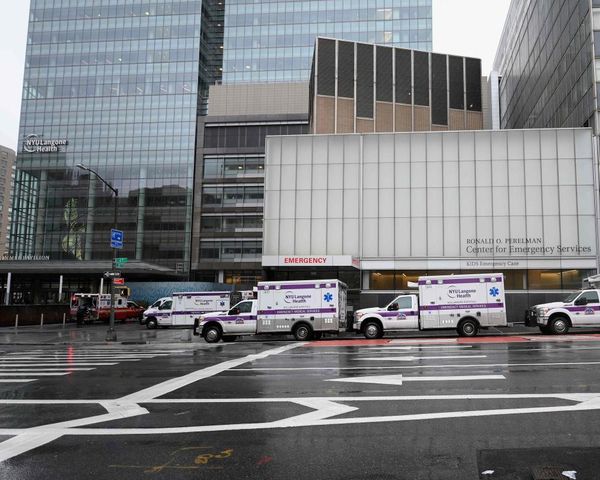
(Bloomberg Businessweek) -- When Superstorm Sandy hit the East Coast five years ago, it blindsided thousands of residents of New York City and beyond who didn’t figure their neighborhoods could flood for the simple reason that they never had before. The disaster highlighted twin challenges: raising basic awareness of flood risks and easing the process of preparing for potential threats when the options are complicated.
Those goals have guided the housing nonprofit Center for NYC Neighborhoods and design firm Ideo in refashioning a post-Sandy flood information site, FloodHelpNY, into a user-friendly portal to help area homeowners suss out their property’s status and navigate the perplexing flood insurance landscape. That’s a straightforward-sounding objective—but a knotty design task.
Ideo is known particularly for deep-dive research and directly involving potential users in shaping design decisions. That had a surprising payoff in this case: The public research process turned the prototyping into a de facto outreach effort, which raised flood risk awareness even as the designers crafted an interactive system that made it as painless as possible for consumers to navigate flood insurance.
Most notably, Ideo in 2016 ran a series of pop-up public installations in Lower Manhattan neighborhoods designed in part to get feedback about the structure and functionality of the flood site, says Ideo creative technologist Peter Olson, one of the project leaders. But this wasn’t a dry matter of people with clipboards hectoring passersby. These were attractions, branding the collective flood-prone areas of the city—encompassing the residences of 400,000 New Yorkers and including neighborhoods such as TriBeCa that may not be obviously associated with such risks—as Storm Surge City, a fanciful sixth borough. In addition to big, eye-catching graphic displays, the designers offered visitors virtual-reality goggles that let them experience the environment of the waterline after Sandy or 2011’s Hurricane Irene and invited them to play with cut-and-paste worksheets to shape the site’s priorities.
The original version of FloodHelpNY, launched in 2014, centered on a mapping tool that incorporated new flood zone data from the Federal Emergency Management Agency. But “people wanted a lot more information and detail,” says Christie Peale, the executive director of the neighborhoods nonprofit, whose mission is to promote and protect affordable homeownership in the city.
Specifically, Peale says, the center wanted to add a sophisticated insurance calculator to address what she calls “the black box that is flood insurance rates.” The calculator would promote an intensive on-site audit, free to qualified participants, thanks to $7.5 million in state funding. These goals meant a serious revamp and upgrade of FloodHelpNY, incorporating access to an array of complicated city, federal, and other databases tracking everything from topology to the gradation and age of a property—but with an interface that was comprehensible and accessible to nonexperts.
Interviews in the pop-up events and more conventional settings such as community meetings led to insights that shaped the framework and language of a late-2016 version of the site. It turns out “fear-based messaging didn’t really work,” Olson says.
The site’s tone and structure aren’t exactly upbeat—a constantly updated graphic on the home page shows how current area water levels compare with Sandy and Irene’s peaks. But the site is concise and straightforward, oriented toward taking actions related to individual property, such as relocating utility fixtures or the more drastic step of filling in a basement. Jargon is minimized or clearly defined.
“It’s very New York,” Olson says. “Here’s where you’re at, here’s what you can do, here’s what this means. We found that resonated across the spectrum of users we were speaking to.”
This points to the significance of the local focus: The nature and details of flood risks and potential responses, as recent hurricanes have underscored, vary by region. A handful of cities have approached the center about replicating the model, including New Orleans and Portland, Ore., and FEMA has highlighted the platform as a model for flood risk education. Meanwhile, Peale rattles off some numbers for the new site: It’s attracted 120,000 users, is engaging enough to inspire 33,000 profiles, and has helped get more than 700 people to sign up for the audits.
One is Luigi Napolitano, a civil engineer who lives in the Howard Beach section of Queens. In the runup to Sandy, his wife was worried about flooding. “Don’t worry about it,” Napolitano remembers telling her. “It doesn’t happen here. It never has.” Much of his neighborhood did flood, and water came right to the edge of the Napolitanos’ house at the block’s high point. They spent 12 days without power.
So earlier this year, Napolitano arranged an audit, which involved a lengthy visit from an inspector and a detailed follow-up meeting, with recommendations that included raising his hot water heater at least a foot—and getting flood insurance. He isn’t committing to that until he can confirm the cost estimates in the audit line up with reality. But he says it’s “probably a no-brainer” to get the insurance, and recent events have only reinforced that. His attitude about flood risk has changed, he says: “You know what? It can happen.”
To contact the author of this story: Rob Walker in New York at rw@robwalker.net.
To contact the editor responsible for this story: Dimitra Kessenides at dkessenides1@bloomberg.net.
©2017 Bloomberg L.P.