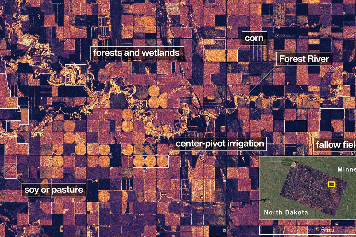
NASA's first radar images from a new Earth-mapping satellite show the Maine coast and Minnesota farmland in incredible detail.
The pictures, released Thursday, are from a spacecraft that rocketed into orbit from India two months ago.
The joint U.S.-Indian mission, worth $1.3 billion, will survey virtually all of the world’s land and ice masses multiple times. By tracking even the slightest shifts in land and ice, the satellite will give forecasters and first responders a leg up in dealing with floods, landslides, volcanic eruptions and other disasters.
NASA said these first pictures are a preview of what’s to come once science operations begin in November.
The satellite, flying 464 miles (747 kilometers) high in a near polar orbit, is called NISAR, short for NASA-ISRO Synthetic Aperture Radar. ISRO is the Indian Space Research Organization.
___
The Associated Press Health and Science Department receives support from the Howard Hughes Medical Institute’s Department of Science Education and the Robert Wood Johnson Foundation. The AP is solely responsible for all content.