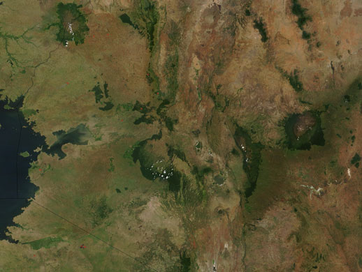
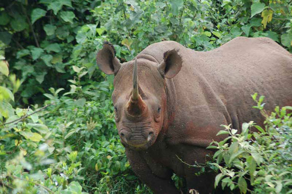
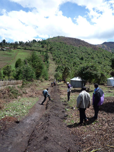
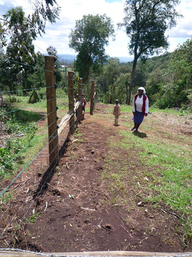
A satellite view of central Kenya and the Aberdare mountain range (the second deep-green zone from the right), located north of Nairobi. At the right of the Aberdares, also in deep green, is Mount Kenya, and on the left is the Mau complex. The blue area on the left is Lake VictoriaPhotograph: NASAAn Aberdare rhino. Twenty years ago, there were believed to be only about 100 black rhino left in Kenya – now there are estimated to be more than 600Photograph: Raphael Muthama/Rhino ArkBuilding in progress. The fence is probably the longest conservation barrier in the world. Its 250 miles (400km) stretches over hills, passes over rivers and runs along the edges of hundreds of communitiesPhotograph: John Vidal
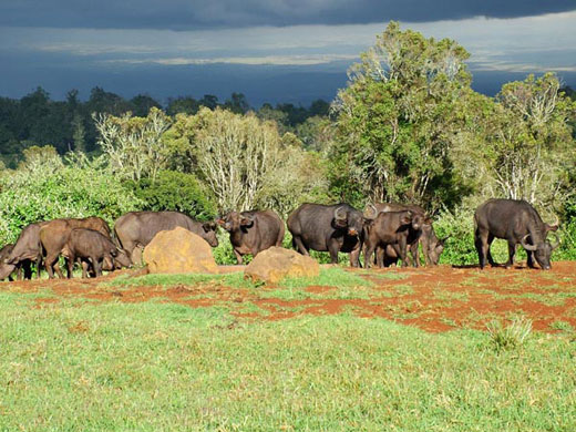
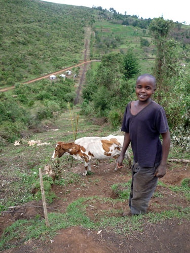
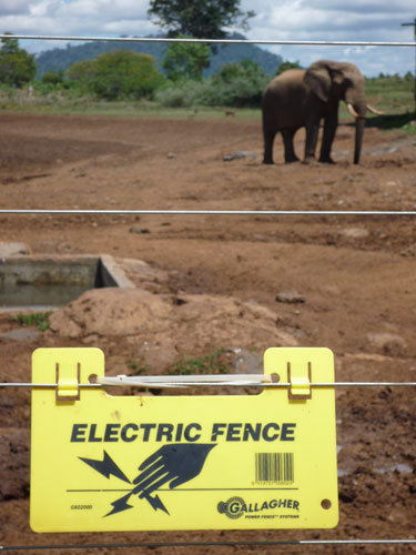
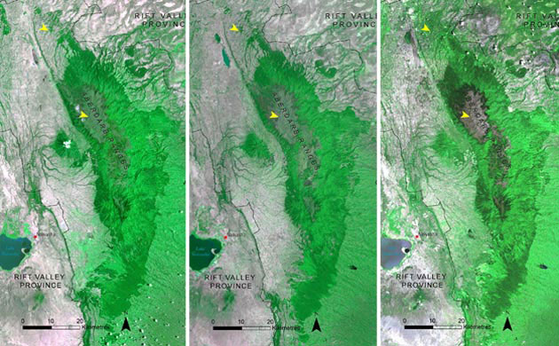
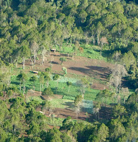
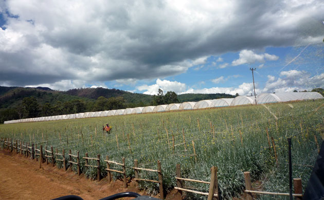
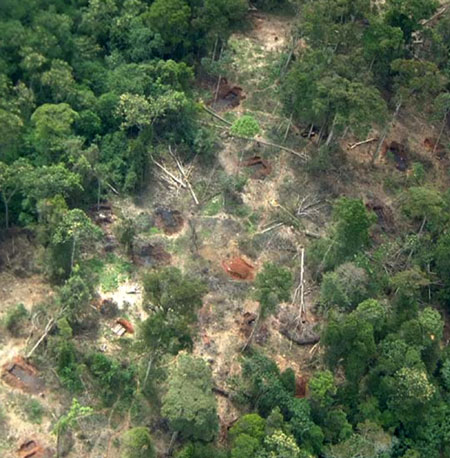
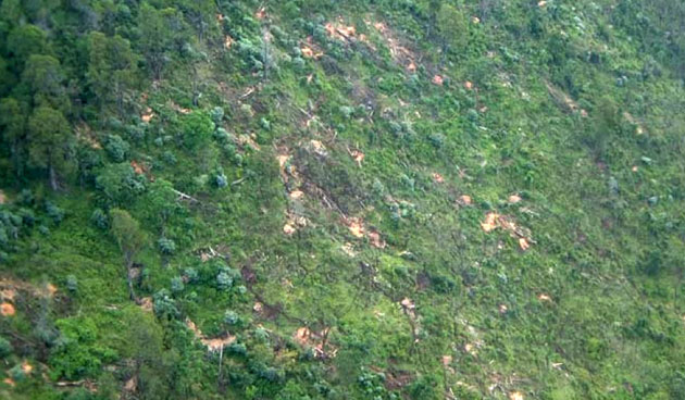
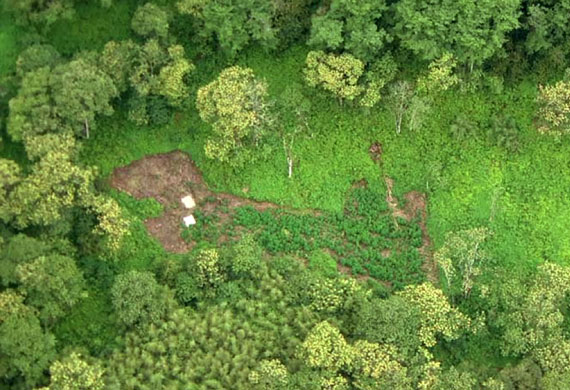
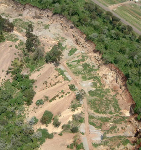
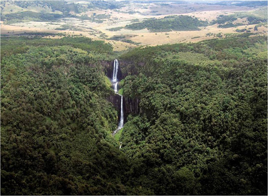
Buffaloes in a forest clearing. The seven-strand, eight-foot electric fence will be finished in a few months' timePhotograph: UNEPA young boy with a cow on the fence. On one side, the barrier protects farmed fields from wild animals – and on the other side it protects the park from livestock grazingPhotograph: John VidalThe fence will be 250 miles long, enclose nearly 772 sq miles and will cost more than $8m (£5.3m)Photograph: John VidalIt is expected to become a blueprint for other parks in AfricaPhotograph: John VidalA combo picture of aerial surveys in 1987 (left), 2000 (middle) and 2006 (right) shows deforestation increasing in Aberdare range forestsPhotograph: UNEPCultivated fields in indigenous forests within the park are threatened not just by ivory poachers, but by squatters wanting to farm, illegal loggers, hunters, villagers wanting firewood and corporates trying to source illegal water for flower and vegetable farmsPhotograph: Aerial Survey/UNEPOne of the flower and vegetable farms, which have a great demand for waterPhotograph: John VidalThreats: charcoal production on the South-eastern slopesPhotograph: Aerial Survey/UNEPLogging of indigenous cedar trees on the south-western slopesPhotograph: Aerial Survey/UNEPMarijuana cultivation is another threat to the Aberdares. This picture shows a planted marijuana field on the eastern slopesPhotograph: Aerial Survey/UNEPA quarry in Kiganjo forest reservePhotograph: UNEPThe Karuru falls. The Aberdares provide 90% of Kenya's capital Nairobi's water supplies and the rivers coming off the slopes are the source of 40%-50% of all the power in the city. Without the fence, Nairobi would be facing water shortages and power cutsPhotograph: Rhino Ark
Sign up to read this article
Read news from 100’s of titles, curated specifically for you.