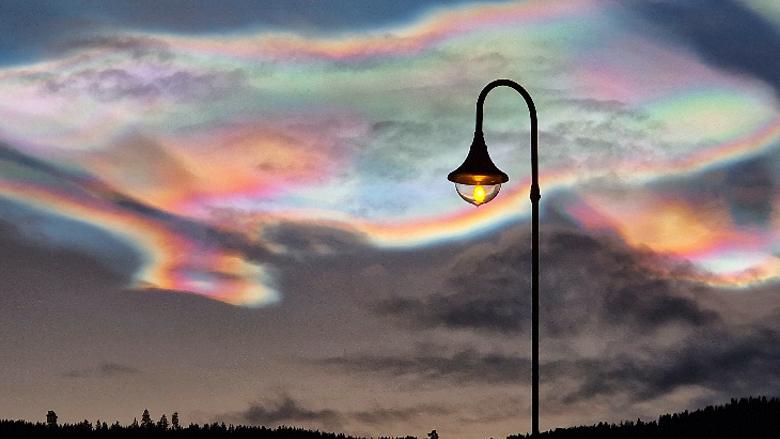
"Spectacular" rainbow-colored clouds have been shimmering in the skies over and around the Arctic for more than three days thanks to an unusual cold snap in the upper atmosphere. And even more of these technicolor treats could appear during the next few months, experts say.
The colorful clouds, known as polar stratospheric clouds (PSCs), were spotted floating high in the sky above parts of Norway, Sweden, Finland and Alaska, and even as far south as Scotland. They began to emerge on Dec. 18 and continued to appear clearly until Dec. 20, according to Spaceweather.com. Some smaller, less distinct clouds were also spotted on Dec. 21, but in general they seem to be disappearing.
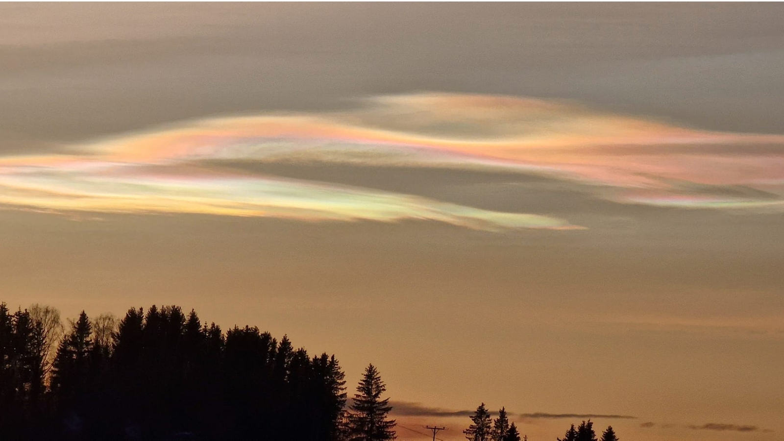
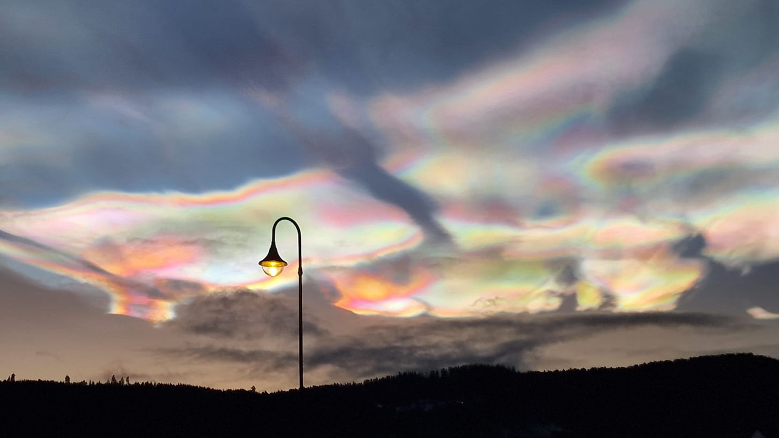
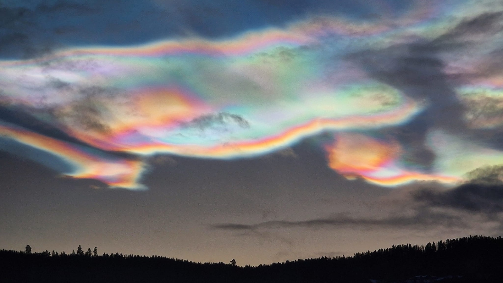
Photographer Ramunė Šapailaitė captured staggering photos of the rare phenomenon above Gran in southern Norway. Her photos revealed the rainbow hues of PSCs and their iridescent shimmer that has inspired the nickname nacreous clouds, due to their similarity with nacre — an iridescent material, also known as mother-of-pearl, that is found in the shells of some mollusks.
"The colors are spectacular," Šapailaitė told Spaceweather.com. "The clouds were visible in the sky all day, but the colors really exploded just before sunset."
The PSCs were caused by a prolonged period of unusually cold temperatures in the sky, according to Spaceweather.com.
Related: 10 bizarre phenomena that lit up the sky (and their scientific explanations)
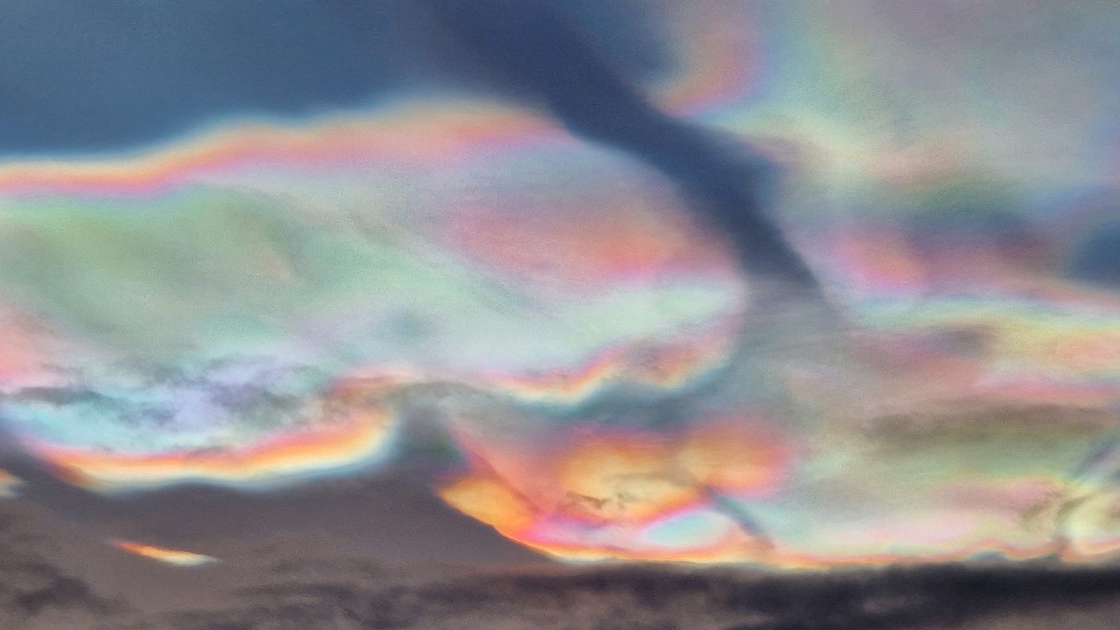
PSCs are made from tiny ice crystals that refract, or scatter, sunlight. This separates the light into individual wavelengths, or colors, and creates the rainbow-like effect we see from the ground.
There are two types of PSCs: Type I, made from a mix of ice crystals and nitric acid, which produce less spectacular colors and are linked to the formation of ozone holes; and Type II, which are composed of pure ice crystals and produce more vivid colors. The clouds that recently formed over the Arctic were Type II.
The shimmering structures only form in the lower stratosphere, between 9.3 and 15.5 miles (15 to 25 kilometers) above Earth's surface. Normally, clouds do not form this high up in the atmosphere because it is too dry. But at extremely low temperatures — below minus 121 degrees Fahrenheit (minus 85 degrees Celsius) — widely spaced water molecules begin to coalesce into tiny ice crystals that further aggregate into clouds.
Stratospheric temperatures in the Arctic rarely drop below the threshold needed for PSCs to form, so they are normally only spotted a handful of times every year during winter months. The extreme cold snap that led to the recent appearance of PSCs may have been triggered in part by the current El Niño event, which can impact temperatures around the poles. However, human-caused climate change could also be to blame, according to Spaceweather.com.
Experts say there is a high chance that we will see more PSCs in the Arctic over the next few months, according to Spaceweather.com.