Apple is about to kick off an eight-month UK project to improve its Maps service that will see Apple's cars and even backpack-wearing walkers traverse the country.
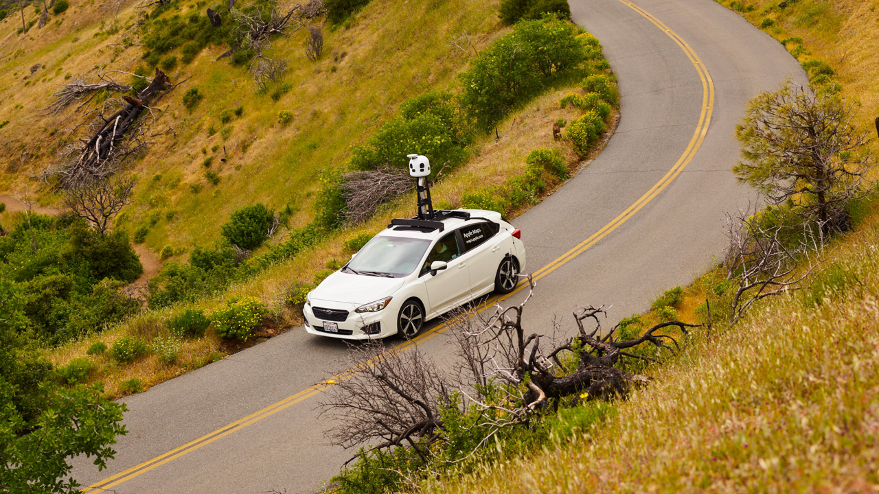
Starting February 21, UK residents will see Apple vehicles driving around the country for the next eight months gathering information as part of the company’s ongoing rebuild of Apple Maps, the company confirmed to iMore on Tuesday. Apple's vehicles will gather information through October 17, and from May 20 through September 11, you’ll also see people wearing Apple backpacks walking the streets of Birmingham, London, and Manchester.
Apple uses LIDAR capture equipment and images to record data and has completely rebuilt its Maps app over the last few years, already rolling out improved mapping in the US, UK, France, Italy, Germany, and more. The company says that the data gathered by its cars and pedestrians will allow Apple to maintain its UK Maps experiences with improved navigation, better detail, and more accurate place information.
"Apple is conducting ground surveys with vehicles around the world to collect data to improve Apple Maps and to support the Look Around feature. Vehicle surveys may use equipment mounted on the outside of vehicles as well as iPhones, iPads, or other devices inside of vehicles,” the company said in a statement given to iMore.
Apple Maps UK is getting some love
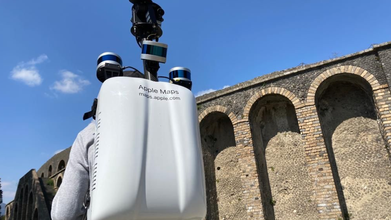
So if you see a pedestrian walking the streets of one of the aforementioned cities over the next few months lugging around an Apple Maps backpack, now you know why. The backpacks are used in pedestrianized locations including streets, parks, and stations inaccessible to cars, using a more compact version of the vehicle-based equipment to gather LiDAR and image data. "Some pedestrian surveys use a backpack system to collect data that may be used directly in Apple Maps, such as in the Look Around feature," Apple explained. "Other pedestrian surveys use iPads, iPhones or other devices to collect data for map improvement purposes. These pedestrian surveys allow us to improve and update Apple Maps in areas where vehicles simply can’t go while using the same privacy protections as the Apple Maps vehicles.”
If you do see an Apple Maps car or pedestrian out in the wild, there’s no need to worry about your privacy, either. Apple says “We are committed to protecting your privacy while conducting these surveys. For example, we will censor faces and license plates on images that are published in Look Around.“
Apple first rolled out its overhauled Maps to the UK and Ireland in 2020.