Around 180 million people will be impacted by heavy rain, wind, snow and large thunderstorms as severe weather is due to hit the eastern half of the US this weekend, AccuWeather experts say.
Meteorologists warn that the extreme weather could result in fallen trees, power outages and other damage across the East this weekend as winds and rain ramp up.
The storm system will start to materialise on Friday as low pressure will be met with energy left over from a weather formation in the Northwest to create an even larger storm, CNN said.
By Saturday, the storm is expected to stretch more than 1,200 miles, spanning from the Gulf Coast all the way to the Canadian border.
Thunderstorms are expected on Friday in Oklahoma, Arkansas, and Texas before larger thunderstorms on Saturday morning will deliver severe winds and hail across areas of the South.
Portions of Texas, Louisiana, Arkansas and Mississippi will be granted a ‘slight risk’ or Level 2 warning of severe thunderstorms by Saturday afternoon, according to the outlet.
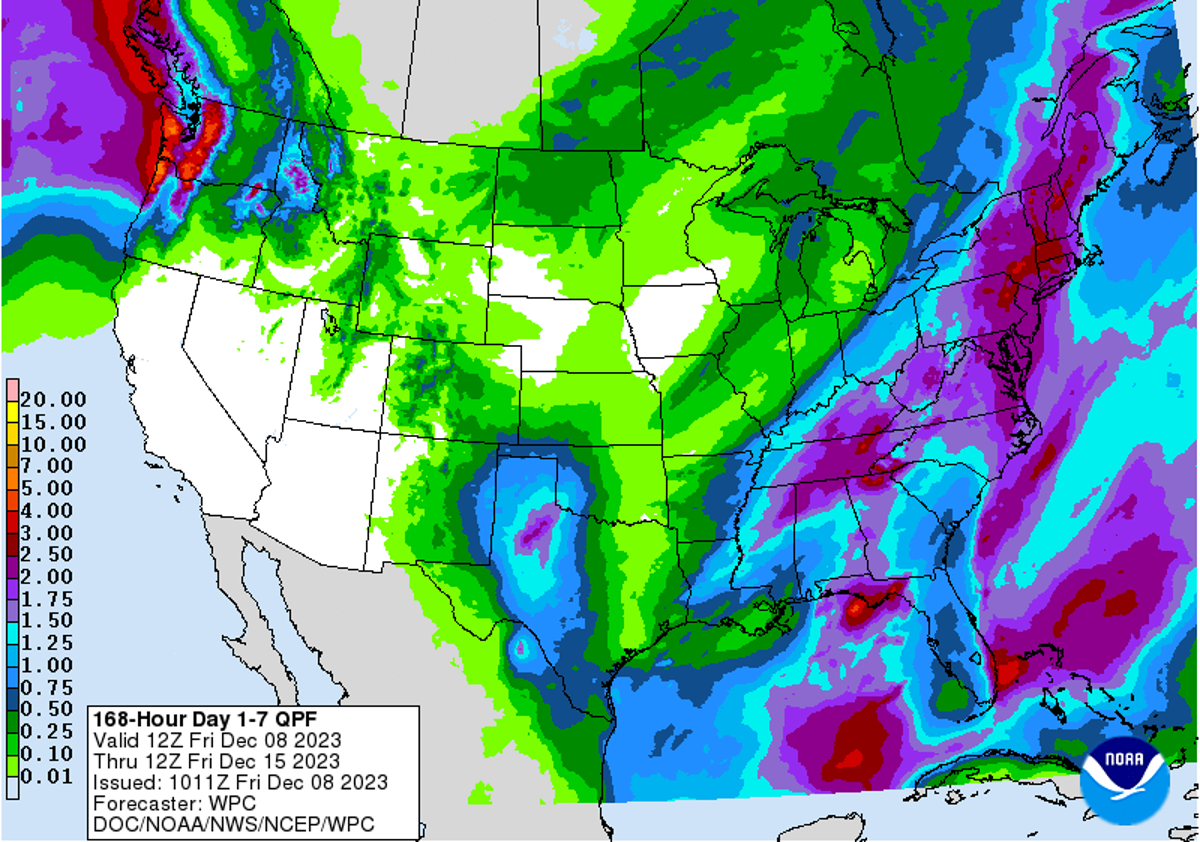
The storm will travel across eastern areas of the US this weekend— (NOAA)
Throughout Saturday, the Gulf Coast to the Midwest will be blanketed with rain, which could cause flooding in some areas, although due to the speed of the storm, it will move along briskly to other areas.
Snow is also expected to make an appearance on Saturday from Wisconsin to Michigan’s Upper Peninsula.
Meteorologists at AccuWeather said that snow would only impact a few areas, as the storm will push warm air in front of itself, causing temperatures to rise 15 to 25 degrees Fahrenheit more than the historical average.
Instead, it is the strong winds and heavy rainfall that concern weather experts more.
By Sunday, the storm will be at its maximum strength and will take hold of most of the East, with powerful winds of 40 to 50mph that could cut power supplies and impact travel plans for people.
The winds are expected to reach around 60mph on Sunday night in New England and coastal regions of New York and New Jersey, which could potentially disrupt power and air travel or make it harder for people to drive.
CNN cautions that these conditions could result in fallen trees and outdoor holiday decorations could be blown away if not secured properly.
Thunderstorms are also expected to become stronger and could be damaging in areas from Georgia to Virginia.
Rain also has the potential to transform into snow on Sunday night to Monday morning in higher areas of West Virginia, Pennsylvania, New York and New England, the outlet said.
While the weekend’s storm will start to push off the East Coast by Monday, New England and upstate New York will still encounter the last remnants of rain and snow until the evening.