Editor’s note: This is Part 1 of Drifting Toward Disaster, a Texas Observer series about life-changing challenges facing Texans and their rivers.
Tip us—and tell us your river stories!
A heavy monsoon season hit the Chihuahuan Desert in September. It flooded city streets in northern Mexico, overflowed some Mexican reservoirs and sent raging water down the Rio Grande through snaking canyons on the West Texas border, which months before had run totally dry for the first time on record.
In the Mexican state of Chihuahua, a massive area with a flourishing commercial nut export sector, residents rejoiced. Just a few weeks before they had drifted so near the brink of disaster that they had caught sight of the terrible hazards ahead.
In mid-August, Chihuahua’s largest reservoirs had dropped to critical levels after years of widespread drought. The largest city in northern Mexico, Monterrey, had been rationing water to its 5 million people all summer. Yet Mexico owed water to Texas. It was 20 months behind on a five-year payment schedule under a 1944 U.S.-Mexico treaty.
Along the Rio Grande, which forms the international border, residents of Texas cities were also confronting the prospect of severe shortfalls. This broad, regional crisis didn’t just result from a single summer’s searing heat and drought. The desperate predicament had been creeping for a century down long rivers and across vast deserts that connect the mountains of northern Mexico to the Rio Grande, South Texas, and the Gulf of Mexico.
When September’s monsoon arrived, it brought only temporary relief from a trend towards scarcity and conflict that spans two countries and affects millions of people.
Most of this vast region’s water problem comes down to the Rio Conchos, the largest single water source and, effectively, the headwaters of the Texas river. It flows—or lately, it doesn’t—from the Western Sierra Madre of Chihuahua into the Rio Grande between Ojinaga, Mexico, and Presidio, Texas.
These days a meek Conchos dribbles into the Rio Grande’s dry bed in a dusty, yellow grassland. Farmers around here grow mostly hay now.
Yet, this valley used to teem with muddy wetlands, back when the two rivers that nursed it were so mighty that Spanish explorers in the 16th century dubbed this La Junta de los Rios—The Meeting of the Rivers. They found some 10,000 people in a dozen villages of two-story mud brick homes raising crops along a 50-mile stretch of fertile floodplain.
“This has been farming country for thousands of years,” said Enrique Madrid, an Indigenous historian with long gray hair and a mustache, thumbing through published English translations of Spanish explorations.
As he speaks, Madrid, the son of the town librarian, pulls books and binders from tall shelves and stacked boxes that fill the living room of the small home where he’s lived all his life in Redford, a town of 23. (It’s seen better days, he said.)
He flips to an illustration of when his ancestors tended fields along the rivers’ muddy banks but built their homes a safe distance away. Then he scans his shelf, picks out the Journal of Big Bend Studies, Volume 8, 1996, and finds his entry, “Native American and Mestizo Farming at La Junta de los Rios,” about how farmers here used the natural rhythm of epic floods to channel water through earthworks to their crops.
This place, like the rest of the Rio Grande, wasn’t part of the Republic of Texas that seceded from Mexico in 1836. Only in 1848, after the U.S. invaded Mexico, did it annex the river’s northern bank, along with all the southwestern territories, including the Rio Grande’s headwaters in Colorado and New Mexico.
After that, the days were numbered for traditional farming in La Junta de los Rios, and for the ancient floods that sustained it. Enterprising immigrants poured in. Railroads brought people and heavy machinery—not just here but upstream in New Mexico and down the Valley as well.
“The Anglos brought in pumps and motors,” Madrid said, chuckling in his worn-out armchair. “They think they can do better than all these poor people who’ve been here 20,000 years.”
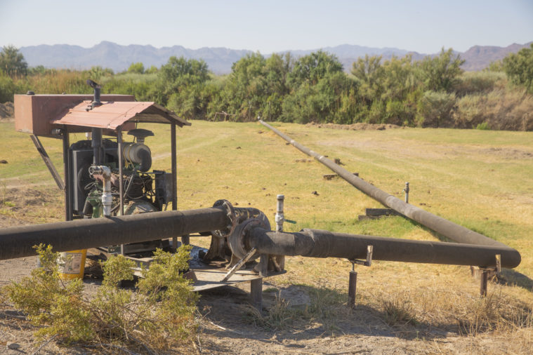
Soon, hundreds of wood-fired pumps were drawing water onto new orchards and fields far upriver in New Mexico and Colorado. By 1916, a massive dam was built to catch Rocky Mountain snowmelt in New Mexico before it rushed into Texas.
Just like that, La Junta de los Rios was gone, its northern arm severed, the floods that nursed its wetlands over. The old Rio Grande was broken into two—one river that flowed from the Rockies to El Paso and a second Rio Grande that flows from the Rio Conchos, through Texas to the Gulf.
“The Anglos brought in pumps and motors. They think they can do better than all these poor people who’ve been here 20,000 years.”
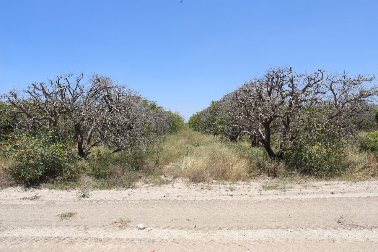
For a century, the Conchos alone has watered this valley. Mechanical pumps enabled farming without floods. But little by little, the Conchos faltered. Mexicans built dams and planted orchards in Chihuahua, as well. This summer, the Conchos stopped running altogether, turning its path through the old Junta de los Rios into a muddy trench.
In Redford, a farmer and retired Customs and Border Protection worker named Esteban Mesa peered into the shallow water where his irrigation pump tapped the Rio Grande, 15 miles below the mouth of the Conchos. He had never seen it so low.
“The climate is changing,” Mesa said as temperatures exceeded 100 degrees during a late morning in May. “I feel the heat of the sun more.”
He recounted only two recent rains—three-quarters of an inch back in June 2021 and four-tenths of an inch that October.
“I don’t know what’s going to happen,” said his wife, Josefina, who grew up here when agriculture thrived. “When there’s no water, what can you do?”
Madrid, the local historian who lives down the street, thinks he knows.
“All the cities on this river are going to fight for the water,” he said.
This dry spell spreads far beyond the old Junta de los Rios. Across a swath of North America, scientists have identified more than two decades of unusual dryness, as wilted cacti in the Chihuahuan Desert attest.
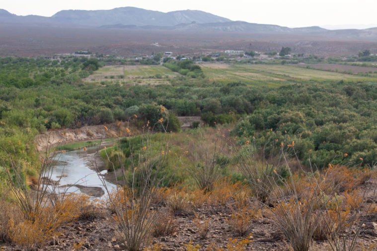
About 150 miles downstream from the mouth of the Conchos, Guadalupe Davila, a 74-year-old retired backcountry firefighter, points out where his tiny village of Boquillas, Mexico, used to grow its food.
“All this used to be full of crops,” he said, standing atop a rock ledge and waving his hand over the sandy desert valley.
Crops grew thanks to rain that fell in the Sierra Madre then rushed past Boquillas on its way to the Rio Grande. A network of crumbling canals built by local families show how they formerly channeled pulses that washed down the mountains into fields of corn, beans, squash, tomatoes, and chiles.
That was almost 30 years ago. Today, no gardens remain. One man raises hay on what little water still arrives, Davila said, pointing to a distant greenish-tan patch in the sand. Most farmers gave up in the late 1990s. Too many dry years wrecked their labors and investments. Even though wet years have come, the rain isn’t reliable. Now, a truck comes to town once a week selling produce.
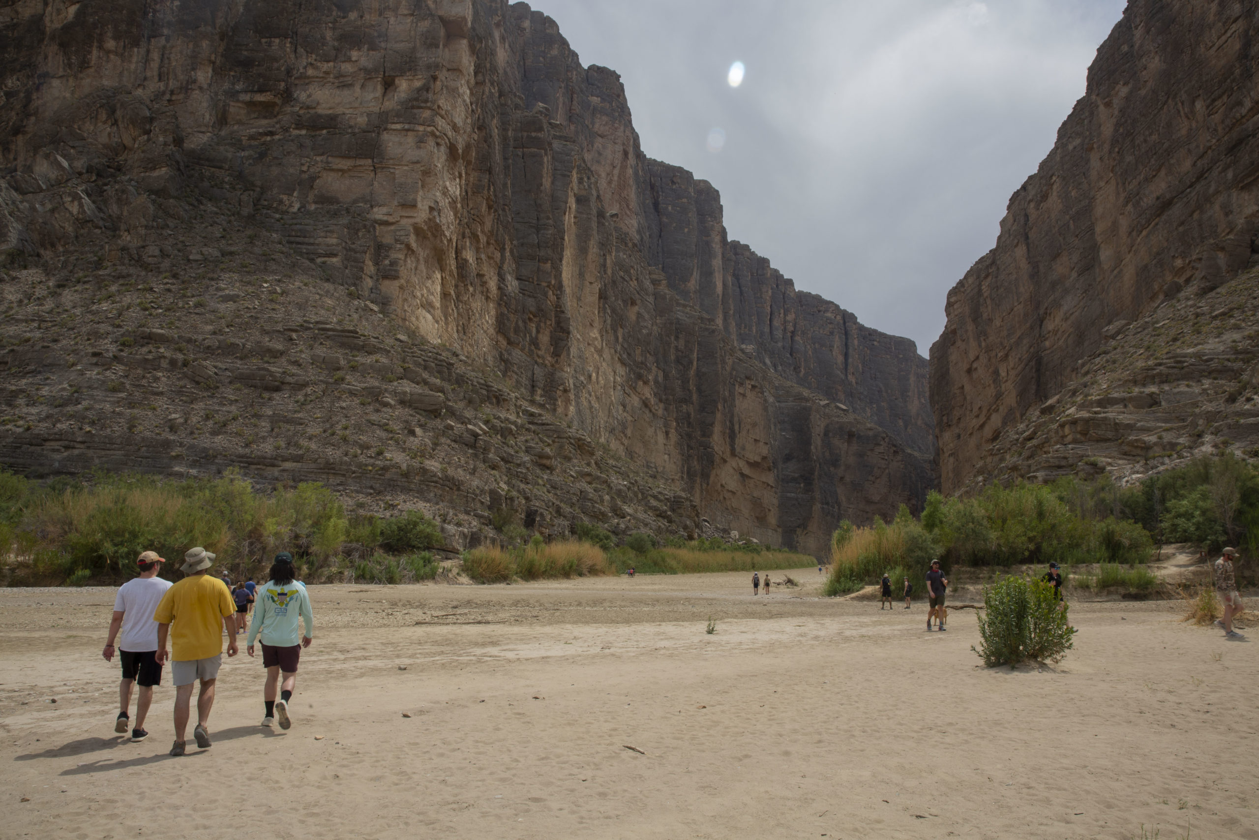
After Boquillas, the Rio Grande squiggles through about 220 miles of wild canyons and pristine, sparsely inhabited country until it hits the dam that forms the Amistad Reservoir. Here, the free-flowing river ends for good. Afterward, its flows are man-made.
This dam, completed in 1969, spans six miles to catch river floodwaters and store them in its massive lake, from which millions drink.
This “lake” is like a giant bank, holding the accounts of hundreds of downstream users—cities and irrigation districts in Texas and Mexico (where water is owned and managed by the federal government). The banker—the Texas Commission on Environmental Quality’s Rio Grande watermaster—knows exactly how much each user has in its account. When a user wants to make a withdrawal, they ask the watermaster. When new water arrives, the watermaster divides it up, giving priority to municipal users and the state.
“The bucket is almost empty. We’re heading toward a point of no return.”
Only last summer, virtually no water was flowing. Amistad fell to 22 percent full while its downstream counterpart, Falcon Lake, hit 11 percent. Communities began asking the state to help extend pump intakes to reach the final dregs.
Yet from the gates of Amistad, water still rushed forth, past a half-dozen cities of the Middle Rio Grande, which seemed reluctant to confront the mounting crisis.
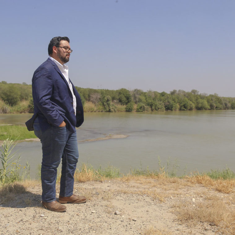
“The bucket is almost empty,” said Martin Castro, watershed science director with the Rio Grande International Study Center in Laredo. “We’re heading toward a point of no return.”
Laredo forms part of the largest metro area on the Rio Grande below the Conchos. Founded in 1755, it’s better known today as Los Dos Laredos since U.S. annexation turned the city’s river into an international divide. About 260,000people live in Laredo, Texas, and another 425,000 in Nuevo Laredo, Tamaulipas.
Laredo leaders are aware of upcoming shortfalls. In 2021, the city’s 50-year water plan said its population would outgrow the water supply by 2040. Its top recommendation: Run a pipeline between 70 and 150 miles to an aquifer in another county and import tens of millions of gallons of water per day.
“The river, we cannot rely on it any longer,” Castro said from the Rio Grande International Study Center, which is housed near the river.

Yet Laredo has no means of paying for an alternative water source. At a recent city council meeting, Mayor Pete Saenz said the city desperately hoped for federal funding from the recent infrastructure bill in order to make the pipeline happen.
“We need help. We cannot do it alone locally. It would throw us into a horrendous financial bind as a community for us to try to attempt to bring water,” Saenz told the council. “If somehow the state says no, we have no choice. We’d have to suspend basically everything that we have just to address that supplemental water.”
For many, this crisis seems invisible—as evidenced by the 10 million gallons of water Laredo residents spray on lawns every day. To the untrained eye, the robust river rushing each day under bridges between Los Dos Laredos seems like a strong water supply. But that’s only an illusion.
“We cannot do it alone locally. It would throw us into a horrendous financial bind as a community for us to try to attempt to bring water.”
This is not just water in a free-flowing river. It’s a commodity in a giant irrigation ditch, and every last drop is spoken for. That water leaves Amistad in meticulously measured releases, bound for specific downstream customers. As such, the river levels in Laredo may rise even during drought, as downstream farmers order more water to offset missing rain.
It’s bound for the thirstiest users in this entire system: the lush cropland and sprawling boomtowns of Texas’ Lower Rio Grande Valley.
About two hours’ drive south from Laredo, the highway dips from yellow grasslands into the vibrant green of irrigated fields and orchards.
This broad, low floodplain extends some 70 miles until it meets the sea at Laguna Madre. Although it is known as the Valley, the Rio Grande Delta would be more accurate. Here, the river used to rise above the low hills that crest the Valley and spill floods from distant mountains into a shifting array of tentacles that spread towards the sea. Water almost always abounded.
Yet unlike the old Junta de los Rios, more than 600 miles upstream in the desert, the delta was never a historical hub for agriculture. Farming here dates only to the 20th century.
Before the time of the Spanish, native people kept their distance from the raging river, whose thrashing course often wiped out any village or farm within miles. Dry land one day could be marshland the next. The water’s invasions came in floods roaring down the river, and in hurricanes roaring up from the Gulf. Semi-nomadic groups made seasonal visits, but the climate was unwelcoming, said Francisco Guajardo, director of the Museum of South Texas History in Edinburg. “This place was not a desirable place to live.”
The Spanish founded ranches along the Rio Grande starting in the 1700s. Tejano cowboys grazed enormous herds of Iberian cattle here for more than a century before the U.S.-Mexico war brought this land under Texan control. After that, entrepreneurs saw the potential that pumps and motors could bring to this fertile floodplain with seemingly limitless water. When a Wisconsin-born farmer’s crop of Rio Grande sugar cane won first prize at the 1904 World’s Fair, the rush began.
Midwestern developers bought up massive tracts and imported pumps the size of houses to spread water across one million acres of alluvial soil and grow premium tropical crops like citrus and sugarcane, plus all kinds of vegetables. Fast-growing cities followed: McAllen, Edinburg, Pharr, Harlingen, Weslaco—all founded after 1900.
All pumped freely from a rushing river. Today it’s a different story.
“We just don’t have the kind of water to be able to do a whole other century worth of agriculture,” Guajardo said. “Something has to give.”
Agriculture has been declining for decades, as U.S. distributors switched to cheaper producers in Mexico and Guatemala. It’s still a cultural pillar for the community and a $1.1 billion sector of the economy, but far smaller than the Valley’s consumer shopping sector.
“We just don’t have the kind of water to be able to do a whole other century worth of agriculture. Something has to give.”
Booms in manufacturing, border security, and subdivisions that attract sunseeking retirees have turned these former farming towns into a solid strip of suburban sprawl lining 60 miles of roaring highways.
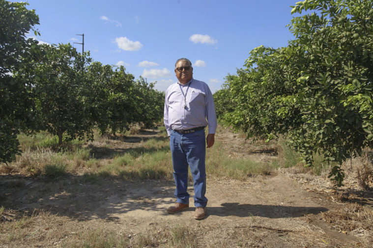
Former farmer Rusty McDaniel guesses that during the 18 years he’s managed Hidalgo County Irrigation District 1 in Edinburg, he’s watched two-thirds of its acreage transform from farmland to suburban development. At 73 with bright white hair, he said he’s the average age for a farmer here. Most are retiring—cashing out on family land for big bucks from developers.
“Look at these homes. They’re all sold. This was just blank land,” said McDaniel, pointing out his office window at a brand-new subdivision. “The ag is going away.”
With ag sales go water rights, signed over to city public utility departments. The region’s largest cities, McAllen and Brownsville, have doubled in population since the 1980s. The third largest, Edinburg, has quadrupled.
In McAllen, about 60 percent of municipal water use goes to water lawns, according to Jim Darling, a former McAllen mayor and head of the Region M Water Planning Group.
“I’d say the average citizen has no concept of where the water comes from,” he said.
Water planners, however, are keenly aware of the long drought on the Conchos and of the summer’s low reservoir levels, he said. They know shortages are coming and were praying heavy rains would arrive in September 2022.
“We’re praying for a hurricane,” Darling said, then corrected himself, sensitive to the region’s traumatic hurricane history. “For a benevolent tropical storm.”
Timely rains have always saved the day before. September is peak storm season and the region’s wettest month. But there are no guarantees, water planners and farmers know.
In July, in a green grove outside Edinburg, Jose Silva, a citrus farmer and growth care manager for the Edinburg Citrus Association, parked his pickup truck beside a small pump station and a one-acre pond. Another similar setup lies nearby, and a third can be seen in the distance.
Silva manages 1,500 acres like this for the ECA on behalf of investors, absentee owners, and a few local farmers. He checks the notes on his clipboard. This pump ran the day before for 9.7 hours and moved 536,000 gallons into the little reservoir, from which it dripped about 61 gallons at the roots of each tree in this 40-acre orchard.
“I’d say the average citizen has no concept of where the water comes from.”
“Those trees will just suck that water up pretty quick,” he said as he drove the rows and surveyed the sprinklers dribbling at each tree’s base.
This efficient drip irrigation method is used on about 20 percent of local citrus orchards, he said. The other 80 percent flood entire fields, using twice as much water. Historically, the water savings of drip irrigation haven’t mattered much to farmers, who pay only $10 per acre-foot (about 326,000 gallons).
Even that’s changing for farmers like him, Silva said. In addition to the groves he manages, Silva raises his own 8.5-acre plot of oranges. His irrigation district, the Donna Irrigation District, is low on water and hasn’t been able to provide the irrigation he needs.
“It’s not a good feeling for me right now,” he said. “To be honest, we’ve never had to deal with this.”
The summer 2022 shortage forced him to buy excess water from neighboring districts for $30 an acre-foot, three times what he usually pays (though below the $1,000 his brother-in-law pays in California). He already suspected other districts would soon need water for themselves.
Last summer, seven of the region’s 32 irrigation districts implemented restrictions.
Cameron County Irrigation District No. 2 imposed restrictions in April 2021. Back then, the district announced that farmers were only guaranteed a supply sufficient for one full crop on their acreage. In September, the district dropped the figure to one-quarter of a crop. In January, it fell to three-tenths.
Manager Sonia Lambert said the district has imposed restrictions on users twice before, in 1999 and in 2012. Each time, they lasted only weeks before big rains broke the drought.
“Never has it lasted this long,” Lambert said. “It’s a pretty scary situation, not knowing how long this is going to continue.”
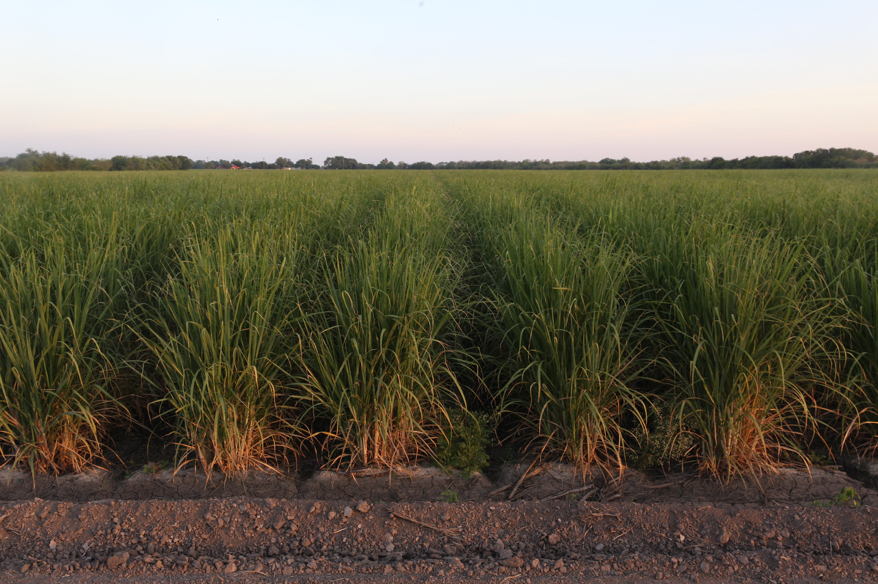
Each district has its own threshold for restrictions. Cameron County No. 2 started early because it’s a big user. On the rural edge of the Rio Grande Valley, almost all of its farmers still flood fields, including sugar cane, one of the world’s thirstiest crops. It requires up to 1.6 million gallons per acre per year during dry times.
More populous urban districts had not been affected. The largest urban water supplier, Hidalgo County Irrigation District No. 2, was still sitting on a healthy reserve, said its manager, Sonny Hinojosa. His district pumps water to cities like McAllen, Edinburg, Alamo, San Juan, and Pharr.
“Should nothing change, we’re a year away from restricting,” he said, crunching numbers on a white board at his office in San Benito.
Hinojosa, a veteran Valley water official with a crisp white button-down tucked into dark blue jeans, has been through this before, in 2002. During two consecutive five-year cycles, Mexico delivered less than half the water it owed Texas farmers under the 1944 treaty—the first two times it had ever come up short. Rio Grande reservoirs sank to record low levels.
“Mexico had the water, and they just chose to use it instead of delivering to the U.S.,” Hinojosa said. “By the time we realized what happened, it was too late.”
Valley irrigators were losing crops, so they asked the state government for help. “Since there was no water to give us, instead they gave us money,” he said.
But the crisis ended suddenly with heavy flooding in November 2002; the next years brought ample rain. By 2005 the reservoirs were nearly full. Years of plenty ensued. Big storms in the Conchos basin sent water gushing down the Big Bend canyons and into Amistad, which spilled over its brim in 2008 and 2010.
Then the wet years ended; 2011 was one of record drought. But Amistad was full, so Valley farmers watered through the dry years undamaged. By 2013, the reservoir had plummeted to 30 percent, before rain in 2014 put it back over 50 percent.
Mexico fell behind on its water payments again. In 2015 it ended a five-year cycle 250,000 acre-feet in debt. By the next cycle’s end in 2020, Mexico was behind again. Even though its own reservoirs were low, the country faced pressure from the Trump administration to pay up.
In Chihuahua state, Mexican authorities opened the dam gates at La Boquilla, the largest reservoir in the Conchos basin, sending its waters into the Rio Grande.
Local communities protested the release of their water to pay off Texas. Two days after the gates were opened, a mob of farmers armed with clubs forced their way into the dam facility and shut off the valve. Clashes with the Mexican national guard left two people dead.
So Mexico hastily devised a legal trick to pay off its debt, signing over rights to water already stored in the Falcon Reservoir. After that, it released no more water from La Boquilla as the reservoir dropped to 21 percent and Mexico fell farther behind than ever before on its debt.
“Mexico has overdeveloped their water supply,” Hinojosa said. “They’re farming desert land. They increased their acreage with water that should have gone to the U.S. And it was U.S. companies doing it.”
“Mexico has overdeveloped their water supply … They increased their acreage with water that should have gone to the U.S. And it was U.S. companies doing it.”
“It’s gonna get real interesting,” he said, leaning back into his leather chair.
Mexico has until 2025—the end of this cycle—until it becomes officially delinquent on water payments. Even then, the 1944 treaty allows for one delinquent cycle—“in the event of extraordinary drought or serious accident”—to be paid up in the next. So Mexico has until 2030 until it would officially violate the treaty.
“Every time that Mexico falls behind in complying with the treaty, there is no question that Texas agricultural interests in the Rio Grande Valley are the ones that bear the most significant impacts,” said Carlos Rubinstein, former head of the Texas Water Development Board.
If Mexico violates the treaty, he said, “it’s up to the U.S. State Department to ensure it is honored.”
That could be done, Rubinstein said, by withholding water from the Colorado River that the U.S. owes Mexico. But no one knows what will happen if Mexico’s debt comes due on water it simply doesn’t have.
In the Sierra Madres of Mexico’s north, the river basins that feed the Rio Grande ran bone dry last summer after six consecutive years of low rainfall.
“Many of the rivers that used to be permanent, now they don’t exist,” said Oscar Leal, water program coordinator at Pronatura Noreste, an environmental nonprofit based in Monterrey, Mexico.
“Many of the rivers that used to be permanent, now they don’t exist.”
With 5.3 million people, Monterrey is Mexico’s third-largest metro area, and one of its richest. Like the Texas Valley cities, its population has doubled since the 1980s. There, authorities have been rationing water since June. Most households get water for just a few hours each morning and others not at all.
Through Monterrey runs the (mostly) dry bed of the Rio Santa Catarina, which later hits the Rio San Juan, which joins the Rio Grande downstream from both binational reservoirs, Amistad and Falcon, so its waters don’t contribute to the reservoirs that sustain South Texas cities and farmers, leaving it outside the U.S.-Mexico standoff.
It’s the Rio Conchos, more than any other, that South Texas depends on. That river flows out of the vast state of Chihuahua, which boasts its own booming population and thriving $3 billion agricultural sector, largely watered by the Rio Conchos system. Its eponymous capital city has one million people. It, too, has doubled its population since the late 1980s.
Pecan groves have become a major industry in Chihuahua, and today it is the world’s second-leading exporter of nuts, after the U.S. It is also Mexico’s top producer of apples. One study found that the depth of irrigation wells for apple orchards in Chihuahua grew from an average of about 200 feet in 1980 to almost 1,600 feet in 2010 as aquifers’ levels receded.
It isn’t the first time that farming has boomed in these dry, fertile valleys, according to Marusia Renteria at the Universidad Autónoma de Chihuahua. The story of the last time around raises a grim specter for what the future may hold.
Seven centuries ago, the Paquimé civilization flourished in Chihuahua. Major works of water infrastructure enabled 3,000 people to farm with a great network of fields, canals, cisterns, reservoirs, and drains, capturing and storing water when it rushed down surrounding mountains. They built multi-story stone cities and impressive public works.
Then the mountain rains faltered. The Paquimé’s decline, Renteria said, lines up with a goliath dry spell from about 1350 to 1450. It was part of an era of drying thought to have brought several civilizations of the American Southwest to their demise.
Scientists call it a “mega-drought”—although some wet years come, too many dry ones make intensive farming impossible.
By the time the Spanish arrived in Chihuahua, the Paquimé’s cropland had disappeared back into the desert. Their canals were abandoned, their cities crumbled, and their civilization dispersed into wandering bands.
Today the farms and canals are back. This time 3.7 million people live in the state of Chihuahua. As years of recurring drought persist across this wide region and beyond, Chihuahuenses can’t help but wonder if this is the drought that will force Mexico, a few years down the line, to choose between its own needs and its water debt to Texas.
Historically, mega-droughts were interspersed with strong monsoons too, Renteria said. She hopes the temporary relief of the September 2022 rains will not distract from the need to confront long-term troubles.
“We are legally obligated, between countries, to comply with the treaty,” Renteria said. “It’s risky to say it, but these are two countries we are talking about. There are grave consequences that this could bring.”
Dylan Baddour covers Texas for Inside Climate News. This report was produced in partnership with ICN.