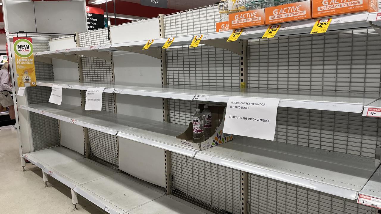
Residents facing a tropical cyclone threat in the Top End have been stocking up on basics with bottled water, bread, canned goods and other household supplies flying off supermarket shelves.
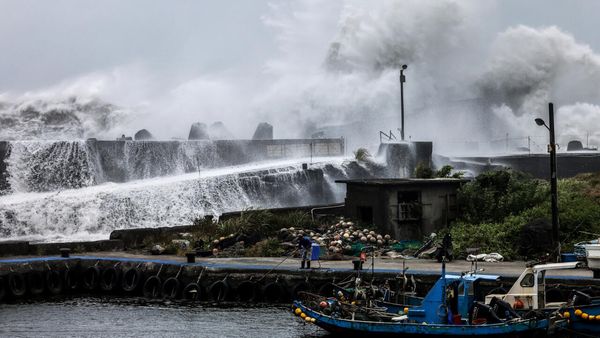
Cyclone Fina is forecast to do a U-turn at sea off the Northern Territory, with coastal and island communities in its path warned of destructive winds, flash flooding and dangerous storm tides.
Bureau of Meteorology cyclone tracking on Thursday had the category two system passing north of Darwin.
But a cyclone watch has been extended to the city, with the bureau warning it can still expect intense weekend rainfall and dangerous winds with the possibility of destructive gusts on Saturday.
Just after midday on Thursday the first cyclone of the season had sustained winds near the centre of 95km/h with wind gusts to 130km/h and was about 390km northeast of Darwin.
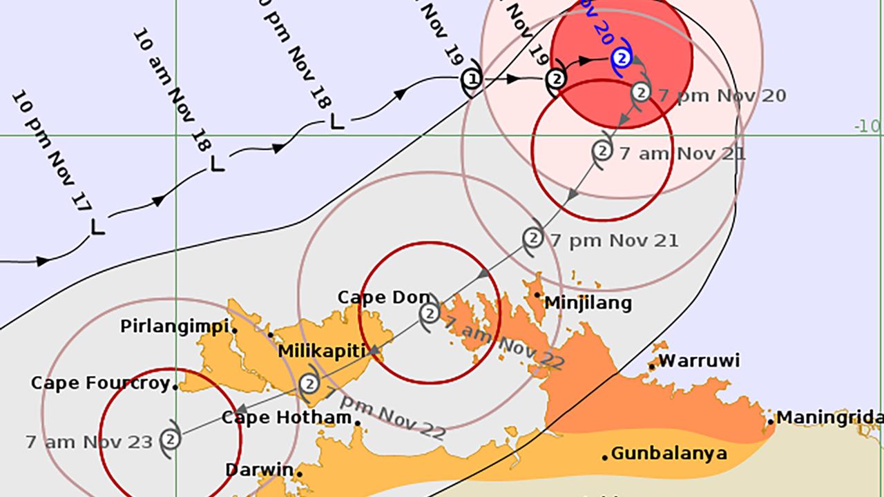
The bureau said a warning zone was in place from Cape Don to Warruwi, including the Cobourg Peninsula and Minjilang. Gales with damaging wind gusts may develop over the Cobourg Peninsula from late afternoon on Thursday and gales are expected for the Tiwi Islands on Friday.
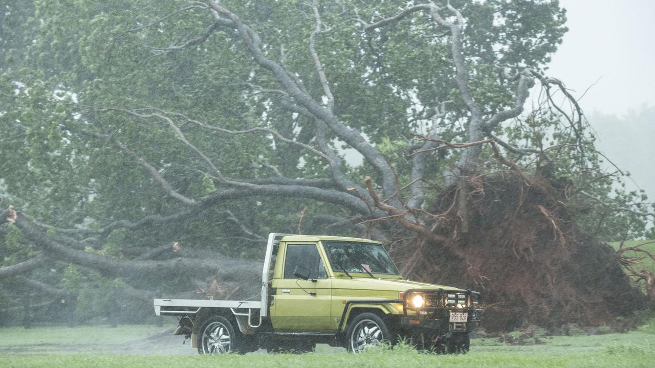
Destructive wind gusts may develop as the system nears the coast and local heavy rainfall may lead to flash flooding in coastal areas between the Tiwi Islands and Maningrida from Friday. Coastal residents on the Tiwi Islands and between Cape Hotham and Maningrida are warned of a dangerous storm tide as the cyclone centre crosses the coast.
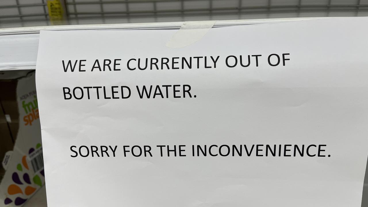
Darwin residents have been stocking up on supplies as they prepare to hunker down ahead of the cyclone.
At Coles supermarket in central Darwin on Thursday, staff restocked shelves with newly ordered supplies of bottled water as quickly as they were snapped up.
Senior meteorologist Angus Hines said there was a small chance Fina could strengthen into a severe category-three system, "but this remains an outside likelihood".
Darwin can expect strong winds, heavy rain and thunderstorms ramping up over the weekend, with the potential for flash flooding.
"The windiest spell for Darwin is likely to be from midday Saturday to perhaps midday Sunday, a very blustery 24 hours there as the cyclone crosses by likely somewhere to the north," Mr Hines said.
The winds could be very strong, potentially damaging property, trees, street signs and caravans and causing power outages and very rough conditions on coastal waters, he said.
The degree to which Darwin was impacted depended on the cyclone's track, forecaster Jude Scott said in a media briefing on Thursday.
If the track hugged the Tiwi Island coast the impact would be less on Darwin, but if it moved closer to the mainland then the city would feel the cyclonic impacts, she said.
People have been urged to ensure they have a cyclone plan and to shelter at home, with most of Darwin's buildings made to withstand cyclone conditions.
Darwin has not experienced a cyclone since category two system Marcus cut power to nearly 29,000 properties in March 2018.
Cyclone Tracey was the most devastating system to hit Darwin, killing 66 people after the city was destroyed on Christmas Day in 1974.