CSIRO-designed 3D mapping technology has been sent to the International Space Station, where it will be fitted to its onboard robot assistant.
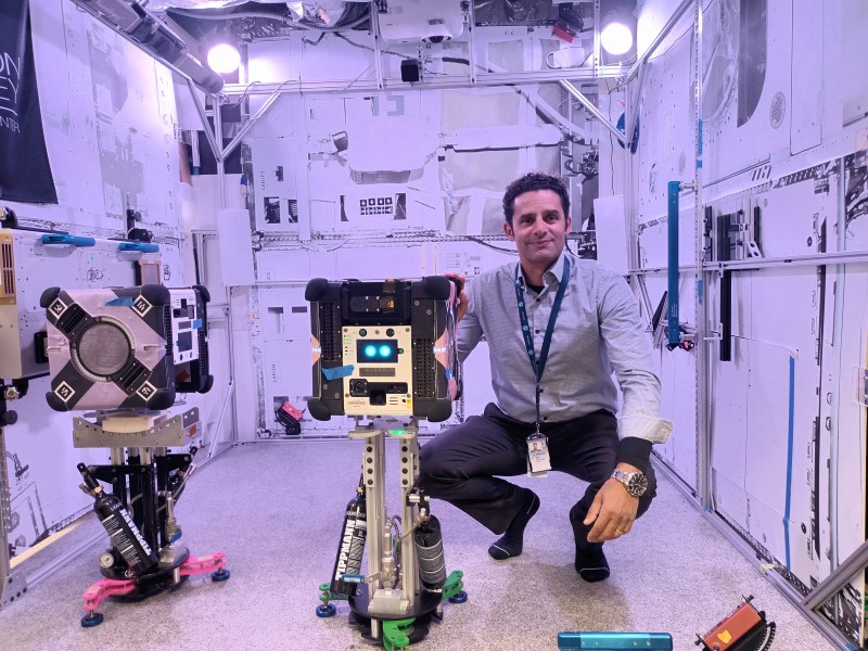
The multi-resolution scanning technology will be used to produce a detailed virtual environment of the International Space Station (ISS) when installed onto NASA’s three Astrobee cube-shaped robots.
It will help the robots fly freely around the ISS autonomously or through remote control and undertake routine tasks like inventory checks, documenting ongoing experiments and moving cargo.
The technology was launched from the Cape Canaveral Space Force Station in Florida on Friday, onboard SpaceX’s commercial resupply services-30 mission.
The first experimentation run for the payload will be at Japan’s Kibo ISS laboratory module.
If the technology is successfully demonstrated, the CSIRO development team will work towards other space applications, such as supporting operations on NASA’s planned Artemis program to return astronauts to the lunar surface.
It would be well suited for deployment to environments that require remote monitoring and management without a full crew, such as for exterior hull scanning for the future Gateway space station, and to support Artemis.
The technology is being developed in partnership with Boeing and has been supported by the ISS National Laboratory and NASA’s Ames Research Centre.
CSIRO research group leader Dr Marc Elmouttie said the 3D mapping technology would provide enhanced 3D sensing and mapping for robotics systems with the potential to support future “autonomous caretaker operations on spacecraft”.
“The device combines two CSIRO technologies – Stereo-Depth Fusion and Wildcat Simultaneous Localisation and Mapping – to produce high-quality data about the surrounding environment and its own movements through space,” Dr Elmouttie said.
“It is designed to showcase its potential to conduct full 3D internal scans, to help keep track of the movement of inventory around the station and assist astronauts and mission controllers in planning activities onboard the station.
“Combining information from a range of different sensors allows us to know not only what the robot’s surroundings look like, but also how that robot is moving through three-dimensional space.”