While it's only one month until Christmas, it might be wise to leave your thongs at home, put your swimmers back in the cupboard and grab a warm jumper instead.
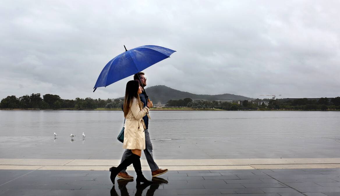
Summer is just around the corner, but rainy days and severe winds are set to put a dampener on the lead-up to the festive season.
The Bureau of Meteorology has issued a severe weather warning for damaging winds across the ACT and much of Southern NSW.
The strong cold front that is behind the gusts - which reached 70km/h at times on Sunday - has also left the territory shivering.
At 11am, the apparent temperature at the airport dipped below zero and - as of 3pm - it has been below 4 degrees since 4am.
Winds of up to 90km/h are forecast for Monday with gusts of 96km/h recorded at Thredbo at around 1am. Winds are expected to ease later in the evening but the risk in Alpine areas above 1900m will remain overnight.
There are reports Perisher received up to 15cm of snow overnight.
There is a chance of thunderstorms and small hail for Canberra on Monday evening and temperatures are expected to hit a top of just 13 degrees.
It comes after hail hit parts of north Canberra last week, only two weeks before the start of summer.
Tuesday is set to ease slightly as rain gives way to partly cloudy skies and a top of 15 degrees. Winds are forecast up to 40km/h.
Come Wednesday, temperatures are forecast for a top of 19 degrees before hitting a comparatively balmy 23 degrees on Thursday.
By Friday, winds are expected to have calmed with a maximum temperature of 25 degrees. The weekend is set to remain cloudy as temperatures remain in the mid-20s.
Meanwhile, the State Emergency Services has asked people in Deniliquin to leave their homes by Wednesday.
Adding to the town's woes, damaging westerly winds are expected on Monday and could reach up to 90km/h.
Showers or thunderstorms are also predicted across the Riverina and southwest slopes.
In the 24 hours until Monday morning, the SES received 617 calls for help, and conducted three flood rescues.
There are 102 warnings in place in the state, 16 of which are at emergency level.
The SES said it was focused on Forbes, Condobolin, Euabalong, Eugowra, Walgett, Bourke, Hay, Albury, Echuca, Mildura, Wentworth, Deniliquin, Wee Waa and Moulamein.
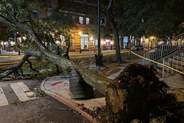
Many of the calls for help on the weekend were in response to damage caused by high winds, including roofs flying off and fallen trees and powerlines.
BOM meteorologist Jonathan How said the cold and windy conditions were unusual late in spring and warned people to listen to warnings and stay away from trees.
"With the winds, because everything is so wet, we are expecting to see trees and even powerlines topple more easily today," he told ABC TV on Monday.
"The winds will continue into tonight and possibly even into tomorrow morning as well. By tomorrow, we should see some of the strongest winds start to ease off."
The flood risk remains in central western towns but no significant rain was expected in saturated catchments this week.
In Forbes moderate flooding continues but the real concern this week is downstream at Condobolin, where the Lachlan River is expected to peak on Wednesday.
Emergency Services Minister Steph Cooke said nine recovery assistance points were opening this week to support communities.
The multi-agency hubs are designed to help flood-impacted individuals, families, farmers and business owners begin the clean-up, rebuilding and recovery process.
"We need the floodwaters to recede to understand the full extent of the damage, but it's already clear that hundreds if not thousands of properties have been impacted by flooding across regional, rural and remote NSW," Ms Cooke said on Monday.
- with AAP
We've made it a whole lot easier for you to have your say. Our new comment platform requires only one log-in to access articles and to join the discussion on The Canberra Times website. Find out how to register so you can enjoy civil, friendly and engaging discussions. See our moderation policy here.