BEIJING -- China's Ministry of Natural Resources published topographic maps of the Senkaku Islands in Okinawa Prefecture on its website on Monday, claiming they are based on a survey using the latest satellite images.
It is assumed that Beijing aims to give an impression of having detailed data of the islands' geographical landforms to enhance its propaganda effort regarding the sovereignty of the islands, which China claims.
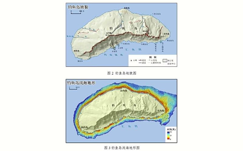
The topographic maps contain geographical names, based on the Chinese side's notations, and the elevation of landforms above sea level.
Locations of mountain streams are also displayed and one of the maps indicates sea depths around the islands.
According to China's Ministry of Natural Resources, "Knowing geographical forms plays an important role for the management of natural resources and the protection of ecosystems of the Diaoyu Islands," using the Chinese name for the Senkakus.
The Japanese government has conducted such surveys as research on the biology of albatrosses on the Senkaku Islands based on analysis of satellite images. It is assumed that China's production of topographic maps aims to rival Japan's activities.
The Japanese government protested via diplomatic channels saying that China's action conflicts with Japan's position.
Read more from The Japan News at https://japannews.yomiuri.co.jp/