In February 2023, Cyclone Gabrielle dumped up to 500mm of rain on the north of New Zealand, with devastating effects. Frank Film set out to investigate what would happen if a similar amount of rain fell on Ōtautahi Christchurch.
On a rainy autumn day, Professor Matthew Wilson and Doctor John Reid trudge through Christchurch’s sodden residential red zone.
Less than 30mm of rain has fallen on the city in the past 24 hours, yet there are already clear signs of flooding: the Avon has swelled significantly and, in the city centre, cars are splashing through the surface water flooding.
Wilson, director of the Geospatial Research Institute Toi Hangarau, studies the ponding in the red zone. “You can imagine that, if something like Gabrielle happened in Christchurch – with 400mm to 500mm of rainfall – we’d be really swimming through the water at the moment,” he says.
This leads the Frank Film team to bigger questions: how well-prepared is Ōtautahi Christchurch for floods? Does the natural lie of the land affect our flood risk? What did this area look like in the past, and what does the future hold for us?
Reid (Ngāti Pikiao, Tainui, Tauiwi), a senior research fellow at the Ngāi Tahu Centre, explains that, before European colonisation, Ngāi Tūāhuriri lived on an Ōtautahi that was very different to the Christchurch we know today.
Ōtautahi Christchurch is naturally a delta: a wetland that forms as rivers drain into another body of water, such as an ocean.
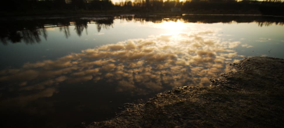
According to Reid, if you want to get an idea of what much of Ōtautahi looked like before European colonisation, you should take a walk through the verdant Travis Wetlands.
“Ōtautahi was an area flourishing with life: high in mauri,” he says. Back then, it was possible to travel in a mōkihi (a canoe woven from flax) all the way from Kaiapoi to Taumutu. “And the wisdom of how best to live on the delta is still held by Ngāi Tūāhuriri today.”
But when Pākehā chose to build Christchurch on the delta in the 19th Century, they decided to “move the water off the land as fast as possible,” says Wilson. In a mammoth undertaking, the swampy delta was drained by European settlers to clear the way for the city’s development.
Over the decades since, Christchurch has been subject to many flooding events. The city’s foundation on wetland has made it vulnerable to flooding from its inception – and it remains vulnerable today.
Wilson believes that we are, in many ways, well-protected. We’re fortunate, he points out, to have the Southern Alps on the west, which suck in much of the rainfall from potentially dangerous weather systems.
But such a system falling on the east of the divide would cause the Waimakariri to rise. “It’s a beautiful river, but dangerous in many ways.” He cites a photograph of a major 1868 flood caused by the Waimakariri breaching its banks.
Fortunately, a sophisticated double-stopbank system now guards us from most such breaches. The Waimakariri stopbanks were initially built in the 1930s, and have since been continually improved and reinforced by Environment Canterbury, with secondary stopbanks completed in 2021.
The experts are confident that the city has a comprehensive flood management plan. In Wigram, for example, Ngāi Tahu and the Christchurch City Council have built several large basins and swales, which catch rainwater and prevent floods.
So far, so good. So – can we relax?
Not quite. Reid and Wilson believe that, despite so many protective measures, there remains cause for concern.
Our deltaic history holds the key to our future.
Climate change is causing sea levels to rise. “As the sea level rises, so, too, the wetlands return,” says Reid. “Current projections show that about 35 percent of Christchurch will be inundated by 2100.”
That is: in 80 years’ time, it is predicted that about a third of Ōtautahi Christchurch will be vulnerable to regular flooding. Low-lying areas of the city – areas that used to be wetlands – are most at risk.
The inevitable sea level rise will cause the water table of these areas to rise. “In that situation, when it rains heavily ... because the water table is so high, it doesn’t have anywhere to go,” Wilson says. “It causes much more flooding, as the ground can’t absorb it any more.”
“The delta is coming back,” says Reid. “What do we do, knowing that’s going to happen?”