QUICK FACTS
Where is it? Moab, Utah [38.47920940, -109.68412599]
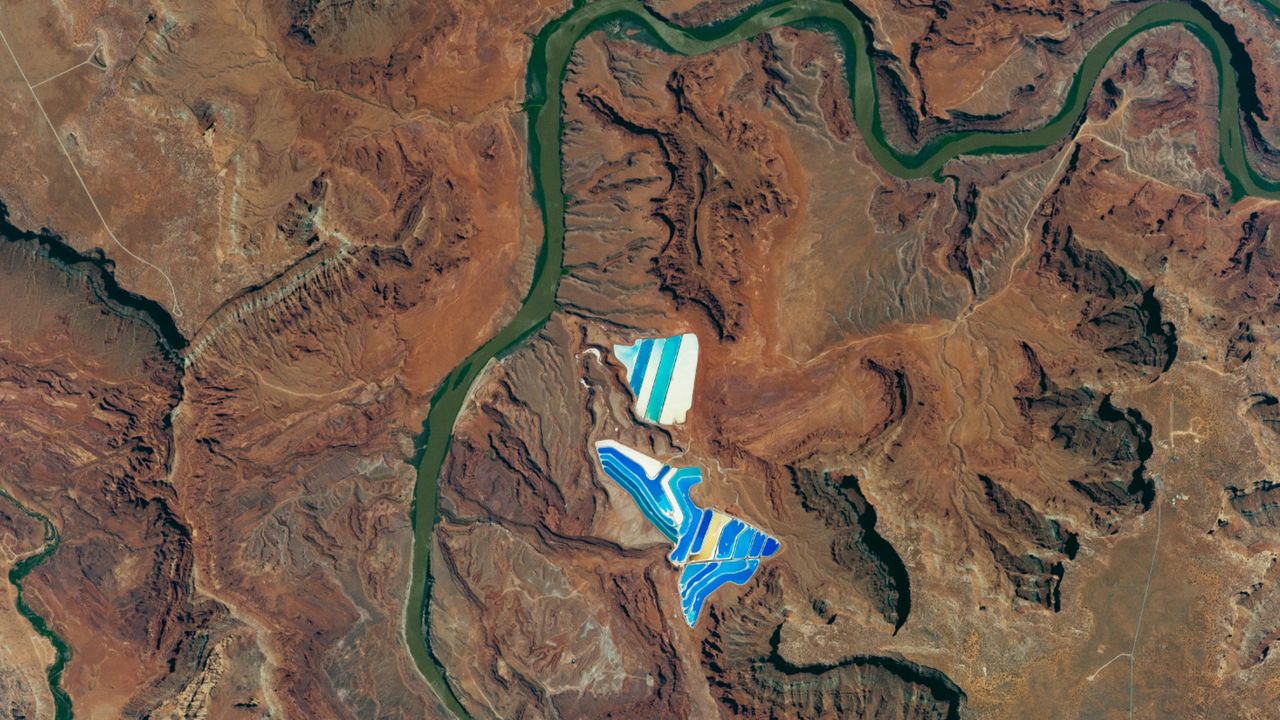
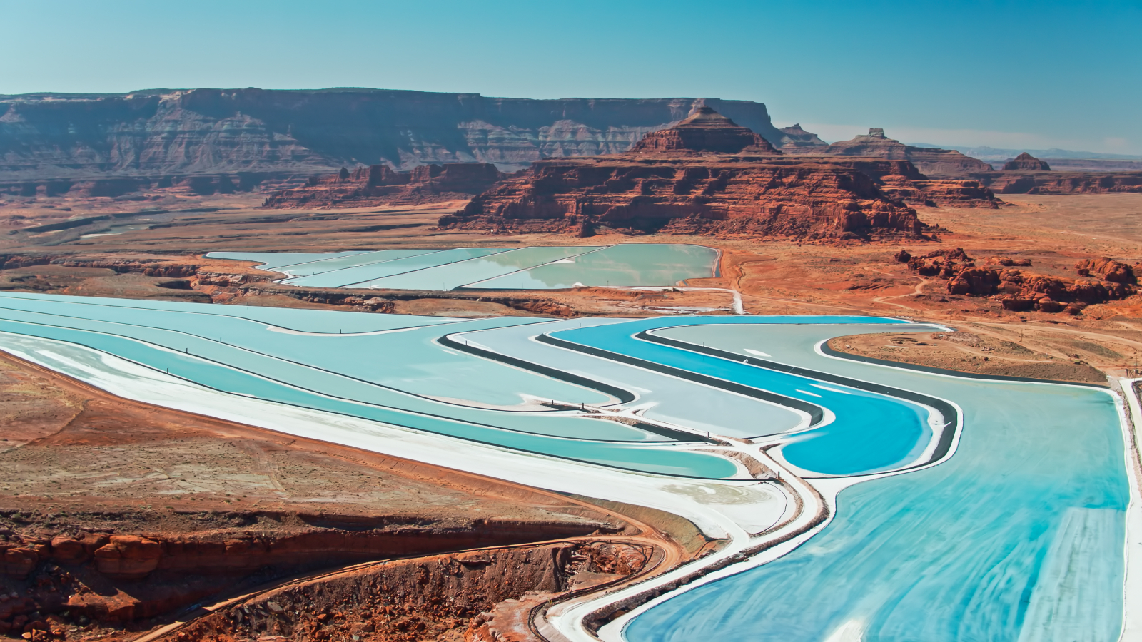
What's in the photo? Dozens of vibrant solar evaporation ponds along the Colorado River
Who took the photo? An unnamed astronaut on board the International Space Station
When was it taken? June 26, 2017
This eye-catching astronaut photo shows a series of bright-blue "potash ponds" near the dark-green bends of the Colorado River as the waterway winds through the rocky plateaus of southeast Utah.
The multicolored stripes are solar evaporation ponds, which are located around 8 miles (13 kilometers) southwest of the town of Moab in the heart of the Colorado Plateau — a roughly 130,000-square-mile (340,000 square kilometers) elevated region spanning parts of Colorado, Utah, New Mexico and Arizona.
The photo shows 23 ponds, grouped into two larger structures, which cover a total area of around 400 acres (160 hectares), according to NASA's Earth Observatory. The ponds are used to refine potassium chloride, also known as potash, which is mined at a site just out of view (below the ponds in the image).
The potash is mined by pumping boiling water into the ground to create a mineral-rich brine that is extracted and transported to solar evaporation ponds, where it is reduced into tiny, brown crystals. The distinct colors of the ponds signify that they are at different points in the evaporation process.
When the ponds are initially filled, workers add a dark-blue dye to the water to help it absorb more sunlight, thereby speeding up the rate of evaporation. However, this dye also evaporates, so as the water level drops, the intensity of the blue decreases. Eventually, the ponds turn white and then tan when a dried layer of potash is all that remains.
Potassium sulfide is mainly used as an agricultural fertilizer but has a variety of other industrial applications, including in the production of medicines, cement, fire extinguishers, textiles and beer.
The term "potash" is derived from "pot ash," which is the name of a preindustrial fertilizer made by combining wood ash with water and evaporating the mixture in a pot. The element potassium was subsequently named after pot ash when it was discovered to be the secret main ingredient in this mixture.
In addition to the usual environmental effects of mining, which include habitat destruction and noise pollution, potash mining produces high levels of waste products, such as sodium chloride and clay, which can cause damage to the environment.
This salty sludge is often piled into large mounds or dumped into tailing pools. A 2017 study found that the sludge is sometimes washed into nearby waterways. This can "significantly alter biological communities" and trigger harmful algal blooms. However, it is currently unclear what, if any, effect potash mining is having on the Colorado River.
The Colorado River is the sixth-longest river in the U.S. and stretches around 1,450 miles (2,330 km) from its source in the Rocky Mountains of northern Colorado to the Gulf of California in northern Mexico. The lengthy waterway, which played a role in forming the Grand Canyon, appears green from above due to high levels of suspended sediment, much like in the aptly named Green River — a tributary of the Colorado River that also runs through Utah.
See more Earth from space
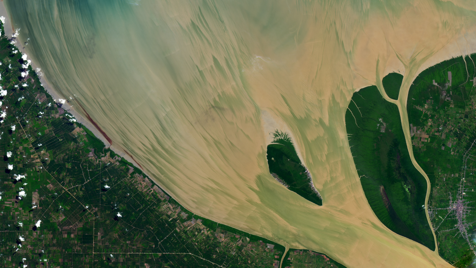
A 2024 satellite snap shows suspended sediments streaking across the mouth of the Rokan River, thanks in part to a particularly high tide caused by a full "Strawberry Moon."
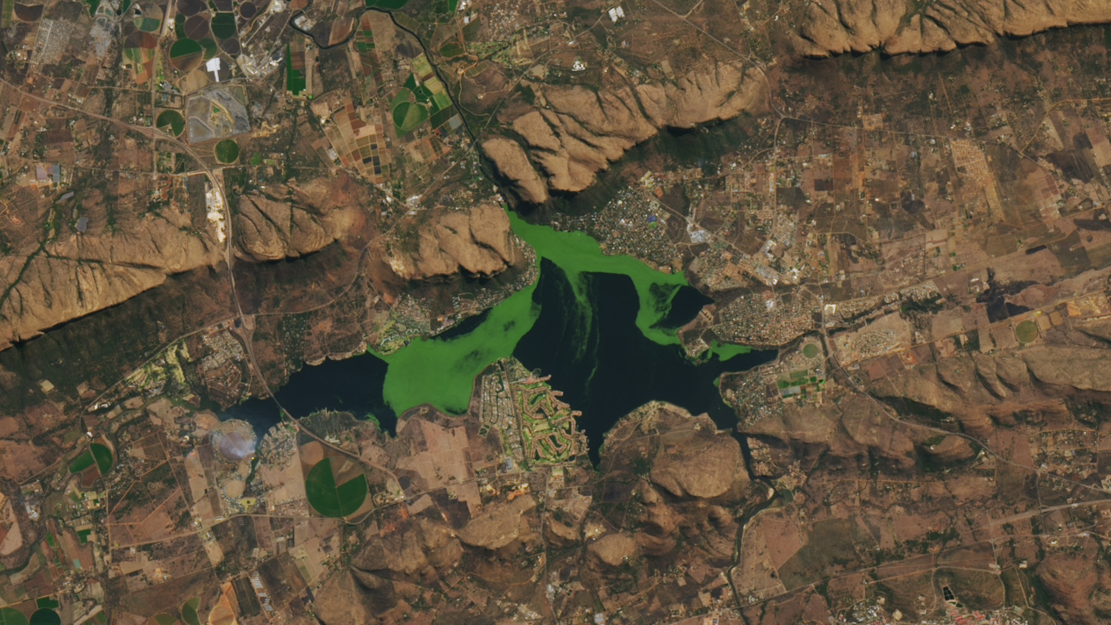
A 2022 satellite photo shows a thick mat of blooming algae and invasive aquatic plants spreading across the surface of the reservoir at South Africa's Hartebeespoort Dam.
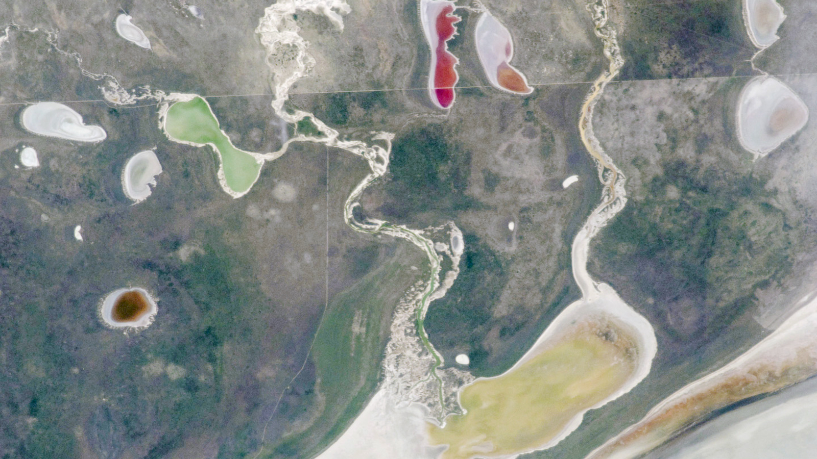
A 2011 astronaut photo shows off a series of colorful mini-lakes that appeared around the edge of a giant salt flat, known as the Etosha Pan, following a major flooding event.