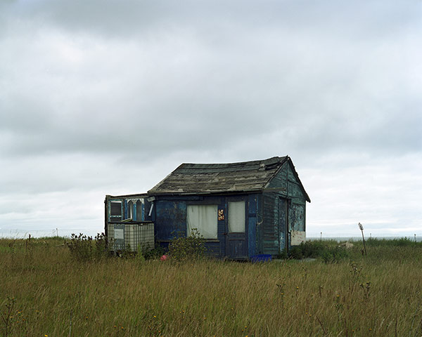
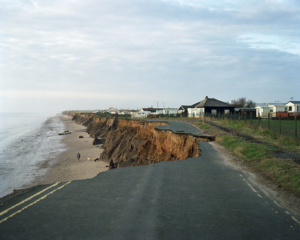
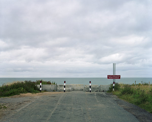
The Holderness coastline, just north of the Humber estuary along England’s east coast, is the fastest eroding in Europe. Its tarmac roads are tumbling into the sea at a rate of five feet a year, and its villages and caravan parks are perched on the cliff edge, staring down the waves. It’s a bleak landscape of shrinking villages and abandoned, windswept buildings, many with optimistic “For sale” signs. →Photograph: Neil A WhiteThe reason is mainly geological: about 18,000 years ago, soft glacial till – comprising two-thirds mud, one-third sand – was slowly deposited on to ancient chalk cliffs that, at the time, were several miles east of where they are today. The result is soft sediment easily eroded by the powerful waves that batter this stretch of the North Sea coastline. Add climate change and rising sea levels into the mix, and you have a perfect storm of environmental damage. →Photograph: Neil A WhiteMore than 30 villages have been lost to the sea since Roman times. One, Ravenser Odd – founded in 1235 – had by 1346 lost two-thirds of its buildings. By 1360, the entire village had disappeared. Today, it is Skipsea, pictured here and previously, that is facing the severest threat from erosion. Many homes there will disappear completely in the next five years. →Photograph: Neil A White
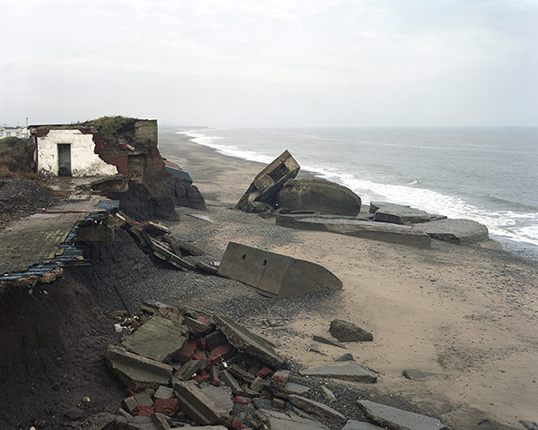
Several second world war defence outposts dot this stretch of coast, many lying in ruins on the beach, as seen, above, at Kilnsea. Photographer Neil A White plans to revisit this part of England, where he grew up, regularly to document its changing face. Some stretches are already unrecognisable, even 18 months after he started shooting. In another few years, it might all be underwater.Photograph: Neil A White
Sign up to read this article
Read news from 100’s of titles, curated specifically for you.