Parts of the UK have experienced some record-breaking temperatures this Bank Holiday before the remains of Hurricane Erin bring wind and rain are expected to hit.
Temperatures reached 29.1C in the village of Hawarden in Flintshire and 24.5C in Magilligan, Londonderry, the Met Office said.
The previous record for Wales was 26.5C dating back to 1991, and 23.8C for Northern Ireland.
Although not a bank holiday in Scotland, it also saw a record for the equivalent day with 27.1C recorded at Charterhall.
It comes as the Met Office said that this summer was already on track to be among the UK's hottest on record, with four heatwaves declared.
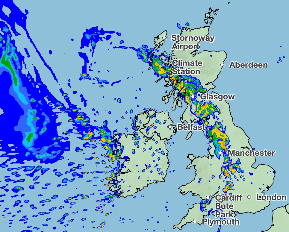
The remnants of Hurricane Erin are set to move in the west of the UK into Tuesday, bringing rain and wind with it which will continue throughout the week.
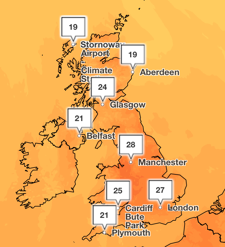
Hurricane Erin’s wind and rain will see temperatures drop to the high teens in the North and low twenties in the South.
No UK weather warnings are currently in place for the arrival of Hurricane Erin, which tore through the Cape Verde at maximum speeds of 160 mph, as only the last remnants of the storm are set to impact the country.
In just over 24 hours, Erin went from a category one hurricane to a category five, before weakening to a category two storm.
People heading to the beach on Monday or Tuesday have been advised to head to ones with life guards as big waves are set to arrive.
From Tuesday onwards spells of rain will be moving across all parts of the country, and it will be wettest in the west, Mr Snell said.
He added: “It will be heavy at times in the west, but at the moment we’re not expecting too many impacts, and it may for farmers or anyone who needs the rain be welcome.”
On Wednesday, a band of rain will go across the whole country, and low pressure will remain until the weekend with further spells of rain.
Today:
A band of rain, heavy at times, will move eastwards through the evening and overnight. Scattered blustery showers following, most frequent in the west. A warm night in the east.
Tuesday:
A day of sunny spells and scattered showers. Showers most frequent in the northwest, some heavy with the risk of thunder. Generally cooler, but still feeling warm in the sunshine.
Wednesday to Friday:
Frequent showers, as well as some longer periods of rain expected. Showers heavy at times, with hail and thunder. Often breezy. Cooler, but feeling pleasant in any sunnier moments.
London mayor rolls out campaign on people blasting music on public transport
Swimming pool closures put children ‘at risk of drowning’
Nearly 100,000 homes sped up by drive to cut red tape, ministers claim
‘Far fewer violent incidents’ at this year’s Notting Hill Carnival, police say
Food inflation jumps to 18-month high with these items seeing a price rise
Three killed as helicopter crashes during flying lesson on Isle of Wight