Sagar Srivastava, 33, has been fascinated by maps ever since he was a young boy. His father, who is in the merchant navy, would regularly bring home huge navigational chartbooks and tell him about countries around the world. “I started sketching maps on anything I could get my hands on,” the aspiring filmmaker recalls.
Today, he works as a researcher at a major Mumbai production company, which gives him the opportunity to flex his passion for history. Cartography, however, is a hobby Srivastava has had to nurture in isolation.
In an era where your phone’s GPS can guide you to any destination, and even map out alternate routes to account for real-time traffic, many of us have forgotten the thrill of adventure that physical maps can inspire. Still, Srivastava was able to tap into a few niche cartography communities online: during the lockdown, he began to post his sketches on subReddits such as Geography, World History, and Cartography, where he got a largely positive response. He regularly posts on his blog, Maps by Sagar, which has 1.7K followers at the time of writing. And he even managed to make some money selling his large scale sketches.
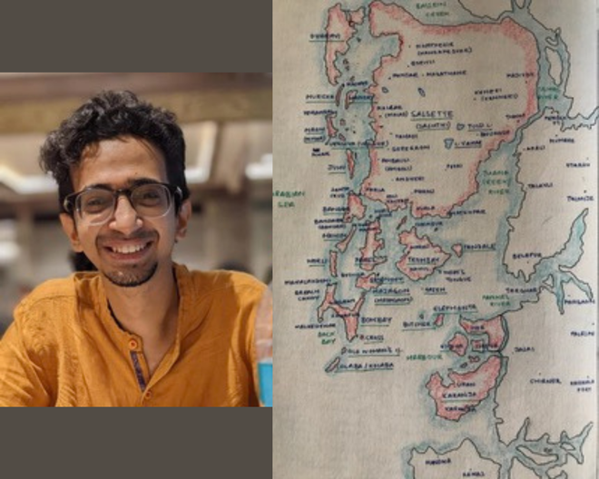
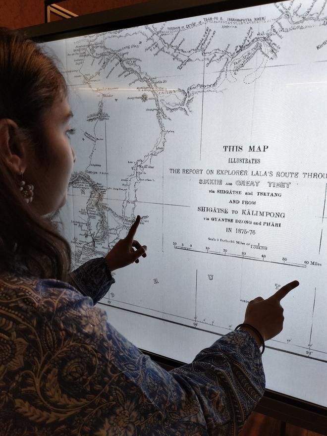
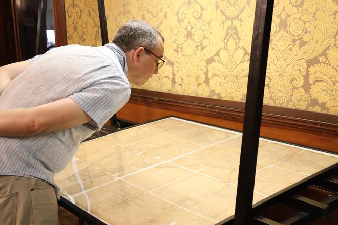
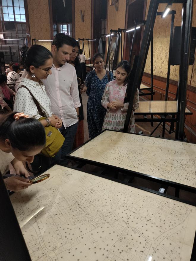
It is still a rare treat for him to meet like-minded cartography enthusiasts in person. So when the Asiatic Society of Mumbai and Rotary Club of Bombay announced Mapped! — a month-long exhibition of 22 archival maps, curated by heritage management firm PastPerfect and put together with support from the Tata Group — Srivastava was more than ready to make the trip to the erstwhile Town Hall in South Mumbai’s Horniman Circle.
Tracing the GTS days
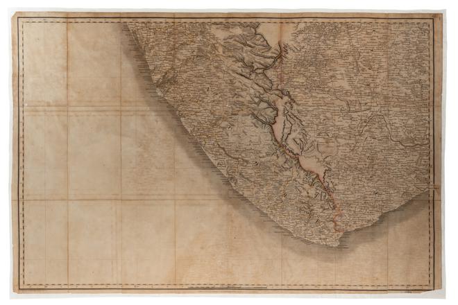
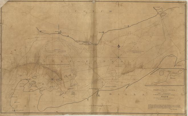
The exhibition highlights maps that were created as part of the Great Trigonometrical Survey (GTS), a scientific enterprise to map and measure the subcontinent launched in 1802, and the Bombay Revenue Survey, a revenue mapping and urban planning initiative undertaken in the 1860s. “It deals with concepts of accuracy, and how that was achieved in the 19th century,” explains PastPerfect co-founder Deepti Anand. “At the time, various colonial powers were at war to claim control over territories of the Indian sub-continent — knowing the land-mass was an invaluable source for revenue. So India witnessed the most advanced mapping methodologies in the world. Mapped! explores everything from how they achieved those levels of accuracy, to the stories of the people that made it happen.”
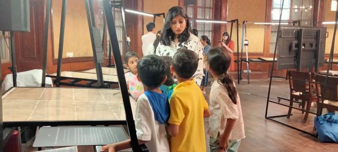
The exhibition is accompanied by a programme of talks, walkthroughs, and even a map-led treasure hunt. “The way geography is taught in schools doesn’t go into the nuances of why something exists where it does,” shares Ashwin Tahiliani, urban designer and founder of geography-inspired art collective ATLASkeeda, who was invited to conduct a storytelling session about the GTS. “Our aim is to shed light on the lesser-known histories across the country.”
Riaz Dean, scholar and author of Mapping the Great Game, also led a public talk about the Survey of India, expanding on one forgotten group, the Pundits, who undertook the secret mapping of India’s northern neighbours. “Indians, as dedicated employees of the GTS, were just as responsible for mapping their own country, even though they often weren’t given due credit as the focus at the time was mostly on the British officers of the GTS,” Dean shares. “Native Indians included sub-assistant surveyors, khalasis [survey helpers], and the Pundits. For example, the best-known Pundit, Nain Singh, is still relatively unknown in this country and yet the famous Orientalist Sir Henry Yule once said of him: “His observations have added a larger amount of important knowledge to the map of Asia than those of any living man.”
Outside of the exhibition, the Asiatic Society has now begun making digital copies of all 1,600 maps in its archive available to view on its digital portal, Granth Sanjeevani.
Rekindling interest
Like all specialised interests, cartography is still a niche hobby, but over the years a number of institutions have attempted to preserve India’s mapmaking legacy.
Since 2015, Bengaluru-based mechanical engineer Udaya Kumar has been travelling across the country in an attempt to raise awareness about the Great Trigonometrical Survey and preserve the stone posts and other benchmark points that still remain. In 2019 in Pune, local corporator Arvind Shinde and architect Abhijit Kondhalkar restored the neglected ‘zero stone’ outside the GPO to its original position, and added open-air exhibits along the footpath to showcase the history of GTS.
Hyderabad-based Kalakriti Archives’ collection of historical maps remains one of the largest in India, some of which is up for public viewing on Google’s Arts and Culture web portal. Over the years, maps have also been auctioned as artefacts, selling for anything between ₹20,000 and a few lakhs, depending on rarity, size, condition and cartographer.
Entrepreneur, film producer and industrial engineer-by-training Mrinal Kapadia, who owns a private collection of archival maps, is confident that as institutions invest in more such offerings, public interest will continue to rise. “The events hosted by institutions like the Asiatic Society, or CSMVS, are all being sold out. There is a huge repository of centuries’ worth of works out there, in different parts of the country, waiting to be shared. It’s only a matter of time,” he concludes.
Collectors’ favourites
Mapped! is on till June 4 at the Asiatic Society of Mumbai.
The freelance writer and playwright is based in Mumbai.