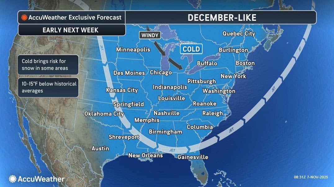
More than 100 million Americans across the eastern U.S. are set to feel the icy chill of an Arctic blast this weekend and into early next week.
The cold front - heading south from Canada - is forecast to send daytime temperatures plummeting into the 30s and 40s for a large swath of the Northern Plains, Midwest and Northeast.
Blustery wind gusts could make conditions feel even colder, with chills possibly in the single digits on Sunday morning in Nebraska, Iowa, Minnesota and the Dakotas, according to FOX Weather.
At night, it may fall below freezing in 35 states.
The U.S. is “skipping fall and going right to winter on the 10th of November,” meteorologist Ryan Maue wrote in a post on the social media platform X.
The Midwest
Chicago forecasters warned Illinoisans about how an “early taste of winter” could bring travel hazards.
Lake effect snow is on the way for the city of 2.7 million, although only areas near Lake Michigan are likely to see it stick on the ground.
“Periods of lake effect snow may lead to localized accumulations and slippery travel on untreated roadways Sunday and Monday near southern Lake Michigan,” the National Weather Service’s Chicago office said on social media.
In neighboring Indiana, forecasters told residents to prepare for wind-driven snow flurries from late this weekend into next week.
“Start preparing for a few wintry days early next week, with lows below 25 degrees Fahrenheit, wind chills as low as 10 to 15 degrees on consecutive nights, highs Monday only in the mid-30s, and wind-driven snow flurries likely the rule late Sunday into Monday,” the National Weather Service’s Indianapolis office wrote.
The Northern Plains and Great Lakes
More than an inch of snow is expected to fall over parts of North Dakota on Friday through Saturday morning and some areas of South Dakota could see more than two inches.
“Rain and snow begins tonight and through Saturday evening. Much colder temperatures for the weekend and to start the work week,” forecasters in Sioux Falls said.
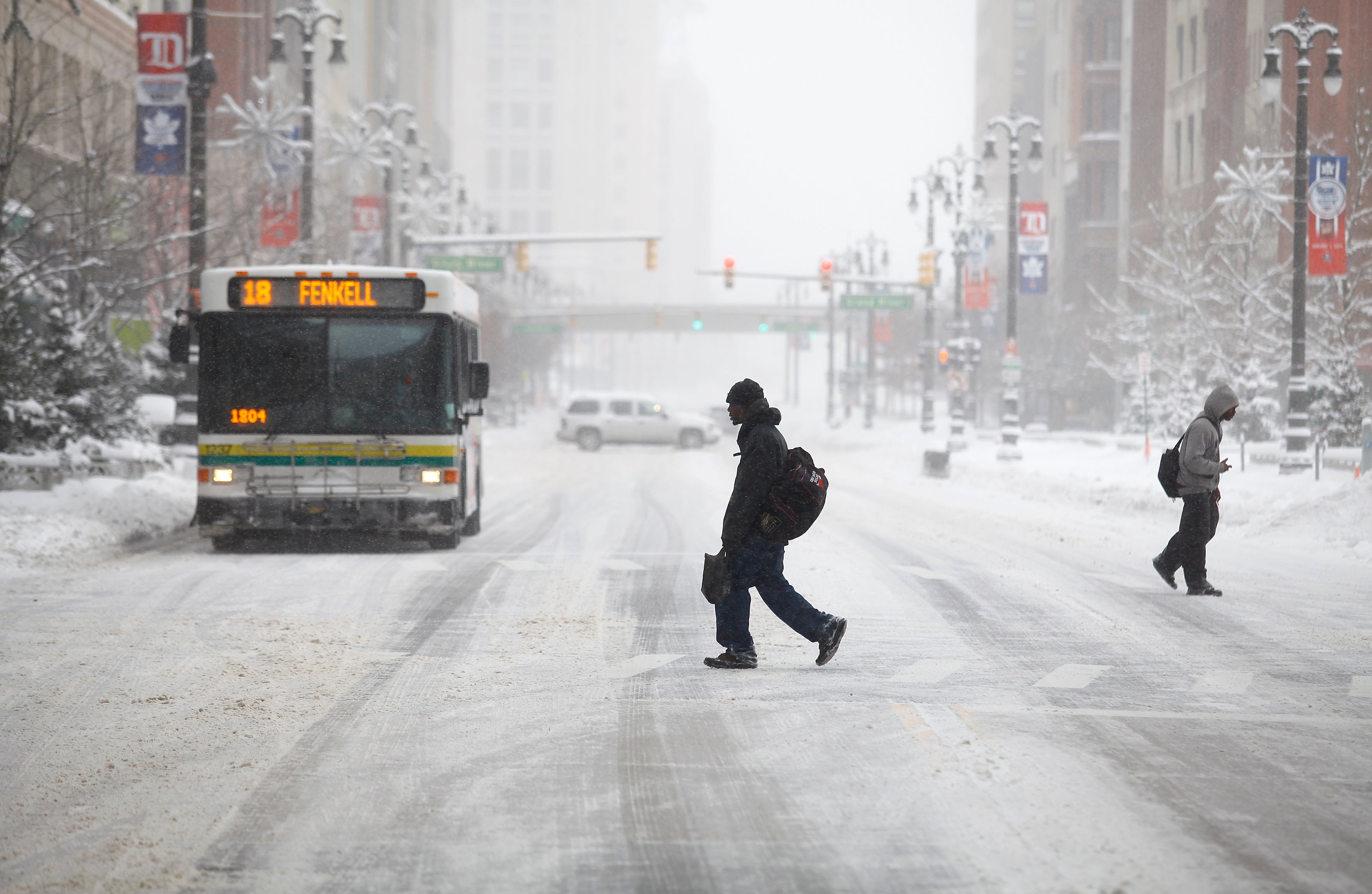
To the east, Michiganders could also see the “first measurable snow of the winter season” in and around Detroit, with rain and snow likely into Sunday.
Areas around Mount Pleasant are likely to see an inch of snow or more.
Multiple Ohio cities are also projected to see flurries and light snow showers into Monday.
“Some minor accumulations will be possible, mainly on grassy and elevated surfaces,” the National Weather Service office in Wilmington wrote.
The Northeast
The Northeast will feel the bitter effects of the wintry weather, but is only projected to see rain Friday night.
Dry conditions are expected there by Saturday and around the tristate area.
Forecasters in Mount Holly, New Jersey, said the area had seen its coldest morning of the season on Friday.
“Showers move in tonight but should end early Saturday, resulting in a pleasant day. Showers return Sunday; colder air arrives early next week,” the National Weather Service office there said.
The Washington, D.C., metro area was also under a frost advisory, but is expecting a milder weekend.

The Southeast
While the temperatures will be the most unbearable in northern states, the Southeast will also feel the air’s icy effects.
Temperatures in the interior Southeast could be 15 to 25 degrees below the historical average by Monday, according to AccuWeather.
In Atlanta, high temperatures on Monday will be in the mid-40s, which is more than 20 degrees below average for mid-November.
The Gulf Coast of Florida will see similar highs, resulting in a strange and potentially dangerous consequence: falling iguanas.
Once temperatures fall below 40 degrees, the cold-blood reptiles become dormant and lose muscle control. When that happens they can fall out of the trees they live in, according to Gulf Coast News Now meteorologist Caroline Castora.
“If you see a cold-stunned iguana, do not touch it! Once they warm up, they can act defensively by biting, clawing or even whipping their tail, according to the Florida Fish and Wildlife Commission,” she explained.
When will it next snow in the UK?
A major EU leader is back in the White House to do Putin’s dirty work for him
Warmest Bonfire Night on record as UK sees ‘remarkable’ November temperatures
UN Security Council lifts sanctions on Syrian president ahead of Trump meet
Trump claims his three-word plan would set up GOP to ‘never lose another election’
Democrats were asked to name who real leader of their party is – and most don’t know