Archaeologists must have one of the coolest jobs ever—as long as a lifetime of digging around in the dirt yields some epic results, like priceless artifacts, treasure-filled tombs, or groundbreaking insights into how ancient civilizations rose and fell.
One team of researchers was lucky enough to have such a breakthrough in the remote Peruvian Andes, unearthing over 100 structures tied to the Chachapoya or “Warriors of the Clouds,” a people who resisted conquest by the Inca Empire for centuries.
A team of archaeologists in Peru has unearthed a collection of over 100 unknown structures in a remote region of the Andes Mountains
The complex contains remnants of the Chachapoya civilization, which thrived in the northeast Andes between the 9th and 16th centuries
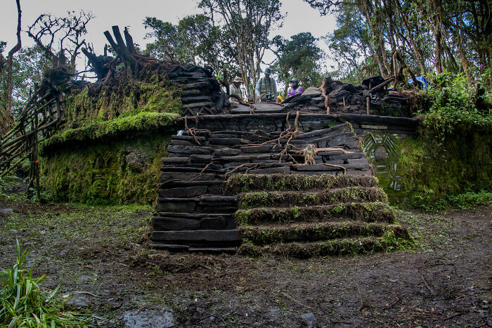
Archaeologists in Peru have just announced the discovery of over 100 previously unknown structures at Gran Pajatén, a pre-Columbian settlement in the most remote region of the Andes Mountains. Situated about 300 miles north of Lima in Rio Abiseo National Park (a UNESCO World Heritage Site), the Gran Pajatén complex contains remnants of the Chachapoya civilization.
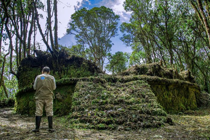
These ancient people flourished in the northeast Andes between the 9th and 16th centuries, repelling invasion by the powerful Inca Empire for hundreds of years, far longer than other groups, before finally being conquered. Sites like Gran Pajatén, all but inaccessible because of its far-flung location, high altitude and dense foliage, helped earn the Chachapoya the nickname “Warriors of the Clouds.”
Sites such as this, at high altitude and packed with dense foliage, helped earn the Chachapoya the nickname “Warriors of the Clouds”
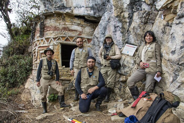
The Gran Pajatén site, first discovered in the ’60s, stagnated after archaeologists recorded 26 structures in the 1980s. This most recent trove of discoveries, announced by the World Monuments Fund (WMF) last month, represents a great leap forward for the study of the mysterious Chachapoya.
“Although specialists suspected that the extension of Gran Pajatén was greater, our findings were unexpected—not only in terms of scale, but in how they reframe the role and significance of the site,” said Juan Pablo de la Puente, executive director of WMF in Peru.
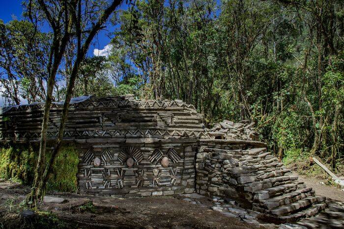
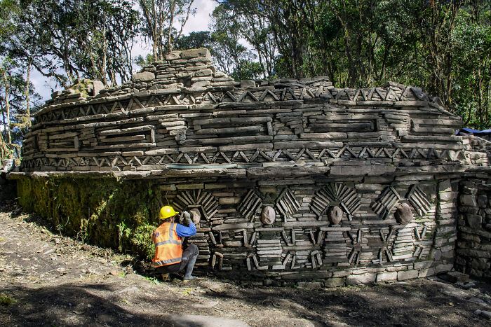
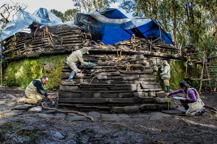
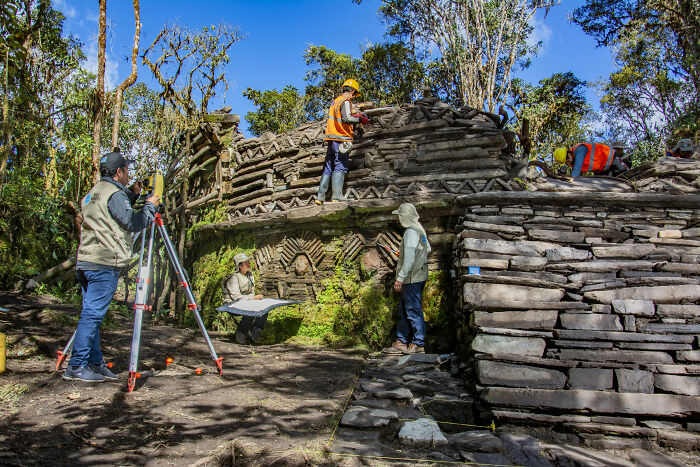
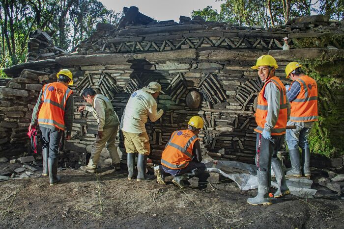
With the help of technology like LiDAR scanning and photogrammetry to “see through the forest canopy,” says a WMF statement, specialists working at Gran Pajatén since 2022 uncovered a sophisticated urban settlement, complete with agricultural terraces, circular buildings and cliffside tombs at altitudes of up to nearly 10,000 feet.
The Chachapoya successfully repelled invasion by the more powerful Inca Empire for several centuries before finally being conquered
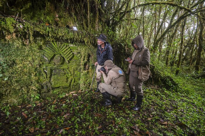
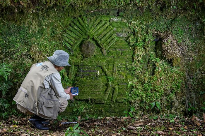
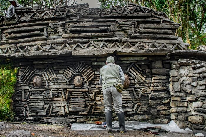
High-relief friezes and stone mosaics of human figures suggest Gran Pajatén’s central cultural role. “The site likely held ceremonial and symbolic significance, while also functioning as a strategic cultural and territorial center,” said de la Puente, pointing out its visual prominence high in the Peruvian Andes.
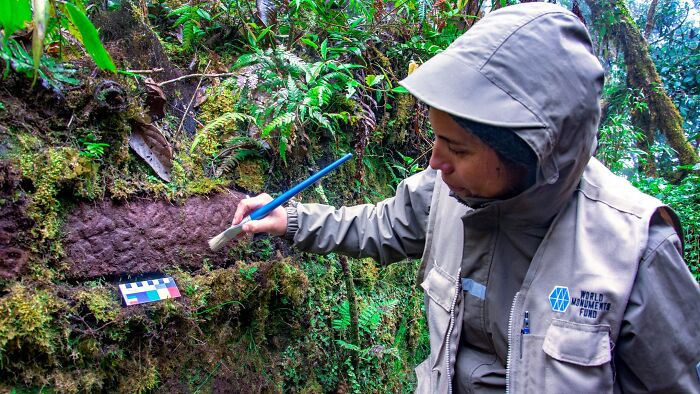
At this time, curators are doing their best to preserve the isolated site while maintaining its integrity and value to other researchers and scholars alike. Certain at-risk buildings have been treated with a specially formulated, clay-based mixture to reinforce stone structures without changing their original layout.
Even though they’ve already mapped hundreds of new structures, the researchers have only processed 10% of the LiDAR data. “What excites me most is that we’re only scratching the surface,” says de la Puente. “The path ahead is full of possibility, and we’re just beginning the journey.”
While the rugged Gran Pajatén site is still out of reach for most, digital mapping and 3D renderings are making the settlement more accessible for tourists and researchers
Even though they’ve already mapped hundreds of new structures, the researchers have only processed 10% of the LiDAR data, and say they’re only scratching the surface