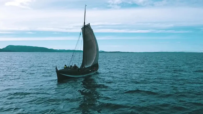
A Swedish archaeologist has sailed a replica Viking boat for 3,100 miles (5,000 kilometers), which helped him to identify what he says are four previously unknown harbors along the coast of Norway that Vikings used more than 1,000 years ago.
The experimental voyage revealed that the boat sailed best on open water, suggesting the Vikings' maritime trade routes took them further from land than previously assumed.
"A lot of the time, we only know about the starting and ending points of the trade that took place during the Viking Age," Greer Jarrett, an archaeology doctoral student at Lund University in Sweden, said in a statement. But Jarrett believed a "network of ports located on small islands and peninsulas was central to making trade efficient during the Viking Age."
For three years, Jarrett sailed a boat called a "faering" — a type of sailboat with oars similar to what Vikings used a millennium ago — to investigate Viking trade routes. With a small crew, Jarrett traveled from Trondheim in central Norway up the coast to the Arctic Circle, and then sailed back.
"This type of boat sails well on open water in tough conditions," Jarrett said, "but navigating close to land and in the fjords sometimes presents challenges."
He also interviewed Norwegian sailors and fishers to learn more about historical maritime routes, using that information and his own experience to reconstruct possible Viking sailing routes.
Related: Weapon-filled burials are shaking up what we know about women's role in Viking society
With this information and a map of what the Norwegian coast and sea level were like in the Viking Age, Jarrett identified four harbors or "havens" located on small islands and promontories. He published his findings May 8 in the Journal of Archaeological Method and Theory.
The four newly identified havens suggest that the Vikings relied on sheltered and easily accessible ports on islands and promontories, expanding experts' knowledge of Viking Age seafaring previously provided only by large ports like Dublin and Ribe, Denmark, Jarrett wrote in his study.
And because the Vikings navigated using "mental maps" rather than a compass, having places to meet up and share information about the sea was important to the Vikings' maritime success.
"You need a boat that can withstand all kinds of weather conditions," Jarrett said. "But if you don't have a crew that can cooperate and put up with each other for long periods, these journeys would probably be impossible."
So far, Jarrett has not done any excavation at the harbors to confirm their use by Vikings. But evidence such as jetties, ballast stones, cooking pits and temporary shelter at the sites, if found, would demonstrate the Vikings used these "havens" in their trade routes, Jarrett noted in his study.