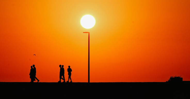
Britain could be heading for another burst of summer heat just weeks after the last heatwave, with forecasters warning temperatures may once again climb towards 30C in parts of the country.
According to the Met Office, conditions are expected to remain unsettled through midweek, with a mix of rain and sunshine, before a marked shift towards warmer, more stable weather over the weekend. Temperatures are forecast to rise above the seasonal average of around 21 °C in southern England, with some areas potentially reaching the 30 °C threshold again.
Met Office meteorologist Dan Stroud said the country is likely to see a noticeable change in air mass later in the week, bringing warmer air from continental Europe. While exact peak values remain uncertain, he noted that temperatures could hit the 30 °C barrier and possibly break it, depending on how high pressure develops.
The forecast comes only two weeks after parts of the UK experienced a record-breaking spell of heat, including late-May highs exceeding 34C in some locations.
High-Pressure System Set to Drive Warm Spell
Weather models suggest a strengthening high-pressure system will begin to dominate from Friday, reducing rainfall and increasing sunshine across much of England and Wales. This shift is expected to push daytime temperatures steadily upwards through the weekend.
Southern and central regions are most likely to feel the impact first, with northern areas warming more gradually. Forecasters say the weekend could bring widespread highs in the mid-to-high 20s, with isolated hotspots potentially touching 30 °C if cloud cover remains limited.
This pattern is consistent with recent early-summer trends, where brief unsettled periods are followed by sharp warm-ups as Atlantic systems weaken and continental heat builds.
Health and Infrastructure Concerns During Hot Spells
Repeated swings between cooler and very hot conditions are becoming more common in UK summers, raising concerns about public health readiness and infrastructure resilience.
The UK Health Security Agency has previously warned that even short heat spikes can increase risks for vulnerable groups, particularly older adults and those with pre-existing conditions. Hospitals and care homes are often placed under additional pressure during rapid temperature rises.
Experts also highlight the strain on transport systems, rail networks, and urban infrastructure during sudden heat events, when rails can buckle, and road surfaces soften.
A recent Guardian analysis on European heat preparedness noted that many northern countries, including the UK, remain less adapted to extreme heat compared with southern Europe, where heat-resilient urban design is more common.
Is This the Start of a Longer Hot Summer?
While a return to 30 °C temperatures would mark another significant heat spike, meteorologists caution against assuming a sustained heatwave pattern.
Forecast uncertainty remains high beyond the weekend, with models split on whether high pressure will remain anchored over the UK or shift eastwards, allowing cooler Atlantic air to return.
However, climate records show a clear long-term trend towards warmer UK summers, with recent years producing more frequent heatwaves and record-breaking daily highs.
Historically, intense heat events in the UK have often arrived in bursts rather than steady periods, such as the prolonged heatwave of 1976, when temperatures exceeded 30 °C for over two weeks in parts of southern England.
What to Expect Next
For now, forecasters say the key period to watch is Friday into the weekend, when the transition from unsettled weather to warmer, sunnier conditions is expected.
If current projections hold, many parts of England could see another spell of summer-like heat, with the possibility of localised heatwave conditions returning briefly.
While not guaranteed to match the intensity of recent records, the outlook suggests that summer 2026 is far from finished delivering sharp temperature swings and potentially more heat alerts ahead.