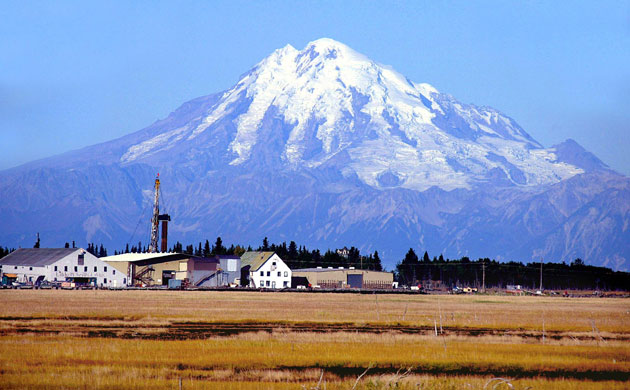
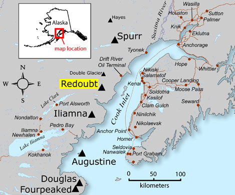
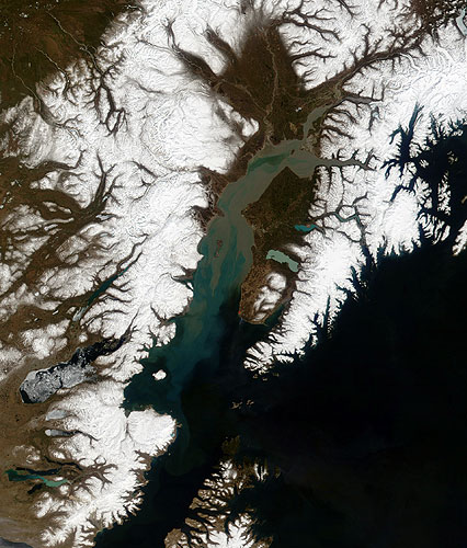
Mount Redoubt looms in the background on the Kenai river in AlaskaPhotograph: Al Grillo/APThe location of Mount Redoubt, in relation to surrounding towns, roads, and other volcanoes, some 100 miles south-west of Alaska's largest city, AnchoragePhotograph: HO/AFP/Getty ImagesSatellite view of the sediment-filled Cook Inlet with surrounding range of mountainsPhotograph: MODIS/NASA
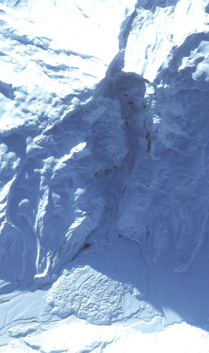
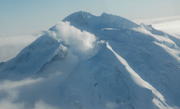
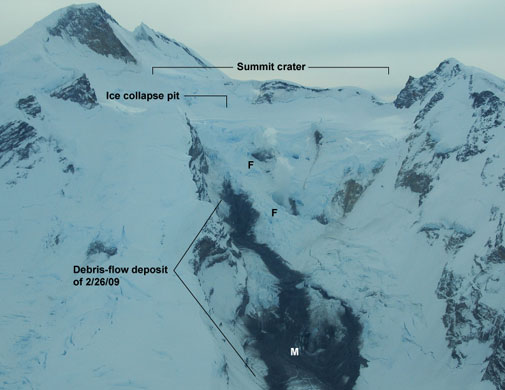
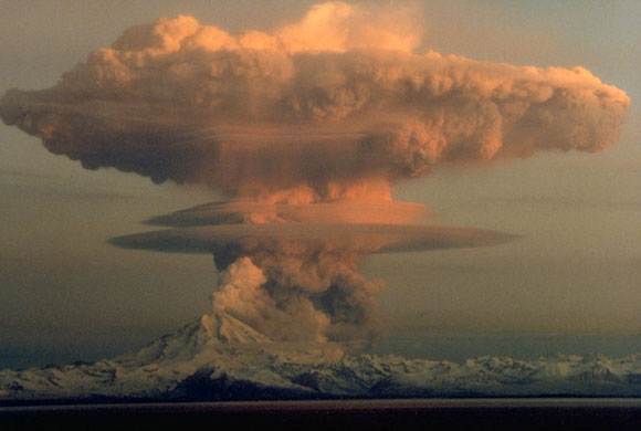
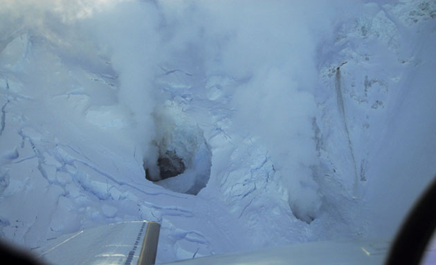
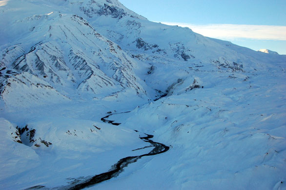
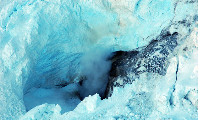
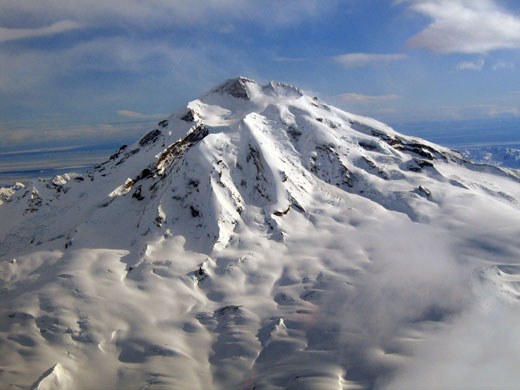
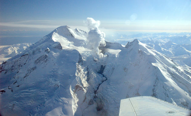
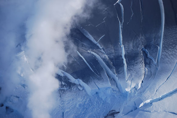
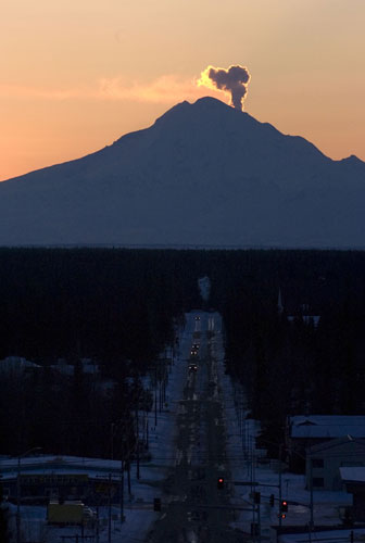
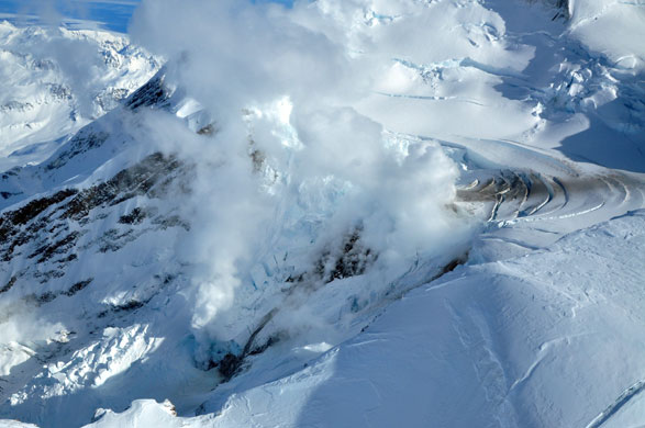
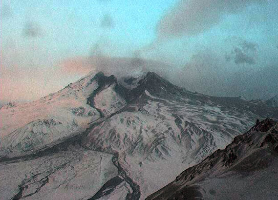
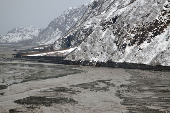
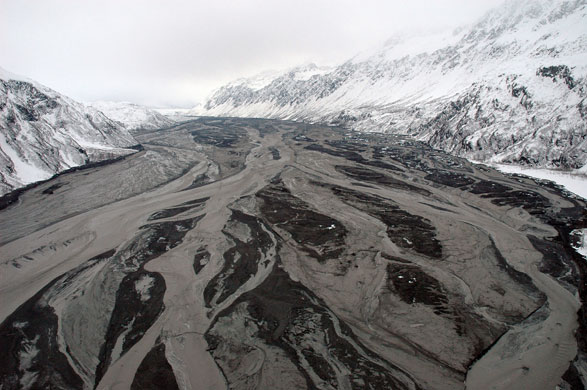
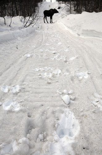
On January 24 the Alaska Volcano Observatory raised the possibility of an eruption in the near future. Tremors suggestive of moving magma continued from late January through February. Visible evidence of increased volcanic activity appeared at the volcano's summit. Holes appeared in the ice, and streams of melt water cut across the surface of the Drift glacier on Mount Redoubt's northern flank. Redoubt's 3,108 metre (10,197-foot) summit is near the centre of the image, casting a deep shadow on the volcano's crater. Dark holes in the Drift glacier were formed where hot magma heated rocks under the icePhotograph: NASAPhoto of Mount Redoubt taken during an observation flight on January 30. The vigorous steam and gas plume is from a large fumarole Photograph: Wallace Kristi/AVO/USGSMount Redoubt's summit crater and upper Drift glacier showing debris-flow deposit. The two fumaroles indicated (F) and melt pit (M) were steaming when this photograph was taken on February 27. The debris-flow deposit was produced by a sudden outflow of water and sediment, probably associated with the failure of an ice dam that released water stored higher up in the craterPhotograph: Chris Waythomas/AVO/USGS21 April 1990: Eruption from Redoubt as viewed to the west from the Kenai peninsula. The mushroom-shaped plume rose from avalanches of hot debris (pyroclastic flows) that cascaded down the north flank of the volcano. A smaller, white steam plume rises from the summit craterPhotograph: R. Clucas/AVO/USGSClose up view of fumaroles below the 1989-90 domePhotograph: Chris Waythomas/AVO/USGSMuddy water flows down the Drift glacierPhotograph: Cyrus Read/AVO/USGSFumarole in Mount Redoubt's Drift glacier with waterfall pouring into itPhotograph: Cyrus Read/AVO/USGSAerial view of the west flank of Mount Redoubt before debris flowPhotograph: Jennifer N. Adleman/AVO/USGSPhotograph taken during observation and gas data collection flight Photograph: Heather Bleick/AVO/USGSView of the area inside the summit crater at Mount Redoubt affected by tephra fall from the small ash eruption. The new vent is obscured and out of view to the upper left. The vapour and gas cloud at left is rising from the new vent and the 1990 dome and other fumarolesPhotograph: Christina Neal/AVO/USGSA plume of steam and ash rises above Mount Redoubt from the town of Soldotna, Alaska, 50 miles to the eastPhotograph: KPA/Zuma / Rex Features/Rex FeaturesSteam and ash errupts from the volcano last weekPhotograph: Cyrus Read/Getty ImagesWebcam image of Mount Redoubt just after it began erupting on 23 MarchPhotograph: AVO/USGSMarch 23, 2009: Photos of the flooding in Drift Valley and tephra deposits from the eruption of Redoubt Volcano.Photograph: Cyrus Read/AVO/USGSMassive flooding in Drift valley after the eruption of Mount Redoubt. High-water marks on the valley walls are estimated to be about six to eight metresPhotograph: Game McGimsey/AVO/USGSA moose calf leaves footprints in ash from Mount Redoubt as it walks along a trail in Trapper Creek, AlaskaPhotograph: Al Grillo/AP
Sign up to read this article
Read news from 100’s of titles, curated specifically for you.