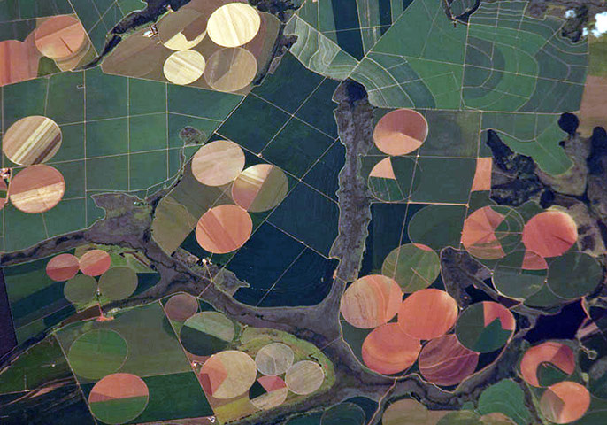
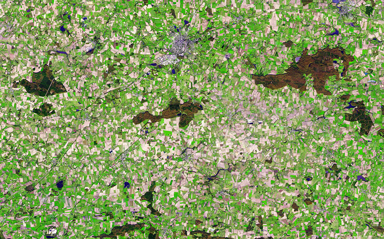
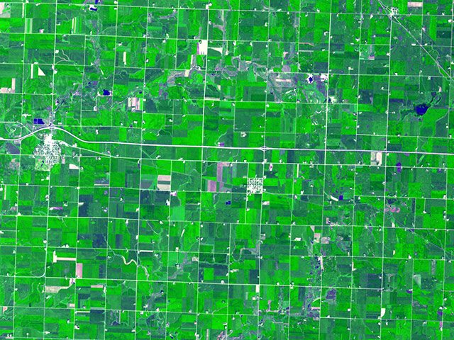
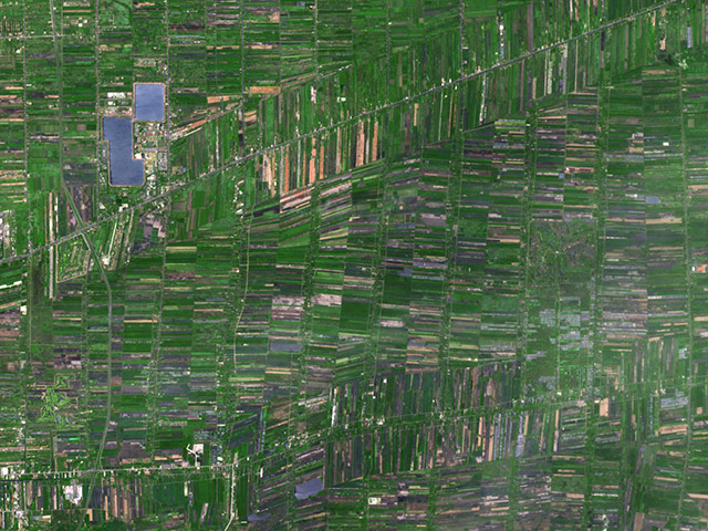
Agricultural fields south-west of Perdizes, Brazil, photographed from the international space station. A mix of regularly gridded polygonal fields and circular centre-pivot fields mark the human land use of the region. Small tributary streams (and their adjacent floodplains) of the Araguari river extend throughout the agricultural landscape. The visual diversity of field forms is matched by the variety of crops produced here: sunflowers, wheat, potatoes, coffee, rice, soybeans and corn Photograph: ISS/NasaVestiges of Medieval Brittany among signs of modern civilisation in this simulated natural colour satellite image of Chateaubriant, France. The small city is silver, coloured by light bouncing off the reflective surfaces. The surrounding country is an irregular patchwork of small fields, reflecting land use in the Middle Ages. Plant-covered land is still green and water is dark blue. By late November, crops had been harvested and many of the fields were bare. The exposed soil ranges from pale tan to brown in the image. Other fields (possibly pastures) remained green, even late in the year. Patches of forest on the right and lower edges of the image are brown and dark greenPhotograph: ASTER/Terra/NasaIn Minnesota the very regular grid pattern reflects early 19th-century surveying; the size of the fields was determined by the need to have a big enough area to make the use of machinery efficientPhotograph: Nasa
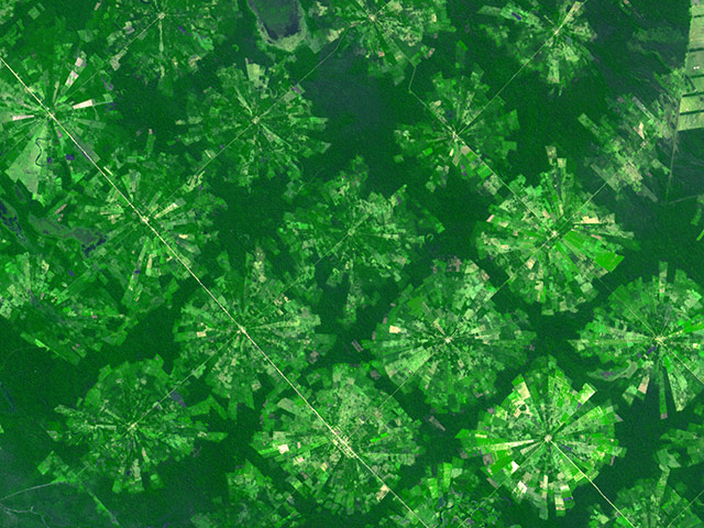
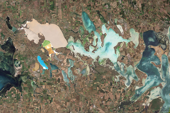
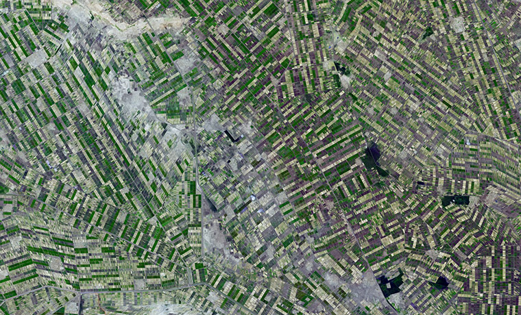
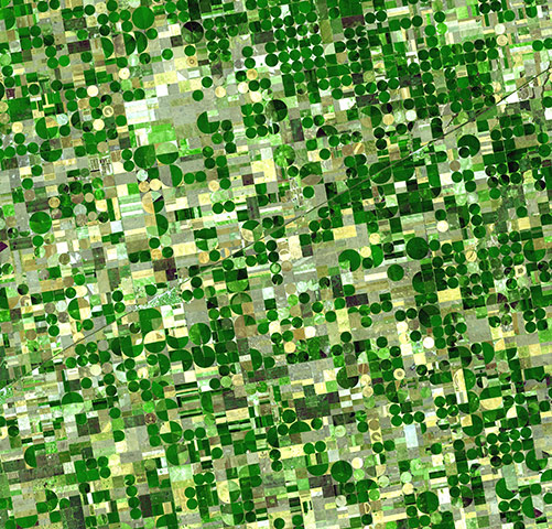
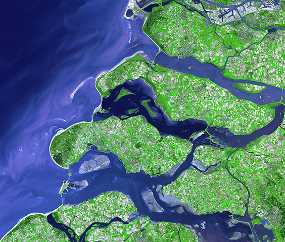
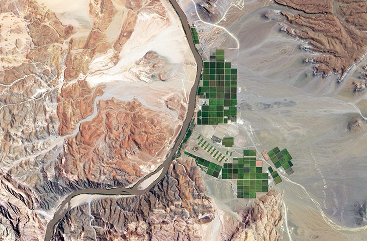
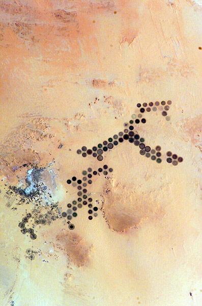
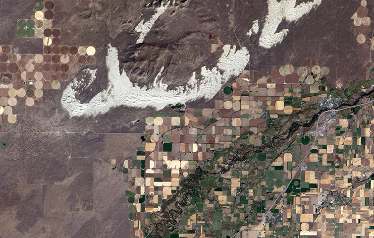
Near Santa Cruz, Bolivia, the radial-pattern fields are part of a planned settlement scheme in a rainforest area. At the centre of each unit is a small community, which is surrounded by fields. A small buffer of forest separates the settlements from one anotherPhotograph: NasaOutside Bangkok, Thailand, rice fields fed by an extensive network of canals that is hundreds of years old appear as skinny rectangular fields. Some fields seem to be flooded (deep purple), which is part of the growing cycle of rice plantsPhotograph: NasaFrom mainland Ukraine, the Crimean peninsula extends southward, bordered on the west by the Black Sea and on the east by the Sea of Azov. Stretching across the peninsula is a network of shallow, marshy inlets sprawling over roughly 1,000 square miles (2,600 square kilometres). This network of lagoons is known as Sivash (also Syvash or Sivasÿ). Surrounding the marshy areas are agricultural fields, most of them rectangular, but some are shaped by centre-pivot irrigation systems. Urbanised areas appear along the shores of the Black Sea, and highways curve and zigzag across the peninsulaPhotograph: Landsat 5/NasaSouth of Khartoum, Sudan, where the White and Blue Nile rivers join, a dizzying arrangement of irrigated fields stretches out across the state of El Gezira. Given the semi-arid climate of the surrounding area, this geometrical spectacle of fertile green fields depends on thousands of miles of canals and ditches that connect the region to the Blue Nile in the west. The man-made rivers and streams are part of an irrigation project called the Gezira scheme, which the British started in the colonial era to grow cotton for export back to EuropePhotograph: ASTER/Terra/NasaResembling a work of modern art, variegated green crop circles cover what was once shortgrass prairie in south-western Kansas. The most common crops in this region are corn, wheat, and sorghum. Each of these crops is at a different point of development, accounting for the varying shades of green and yellowPhotograph: ASTER/NasaThe south-western coastline of the Netherlands is a series of islands crisscrossed with river outlets and estuaries. The patchwork of green, cream, and lavender colours on the islands shows the prevalence of agriculture in the province and fields in various stages of growth or harvestPhotograph: Terra/ASTER/NASAThe Orange River serves as part of the border between Namibia and South Africa. Along the banks of this river, roughly 100km (60 miles) inland from where the river empties into the Atlantic Ocean, irrigation projects take advantage of water from the river and soils from the floodplains to grow produce, turning parts of a normally earth-toned landscape emerald greenPhotograph: ALI/EO-1/NASAGreen circles in the desert frequently indicate tracts of agriculture supported by centre-pivot irrigation. The Al Khufrah oasis in south-eastern Libya is one of Libya's largest agricultural projects. Because only about 2% of Libya's land receives enough rainfall to be cultivated, this project uses fossil water from a large underground aquifer. Darker colours indicate fields where such crops as wheat and alfalfa are grown. Lighter colours can indicate a variety of agricultural processes: fields that have been harvested recently; fields that are lying fallow; fields that have just been planted; or fields that have been taken out of productionPhotograph: ISS/NASASand dunes spill across the Snake River plain in Idaho. Freshly harvested fields line the southern boundary of the dunes, and to the north is a darker brush-covered lava plainPhotograph: ALI/EO-1/NASA
Sign up to read this article
Read news from 100’s of titles, curated specifically for you.