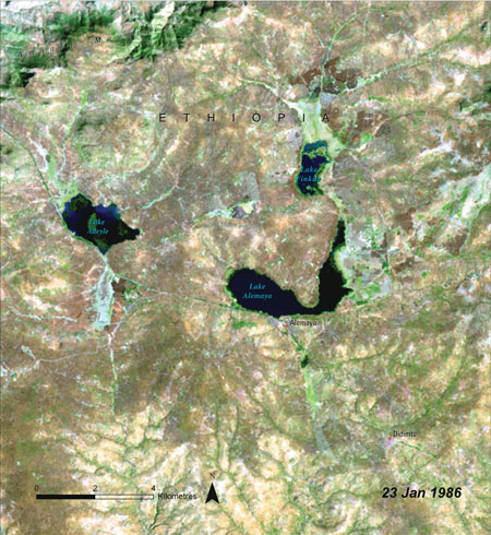
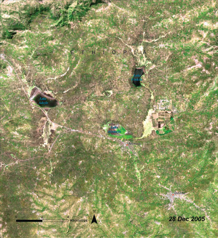
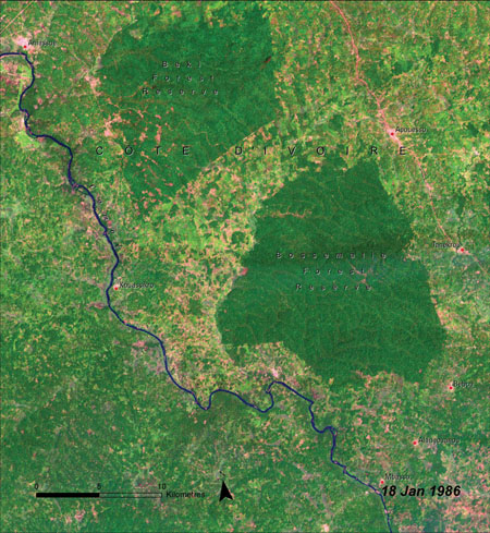
Before: Lake Alemaya, Ethiopia 1986 Photograph: Public domainAfter: The 2005 image underlines the loss of the Lake Alemaya due to siltation, irrigation demands and possibly by rising temperatures since the mid-1980sPhotograph: Public domainBefore: Beki forest reserve, the Ivory Coast, 1986. The forest reserve is seen as a verdant green areaPhotograph: Public domain
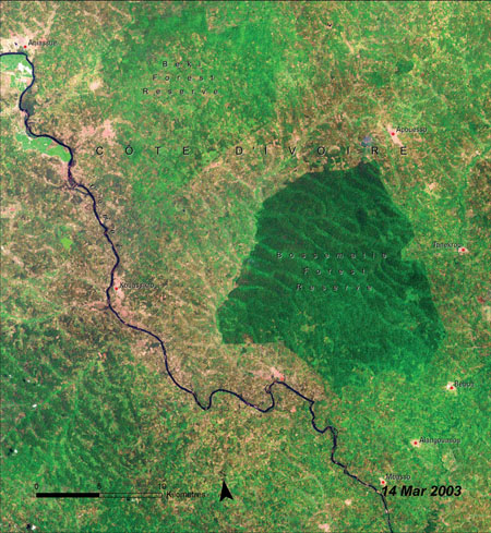
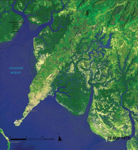
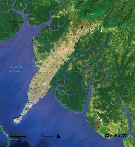
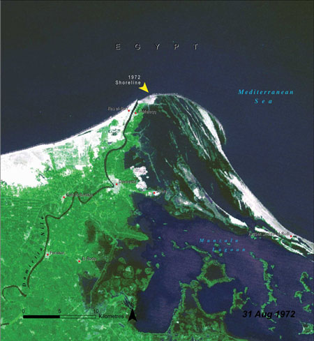
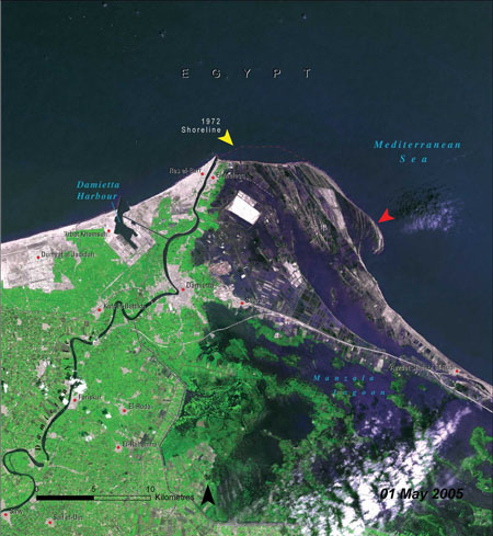
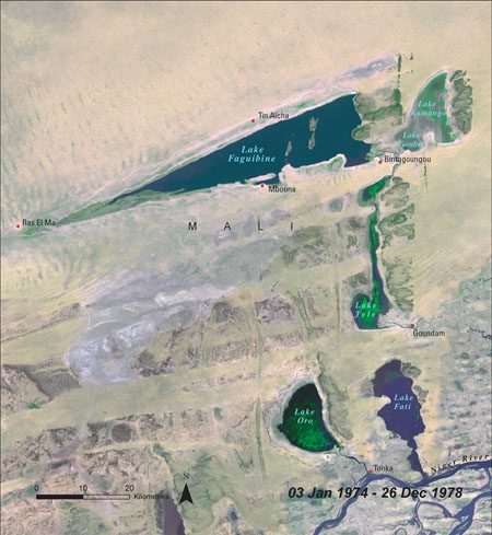
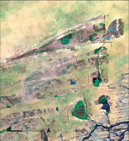
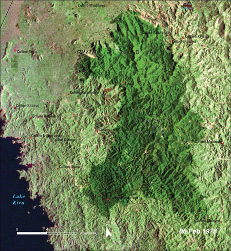
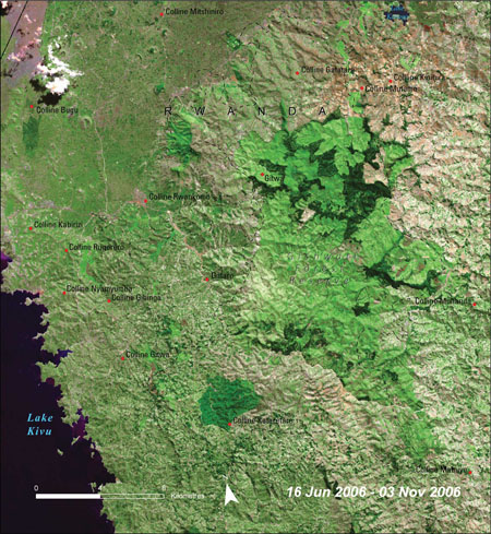
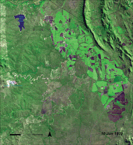
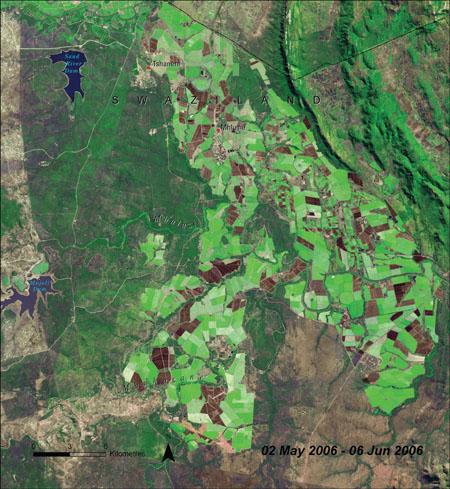
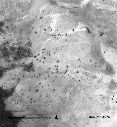
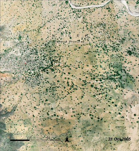
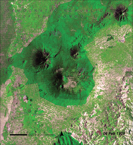
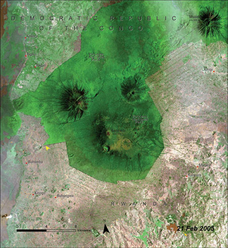
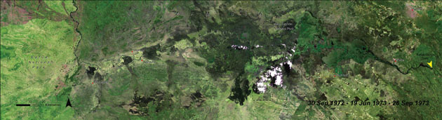
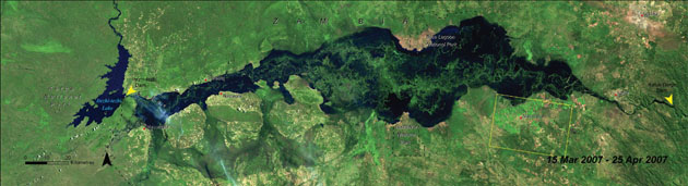
After: Beki forest reserve, Ivory Coast, 2003. The green area has been dramatically reduced by destruction of the reserve for coffee and cocoa plantations Photograph: Public domainBefore: Conakry, the capital and largest city of Guinea, pictured in 1975 Photograph: Public domainAfter: This picture, taken in 2007, shows the huge northwards growth of Conakry Photograph: Public domainBefore: Damietta promontory. The River Nile, Egypt, 1972Photograph: Public domainAfter: The 2005 image shows the dramatic loss of shoreline and erosion which has been caused by dams on the River NilePhotograph: Public domainBefore: Lake Faguibine, Mali Photograph: Public domainAfter: The drying out of Lake Faguibine, shown here in 2006, has been linked to climate changePhotograph: Public domainBefore: Gishwati forest, Rwanda, 1978 Photograph: Public domainAfter: The effects of dramatic deforestation in Gishwati forest can be seen by 2006 Photograph: Public domainBefore: Lubombo province, Swaziland, 1979Photograph: Public domainAfter: The extent of land given over for sugar cane expansion in Lubombo province, Swaziland, 2006Photograph: Public domainBefore: Tahoua province, Niger, 1975. The land is severly degradedPhotograph: Public domainAfter: Conservation and rehabilitation measures have paid off by 2005, after a 20-fold increase in trees in the provincePhotograph: Public domainBefore: Virunga national park, Democratic Republic of Congo, 1978. This image shows agricultural development around the parkPhotograph: Public domainAfter: Virunga national park, Democratic Republic of Congo, 2005. Twenty-seven years later, the sheer intensity of deforestation now ringing the park is visiblePhotograph: Public domainBefore: The Kafue River, Zambia, 1973, where natural and managed flooding takes place Photograph: Public domainAfter: the 2007 image shows how management of the Itezhi-tezhi dam that now mimics natural flooding is transforming the ecosystemPhotograph: Public domain
Sign up to read this article
Read news from 100’s of titles, curated specifically for you.