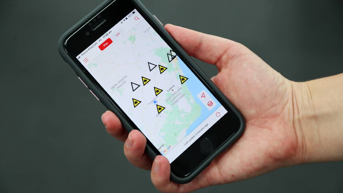
The ACT will develop its own bushfire warning application based on NSW's Fires Near Me, with the government hoping it could be in action before the next bushfire season.
The territory government said work was under way on the app, which uses people's location to issue alerts about nearby fires.
It will mean people using the ACT app will be able to receive alerts about fires burning in NSW and vice versa, with plans for data from the two jurisdictions to be integrated.
This comes after calls for greater and more timely information sharing during natural disasters, following the Black Summer bushfires of 2019 and 2020.
An ACT Emergency Services spokeswoman confirmed to The Canberra Times the government would proceed with the development of the app.
"The ACT government has identified the need to develop and implement an ACT-specific 'Fires Near Me' application," she said.
"An ACT Fires Near Me app will allow for more timely information to be broadcast to the community, including notifications and alerts to our communities based on the geographical location of users."
The ACT Emergency Services Agency has worked on the app with the NSW Rural Fire Service through project committee meetings and national working groups.
Cross-border bushfire information sharing proved to be a sticking point during the 2019-20 Black Summer bushfires.
Each state and territory has its own online notification warning system but alerts are not issued across jurisdictions.
During the Black Summer bushfires, Canberrans were not able to get notifications about fires burning in NSW through the Fires Near Me app. Likewise, people in NSW were not able to get notifications about bushfires burning in the ACT.
It proved to be an issue as there were several bushfires in both NSW and the ACT that burned neared the border.
The massive Orroral Valley fire crossed the border into NSW and destroyed 12 properties. As well, the Beard fire, which started near Canberra Airport and burned through parts of Pialligo, Beard and Oaks Estate also threatened homes in Queanbeyan West.
The ACT Rural Fire Service and the ESA came under fire from its own staff who criticised the ACT's online bushfire map for not showing surrounding areas of NSW. This came from leaked feedback from an ESA operational review into the fire season.
The Commonwealth royal commission that was convened in the wake of the Black Summer bushfires recommended that states and territories explore the development of a national all-hazards warning app.
The Royal Commission into National Natural Disaster Arrangements states the development of a national warning app is possible but governments had different views on the viability of the app.
The ACT "recognised the benefits of adopting a national approach to the design, development and delivery of an initiative", according to the commission of the findings.
Both NSW and Victoria expressed reservations.
The ACT ESA has previously relied on its incidents map, which is on the home page of the agency's website to inform the public of bushfires. The map also shows other incidents such as power outages, car crashes and ambulance responses.
An ESA spokeswoman said the incidents map would remain.