c 1560
"The first thing to get over is this idea that maps are neutral representations of what's there, to the best of the knowledge of the person who made them," says Tim Bryars, one of the three specialist map sellers who runs the fair. "There's always an agenda."
Photograph: Courtesy of Antiquarius

1915
"Louis Raemaker's map fits national stereotypes within political boundaries - for example, Turkey is a guy with a fez cutting his throat with a sword made in Germany," says Bryars.
Photograph: Courtesy of Tim Bryars Ltd

1568
A rare map of Venice designed by Ferrando Bertelli.
Photograph: Courtesy of Antiquarius
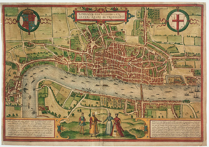
c 1574
“Made by German merchants during the rein of Bloody Mary, the map was distorted to reduce the size of the English merchants’ Guildhalls or erase them altogether."
Photograph: Courtesy of Altea Gallery
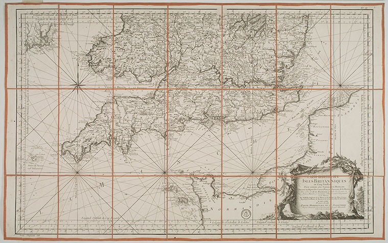
c 1798
"These sea charts of the English coast were put together in the late 18th century when Napoleon was planning to invade England," says Bryars. "Just knowing that the person originally poring over them was planning a putatative invasion is quite something. They are a very direct link with history."
Photograph: Courtesy of Altea Gallery
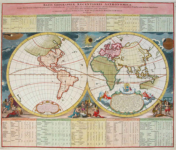
c 1720
Based on the latest astronomical observations of the time, this map shows California as an island and Australia connected to New Guinea.
Photograph: Courtesy of Garwood & Voigt
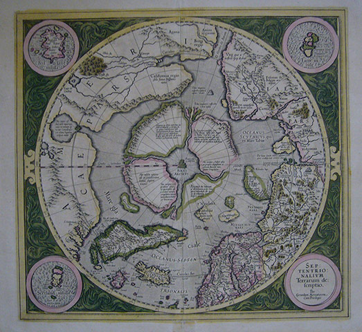
1595
"The first map of the region, showing a magnetic mountain at the North Pole, surrounded by a whirlpool drawing water from the seas of the world deep into the earth. Some of the detail is based on the latest discoveries by Elizabethan seafarers such as John Davis and Martin Frobisher."
Photograph: Courtesy of Tim Bryars Ltd

1609
"An important early map of the American south east. Indian settlements in Florida and Virginia flank the cartouche, and a king and queen in Floridan dress are also shown, as are deer and a turkey."
Photograph: Courtesy of Tim Bryars Ltd
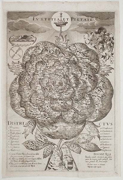
1677
"A very rare and beautiful map of Bohemia depicted as a stylised rose. Prague is located at the centre of the rose and Vienna, the main seat of the Hapsburg dynasty, is shown at the root."
Photograph: Courtesy of Altea Gallery
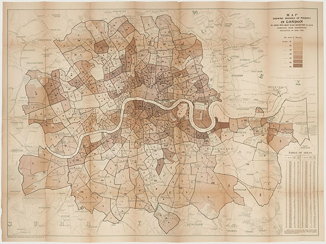
1889
"The philanthropist Charles Booth walked the streets of London in the late 19th century and colour-coded the streets on a large scale map of the capital, using his own criteria, to show very wealthy areas right through to places he described as semi-criminal poor."
Photograph: Courtesy of Altea Gallery


.png?w=600)