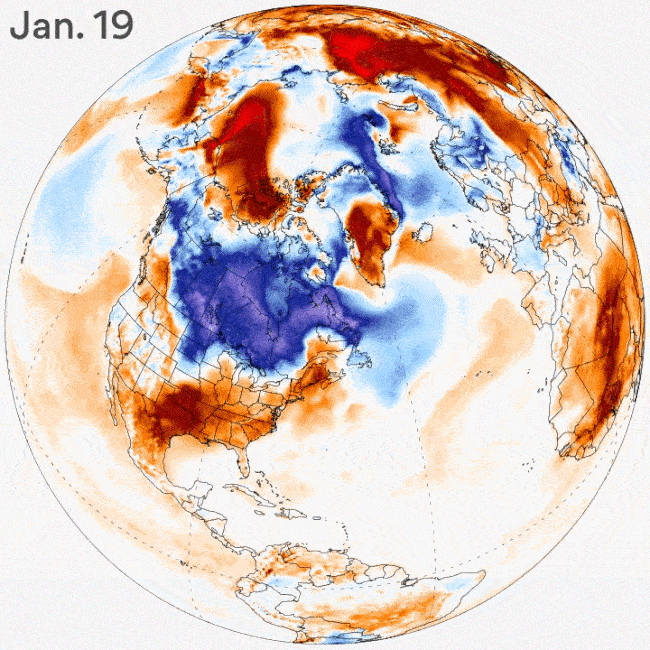
The polar vortex, which typically keeps the coldest air in the Northern Hemisphere effectively locked up in the Arctic, has split into three pieces. Now, Arctic air is poised to blast across the Canadian border and into the Midwest and East Coast, along with a major winter storm.
Why it matters: A coast-to-coast storm during the next several days could deposit feet of snow in parts of the West and Northeast, while ushering in the coldest air of the season. This will yield travel headaches and economic impacts — and the storm won't be the last of this event.
The big picture: Computer model projections show repeat rounds of below-average temperatures surging into the eastern half of the U.S. from late January through much of February.
- In fact, some projections show the colder-than-average pattern, which will favor the development of significant East Coast winter storms along with potent weather systems in Western Europe, could last off and on through early March.
The bottom line: Residents of some cities — like Boston, where people have been asking, "Where's winter?" — may soon regret having uttered that question.
Go deeper: