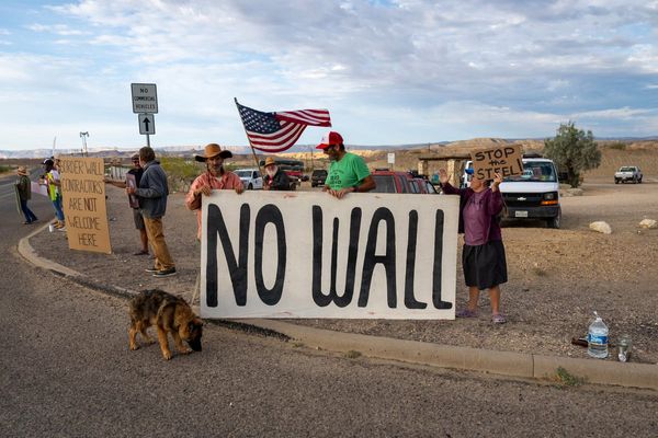
In October 2022, New York City officials unveiled a new bike lane on Schermerhorn street, one of the most dangerous and heavily trafficked streets in downtown Brooklyn and somewhere I had always avoided on my bike. Unless I was a religious reader of transportation department press releases (I’m not), I would have no way of knowing the lane existed – except that very same morning, my Apple Maps app sent me on the new Schermerhorn bike lane, instead of hurtling down Dean Street. By the time I was taking my return route, it was busy with cyclists.
For Apple to know the lane was open, it had to have updates from the Adams’s administration, as well as, presumably, hundreds of other city governments around the world. How was the company pulling it off? And it’s not just cycling: it also knows the placement of the trees in Central Park, when the bus is coming, and whether a dive bar takes contactless payments or is cash only.
“It’s a huge effort,” says Eddy Cue, Apple’s senior vice-president of services and the man with the responsibility for Maps alongside services such as iCloud, Apple TV+ and Apple Music. “You say something like we’re going to introduce cycling – how big of a deal is it? Well, if you want to do it really well, it turns out, it’s a big deal. Because you got bike lanes, you don’t want to put people in a more difficult position, so we let them choose if you stay away from heavy traffic roads. So there’s a lot of a lot of effort and detail that goes into creating a great cycling map.”
Apple Maps’ offering might surprise people who remember its disastrous launch in 2012, which the Guardian described as the company’s “first significant failure in years”. Users were more than furious – they were lost, sometimes dangerously so. In Australia, police had to rescue tourists from the huge Murray-Sunset national park, after Maps placed the city of Mildura in the wrong place by more than 40 miles. Some of the motorists located by police had been stranded for 24 hours without food or water. In Ireland, ministers had to complain directly to Apple after a cafe and gardens called “Airfield” was designated by the service as an actual airport.
But mostly the map was just glitchy and unhelpful, its directions always a little off kilter. Users revolted and Apple made a rare retreat, allowing Google Maps to be used as the default on many iPhone apps and apologizing for the product.
But since then it has spent an inordinate amount of money and time improving maps. It has sent out teams worldwide, not just in vans with cameras but on bikes and on foot, walking in places where aerial mapping technology can’t provide enough information.

Over the past month, I’ve spoken with engineers at Apple about how Maps started to get good. They told me that as well as data from city officials, including digital dashboards that update maps automatically, they also monitor changes from riders themselves. They can see if there is an unusually large number of people riding bikes in a particular location and then send someone with a backpack or a car to see if there’s a new bike path in that area. Sometimes they get this information before it’s been officially recorded by the government.
These kinds of techniques mean that while Apple has become more competitive with Waze and Google Maps on driving instructions, it’s on cycling and public transit that Apple Maps has built perhaps the most impressive resource yet available – with incredibly detailed instructions than can open up a city even for a nervous cyclist (Eddy Cue, unsurprisingly, describes it as the best cycling map in the world).
Cycling is one of the only silver bullets in the fight against climate change. It’s cheaper, healthier and often faster than driving – and crucially, a person who choses a bike over a car just once a day reduces their carbon emissions from transportation by about 67%. But many people are rightly terrified of getting on a bike. Accidents remain high, and although cities including London, Paris and New York have done a lot to improve cycle lanes in the past decade, it’s very difficult to make sure you’re always cycling the safest route without an incredibly detailed knowledge of a city’s streets. Often governments close streets to cars, or build protected cycle lanes, but then it takes months before cyclists actually discover them.
But with one earbud in and Siri activated, you can have a friendly voice guide you through a foreign city, drifting you towards cycle lanes and safer routes and navigating often complex one-way systems.
It’s not perfect; in New York, the cycling instructions don’t seem to know what times bus lanes are active, so on weekends the app will send you down congested streets instead of nearby cycle paths. In my hometown of London, where a lot of cycling routes are pathways in woods or through reservoirs, it has a habit of sending you down these dark and sometimes dangerous paths at night when the streets are much quicker and mostly empty. Engineers at Apple told me that routes were designated through a points-based algorithm in which points are tied to factors such as speed, traffic, distances and hills and then the routes with the highest points are offered to the user – so in theory, the points system can be refined over time to take in more factors.
Those kinds of algorithms are something mapmakers of even 30 years ago could not have imagined, and they are starting to have an effect on our real world.

In the post-apocalyptic, post-internet world in HBO’s The Last Of Us, there’s a scene in which the main character Joel, having spent weeks traversing an icy wasteland, happens upon a small cottage inhabited by an old couple. He holds them hostage at gunpoint to make a single demand: not food or shelter, but to know where he is on his map.
Joel’s desperation is familiar to the lost and weary of the last millennium, when the vast majority of maps were drawn the same way: an aerial view of streets, the reader left to work out their location using street names or landmarks. That’s normally OK in the throng of a city, but once you move to woods, parks or beaches (or an apocalyptic zombie world), such a map could quickly become useless.
That all changed with the arrival of the little blue dot – the constantly updated “you are here!” on our smartphones, one of the most fundamental shifts in our view of the world and our space within it. The ability to see not just our surroundings but our position in relation to them has made the world infinitely more navigable. Maps now transform in relation to us; north can be on the bottom or to the side; the world spins around us. Hiking maps like AllTrails have taken things further, drawing a line wherever the walker goes, so they can see how far they have veered from the path and in difficult situations, retrace their steps back home – a map being made in real time.
It feels like these tools have been around for ever, but Google Maps only launched a mobile app in 2007, and it only began offering turn-by-turn navigation for cars in 2009. Although satnavs had been available for longer, the ability of every person with a smartphone to know exactly where they were revolutionised how we saw our world and came close to ending one of the most common states of being for the previous millennia – being lost.
Now, of course, we have the opposite problem: we’ve become so reliant on our maps that our sense of direction has been shot to pieces. Some research says the brain’s hippocampus is actually smaller for people who rely on GPS. But there are many things the blue dot can’t tell you. Is your short walk to work actually a strenuous hill climb? Is it OK go jogging through the woods on your summer vacation, or are you encroaching on private property? Is a bike lane protected from traffic or a bumpy track? That’s the next frontier of digital maps and the implications could be even bigger than the dot.
“Most people think of maps as driving, but they play a much bigger role than that,” Cue says. “Maps play a big role in dining, in cycling, in air travel … where we now have detailed maps of restaurants and bathrooms inside terminals. It’s a huge part of what an iPhone is.”

In some cities, Apple Maps now has detailed drawings of landmarks and multi-city transit instructions that work across systems and even across countries.
These changes in maps also change our behavior and our environment. There are hundreds of stories of Waze destroying quiet neighborhoods by revealing once secret shortcuts to every driver. They can also transform the fortunes of businesses that show prominently on the maps, and push millions to take public transit options they might not know were available.
But for some in the cartography community, lack of transparency in such systems creates serious issues. Google has a secret algorithm selecting the businesses and landmarks that appear prominently, leaving many small businesses wondering why they’re not showing up.
As Cue himself recognises, “there are really only two mapmakers left in the world, in ourselves and Google” – and that monopoly of information, says Clancy Wilmott, a professor specialising in digital cartographies at Berkley, has consequences.
Wilmott worries that these maps, now dominant, lack information that more traditional maps like Britain’s Ordnance Survey (OS) still have: “An OS map shows you where a stile is for horses; I’m not sure Google Maps even knows what a stile is. When you’re surveying a space, you find that information but geo AI doesn’t have that information. I’m from Australia – you can look at a space where Google Maps might tell you to walk a route through tall long grass, but if you’re from a place you know: there will be snakes in there. Most of this kind of mapping, because it was developed out of urban maps, privileges urban information, not rural information.”
Willmott is a strong advocate for publicly owned mapping services but recognises that no government body has the kind of infrastructure that Apple does. For their part, the Apple Maps engineers I spoke with acknowledged that they were more reliant on AI, aerial photography and existing data in rural settings and were focusing on expanding to more cities. But they are also experimenting with new ways of reaching non-urban areas that don’t have such obvious landmarks and street names. Right now, the app will tell you to “turn right at the stop sign”, or “at the lights, go straight over”, but they want to expand the kinds of objects included. Maps engineers hope that in countries where street names are often unclear, the app might be able to route you based on landmarks alone.

“If I was giving you instructions to my house, besides giving you the address, I wouldn’t just tell you to turn left, turn right. I’d say: ‘Once you’re on my street and you see the brick column, that driveway right after is mine.’ We’ve been working hard on that as well,” Cue says, adding that the future might be Siri telling you to “make a left at the yellow house”.
Even so, he acknowledges that unlike many of their other products, Apple Maps will never really be finished.
“Things are changing constantly over the world,” says Cue. “The cool thing is, there’s always more to do. It’s truly a lifetime’s work.”