Get all your news in one place.
100’s of premium titles.
One app.
Start reading
Newcastle Herald
Newcastle Herald
National
Matt Carr

3.0 earthquake recorded south of Muswellbrook

RADIUS: Geoscience Australia's map of where the tremor was felt.

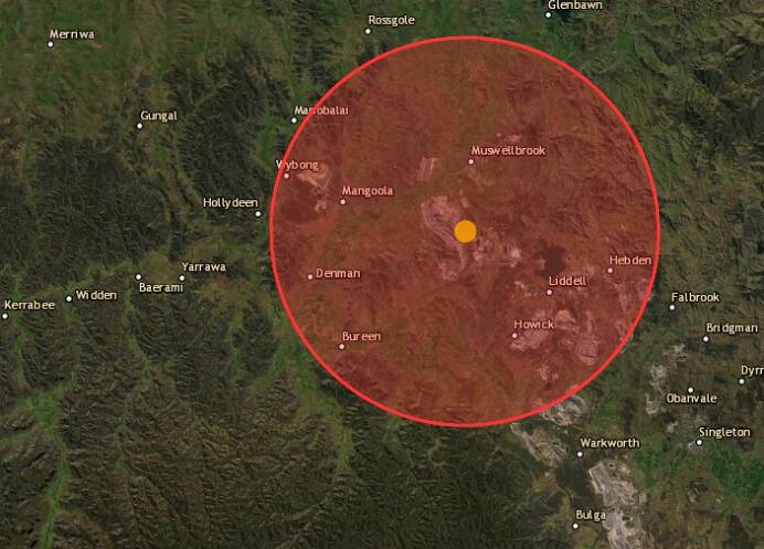
A SHUDDER has run through an area south of Muswellbrook after a federal science bureau recorded an earthquake overnight.

Geoscience Australia recorded the quake shortly before 1am on Tuesday.

Mapping from that agency pinpoints the quake as emanating from a point near the Mt Arthur coal mine, to the south of Muswellbrook.

The magnitude 3.0 earthquake was recorded at a depth of three kilometres.

By 8am on Tuesday Geoscience Australia said 46 people had felt the tremor.

In May last year a 3.9-magnitude earthquake was recorded near Muswellbrook, with another west of Lake Liddell in February 2020.

Sign up to read this article
Read news from 100’s of titles, curated specifically for you.
Already a member? Sign in here
Related Stories
Top stories on inkl right now
One subscription that gives you access to news from hundreds of sites
Already a member? Sign in here
Our Picks
Fourteen days free
Download the app
One app. One membership.
100+ trusted global sources.