The map might not be the territory, but gosh darn it both aren't fascinating to look at! We’re pretty big fans of maps and we can’t wait to set our eyes on even more unusual and peculiar ones in order to expand our minds and feed our imaginations which are hungry for aesthetic designs. Luckily for us, there are tons of like-minded internet users who are nearly bursting with their love of maps.
This subreddit about maps has nearly 1.5 million members and probably has more creativity than I’ve personally seen anywhere else on Reddit so far. Even though we can’t mention the subreddit’s full name because we'll get censored, the community is truly friendly and has stood the test of time since May 2011. And the person to thank is land surveyor Patrick McGranaghan, the founder of the entire project, whose passion for maps is beyond measure and keeps the online group together.
Patrick and I had a wholesome chat about how to get ourselves moving outside our comfort zones and on adventures, what maps he's recently been working on, as well as the ins and outs of moderating the subreddit.
"I've noticed, especially as I've gotten older, that you only have so much time on this planet and every day that is wasted is a day that you'll never get back. If you want to get out and explore the world you just have to do it. Some adventures will cost time and resources, but the real question I ask myself is can I afford not to do some goal I have my heart set on. There are so many opportunities in this world that it may be hard to choose, but if you wait too long those opportunities will be gone forever," he told Bored Panda to seize the day and really start living.
Bored Panda has featured the subreddit extensively in our previous articles. When you’re done upvoting and commenting on your fave maps in this list, keep in mind that there’s a whole land of adventure waiting for you in these earlier posts right here: Part 1, Part 2, Part 3, and Part 4.
More info: Reddit | Twitter | Tumblr
- Read More: 30 Unusual Maps That Might Change How You See The World, As Shared In This Online Group (New Pics)
#1 This Is A LEGO World Map I Designed! I Spent Many Hours Staring At Google Earth And Topological Maps To Make This
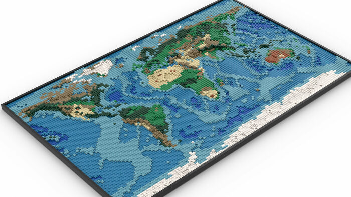
Image credits: GooseWithDaGibus
#2 Map Of Africa's Borders If Divided By Languages and Ethnicities

Image credits: Danielbrenim
#3 Hello! I Was Told You Would Enjoy This- Took Me 3 Years!
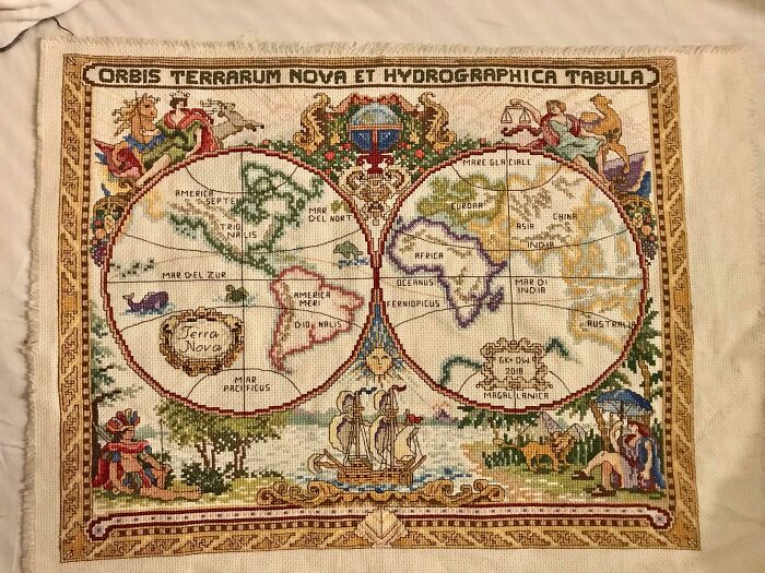
Image credits: avalonal5464
#4 World Map Of Borders
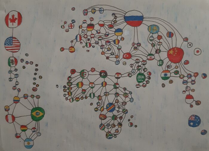
Image credits: krinkyee_113
#5 Hello! I Cross Stitch Earth Science Maps And Have Been Told They Belong Here. Great Lakes Bathymetry Is My Favorite So Far
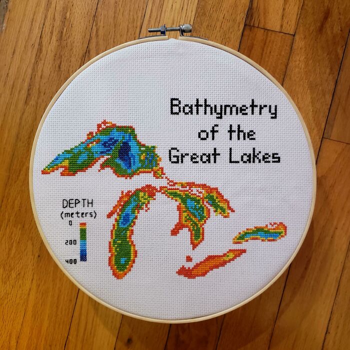
Image credits: blondeboxshell
#6 I Am Working On A Picture Book With Each State Drawn With One Line. I Finished My 7th State Last Night
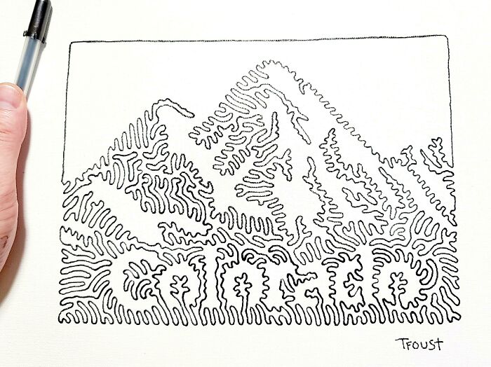
Image credits: tfoust10
#7 Hand Drawn Map Of China And Neighboring Countries With Placenames In Mandarin (I Drew It As An Exercise To Memorise All The Provinces)
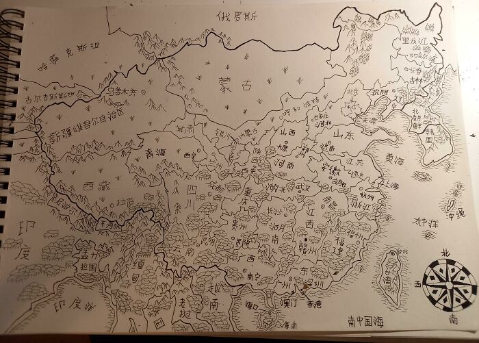
Image credits: LuKing-Ra
#8 Antarctica Without Ice, U Don't See That A Lot
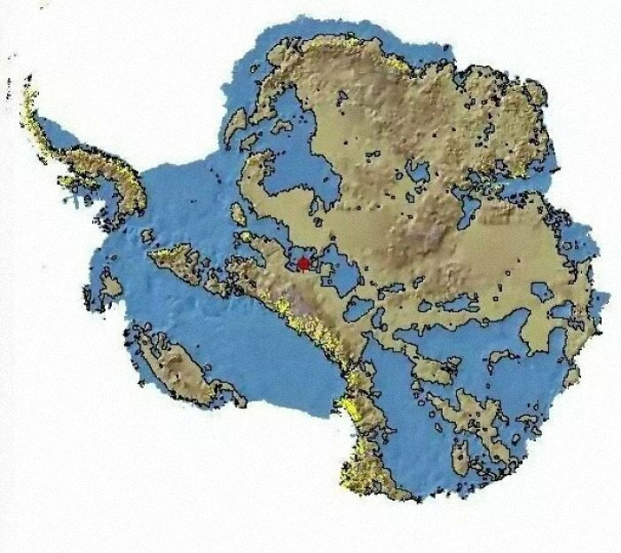
Image credits: Rajni_Rao
#9 Are You Closer To Georgia, Or To Georgia?
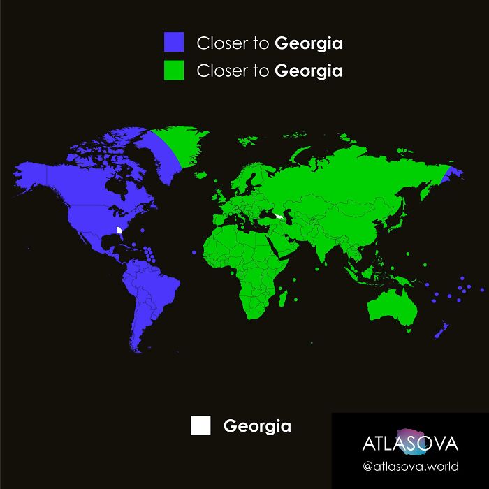
Image credits: atlasova
#10 Mythical Beasts Of The United States Of America
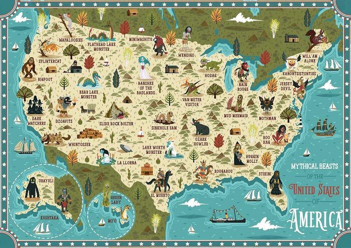
Image credits: NeilParkinsonMakes
#11 The Topography Of The Roman Empire, Ad 117
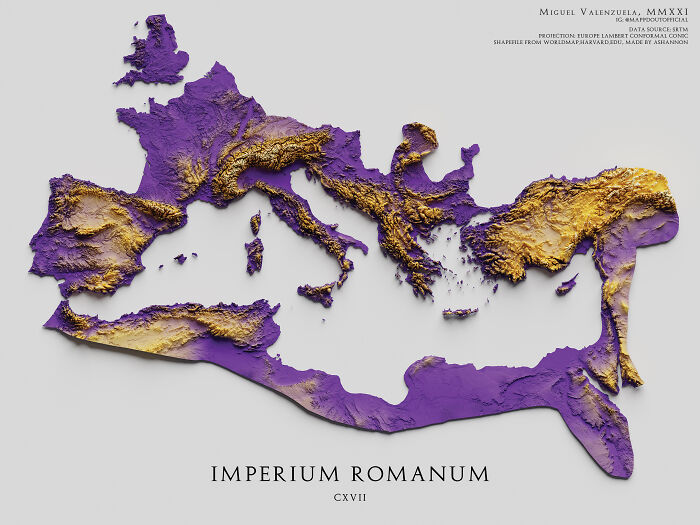
Image credits: boytutoy
#12 Average Number Of Languages Spoken By The EU Population
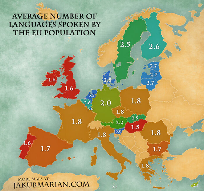
Image credits: JeannaLeavy
#13 How To Read A Topographical Map
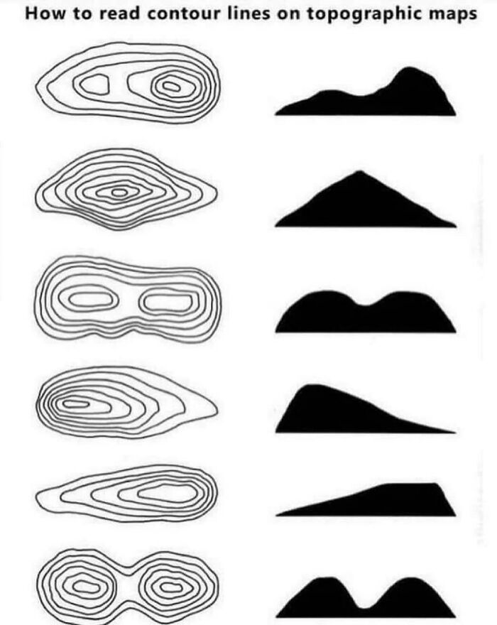
Image credits: World-Tight
#14 I Drew A Map Of All Japanese Prefectures (Took 6 Hours). Hope You Like It
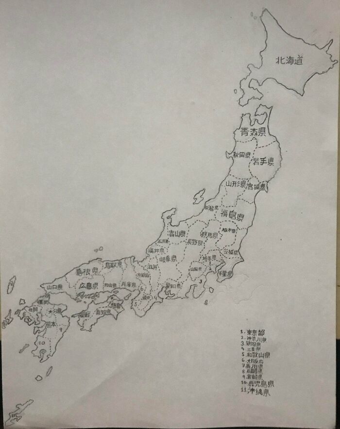
Image credits: GoroMajimaKun
#15 This Is My Friends Wood Shop Project, Thought It Would Be Fitting Here
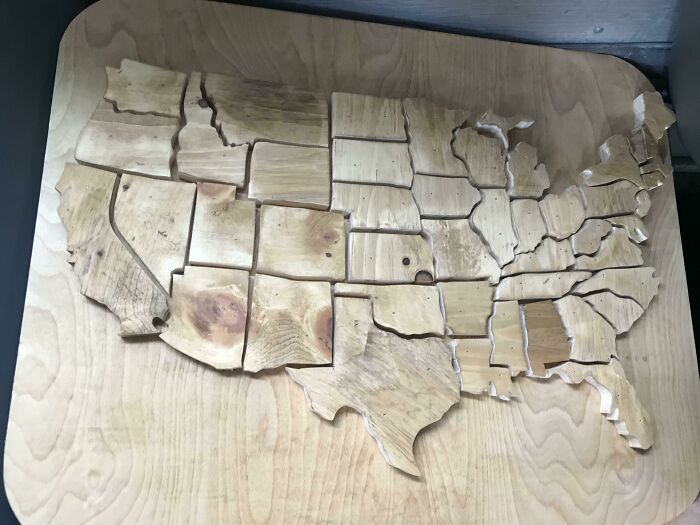
Image credits: Fleebo-1
#16 If US Land Were Divided Like US Wealth

Image credits: mapsfactory
#17 The United States — All Of It
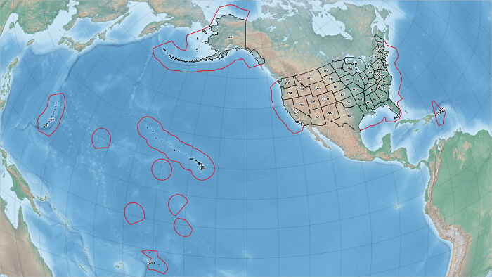
Image credits: guspolly3
#18 What Are Your Thoughts On This Breggsit?
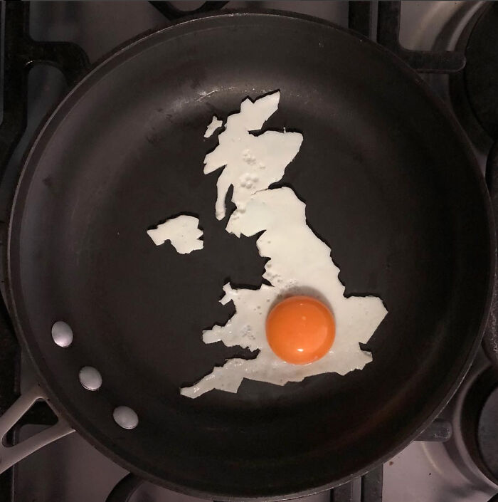
Image credits: the_Eggshibit
#19 My Son’s (12) Map Of The Balkans
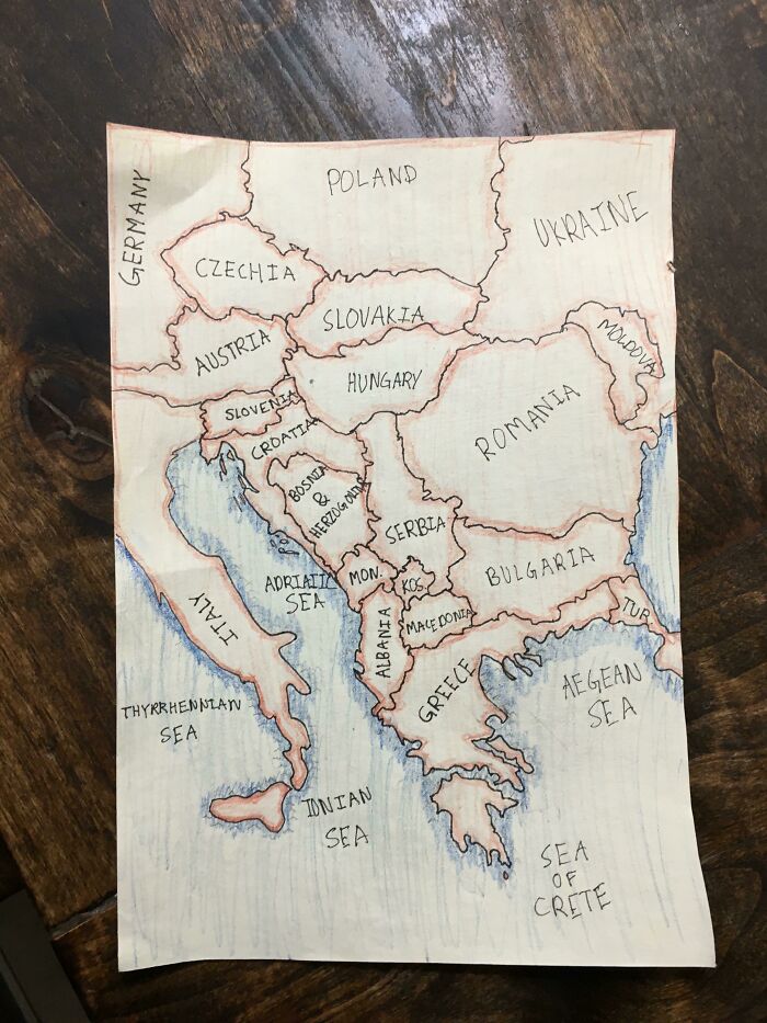
Image credits: Lindadorse
#20 Rural Equivalent Of New York City, Los Angeles And Chicago
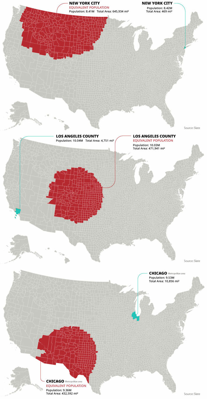
Image credits: kapowitz9
#21 Children’s Map Of The World (Only Shows Countries Where Smacking Children Is Illegal)

Image credits: OwlRepair
#22 The Great Lakes And Saint Lawrence River Superimposed On A Map Of Europe
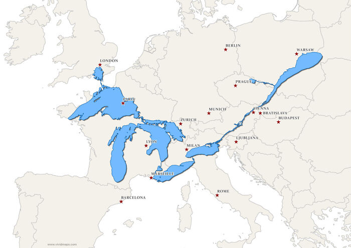
Image credits: fraterkretert43
#23 Why Is [country]...? - Google Autocomplete Results (European Countires, 2021)
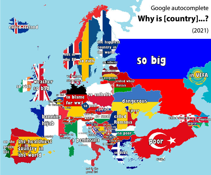
Image credits: Morwon
#24 I Made A Gingerbread Eastern Hemisphere!
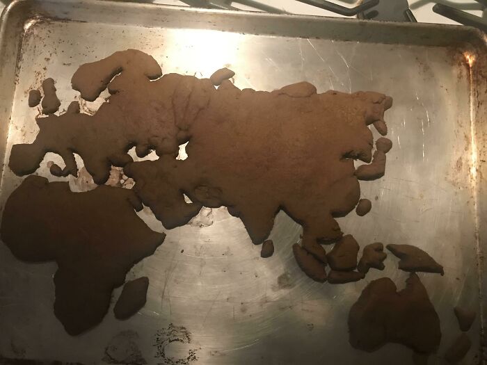
Image credits: etymologynerd
#25 Age At First Marriage
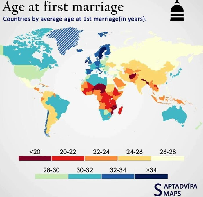
Image credits: latecomer11
#26 Africa, 10 Million Years Later. (Based On Current Predictions And Data)
Image credits: TheAssConsumer
#27 The Most Culturally Chauvinistic Europeans
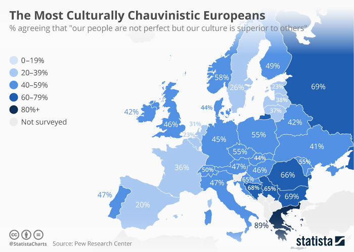
Image credits: tiredeggy
#28 What Does A Horse Say In Your Language?
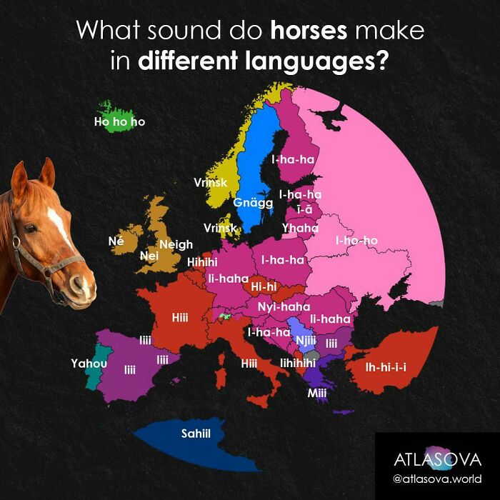
Image credits: atlasova
#29 Territories Of Modern Ghana And Ghana Empire
- You Might Also Like: The Real West: 21 Unfiltered Photos Of Cowboys And Native Americans In The 1800s
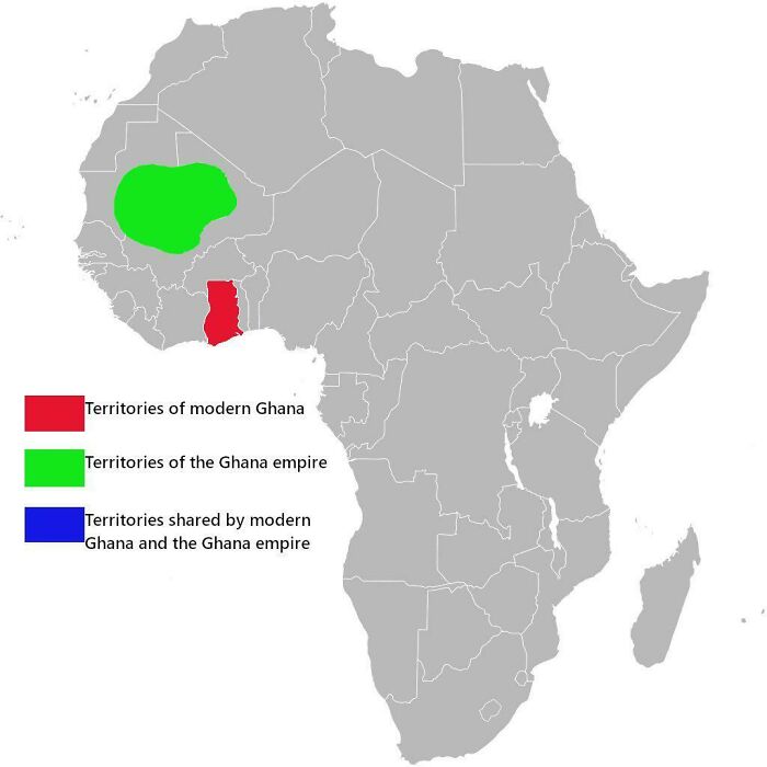
Image credits: logatwork