We can’t stop feasting our eyes on gorgeous and interesting maps, and we know that some of you Pandas can’t either. That’s why we’ve put together another list of the coolest content to come from this subreddit that has a dedicated community of nearly 1.4 million fans.
And while we can’t mention the full name of the subreddit (the internet’s gotten a lot stricter in recent years when it comes to certain words! Gosh darn you, internet censorship!), we can tell you all about the project that was started up way back in 2011 by map lover Patrick McGranaghan. What started out as a labor of love has since grown into a dedicated niche for map geeks the world over.
Patrick, the founder of the subreddit dedicated to maps told Bored Panda about how we can improve our spatial awareness and navigational skills. "The older I get, the more I realize that spatial awareness just comes naturally to some people, and for others, it's a struggle," he said, highlighting that practice and repetition are key to honing this skill.
However, just like spell check can make our grammar skills go numb, so can GPS and easily accessible digital maps harm our ability to orient ourselves. "In a way, reliance on Google Maps has made us dumber. We let the navigation app do all the work for us and don't engage with making the decisions," Patrick said. Be sure to read on for the rest of our latest interview with the subreddit's founder, Patrick, below.
In the mood for some more amazing maps? We know you are! When you’re done upvoting your fave maps in this list, check out Bored Panda’s previous posts about the cartography-loving community here, here, and here.
More info: Reddit | Twitter | Tumblr
#1 Oklahoma Man Hole Covers Have A City Map On, With A Blue Dot To Show Where You Are
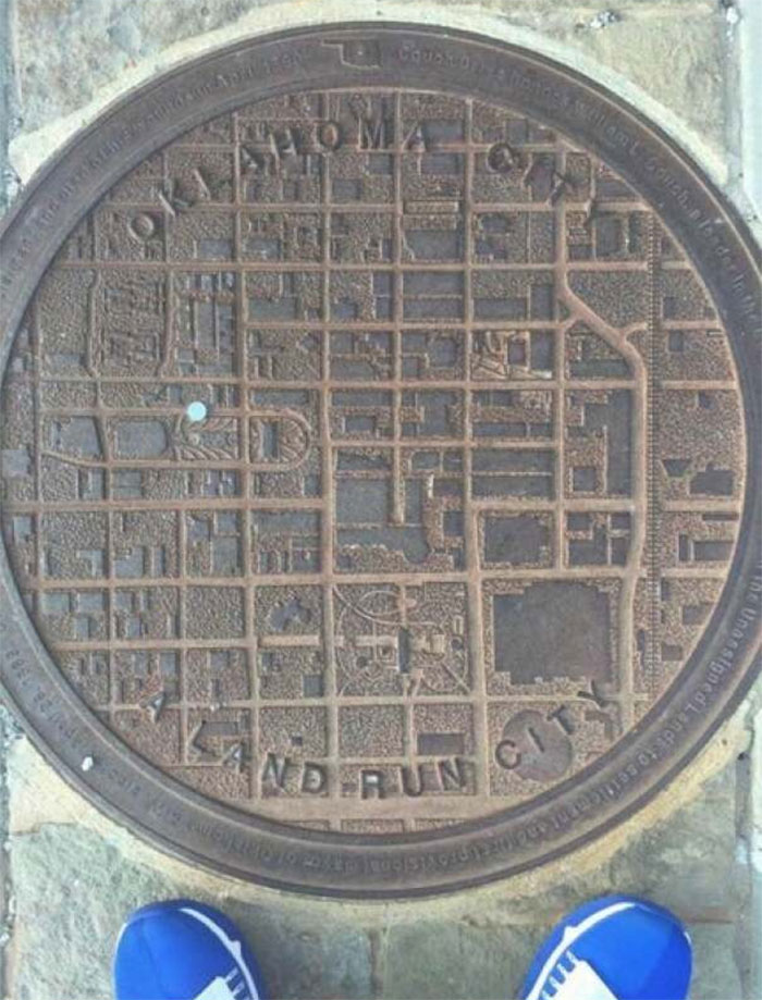
Image credits: CatherineCortez
#2 Map Of Regional Rug Patterns Of Iran
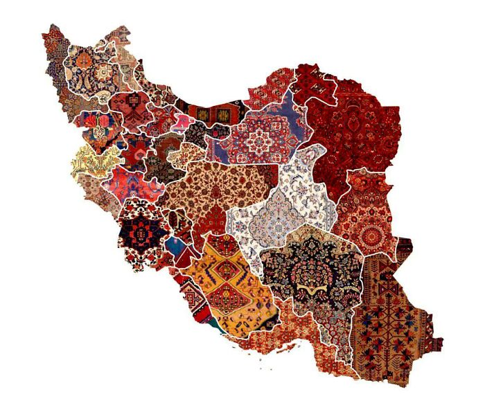
Image credits: knownothingwiseguy
#3 Animals Of The World Map
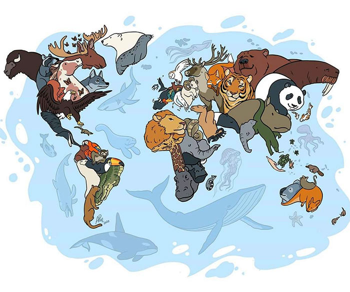
Image credits: ShapeShiftingCats
#4 World Map Mural
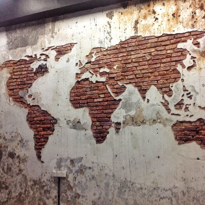
Image credits: eveildancer
#5 Someone Joked That Instead Of Google Earth I Should Make Doodle Earth. I Liked The Idea So I Gave It A Shot
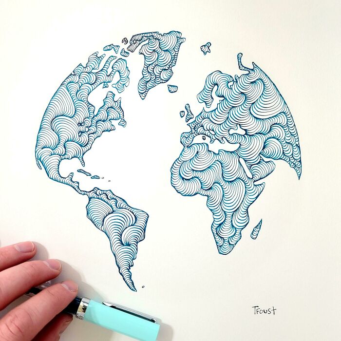
Image credits: tfoust10
#6 United States Elevation Map
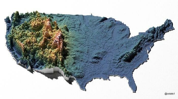
Image credits: blntdfam
#7 My Great Grandpa Drew This Map Of Africa In The 1910’s
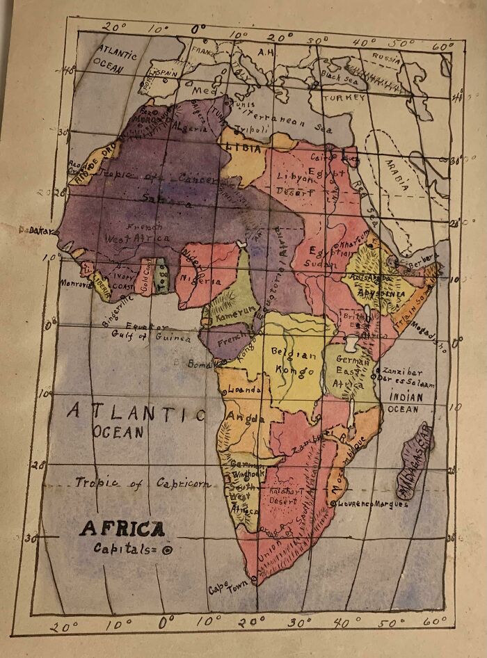
Image credits: zherper
#8 Europe In The Style Of Super Mario
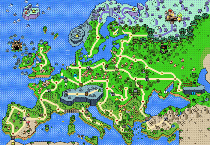
Image credits: vladgrinch
#9 Since You All Liked My Great Grandpa’s Drawing Of Africa At Age 12, Here’s One He Did Of Asia (Ca. 1910’s)
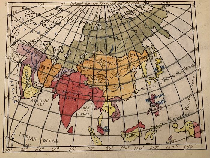
Image credits: zherper
#10 Abstract World Map
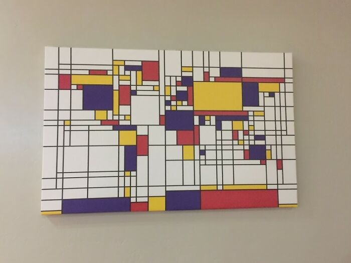
Image credits: CHWDP_2137
#11 A Map Of All Of The World's Roads

Image credits: RossBoss31
#12 Countries That Recognises The Uyghur Genocide As Of February 26, 2021
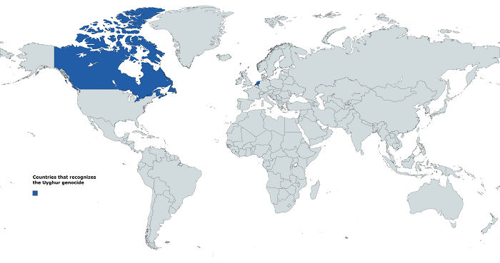
Image credits: Blulien
#13 Map Of Most Photographed Places In The World

Image credits: the-70s-kid
#14 The Iberian Peninsula At Night By Nasa
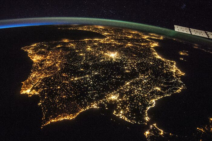
Image credits: Homesanto
#15 An Artists' Impression Of The Roman Port City Of Londinium, Established Between 47-50 Ad
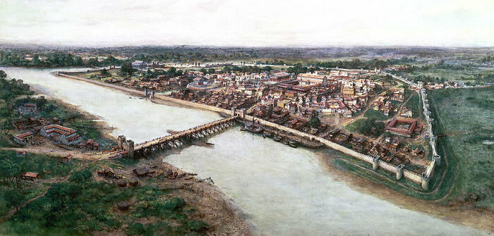
Image credits: last_goodbye1
#16 World Map Resized According To Population
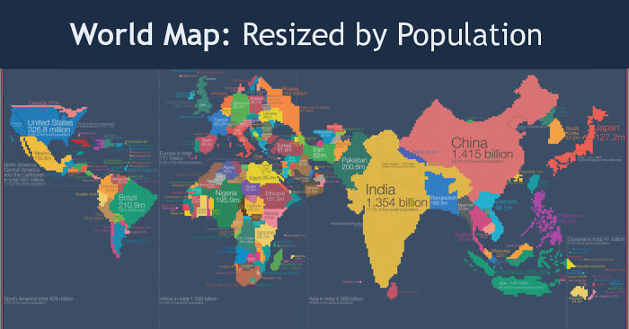
Image credits: fasterthanksi
#17 The Roman Empire vs. The Mongol Empire At Their Peaks
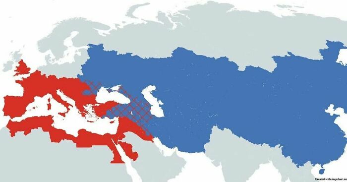
Image credits: vladgrinch
#18 The Island Of Sardinia As Seen From The International Space Station
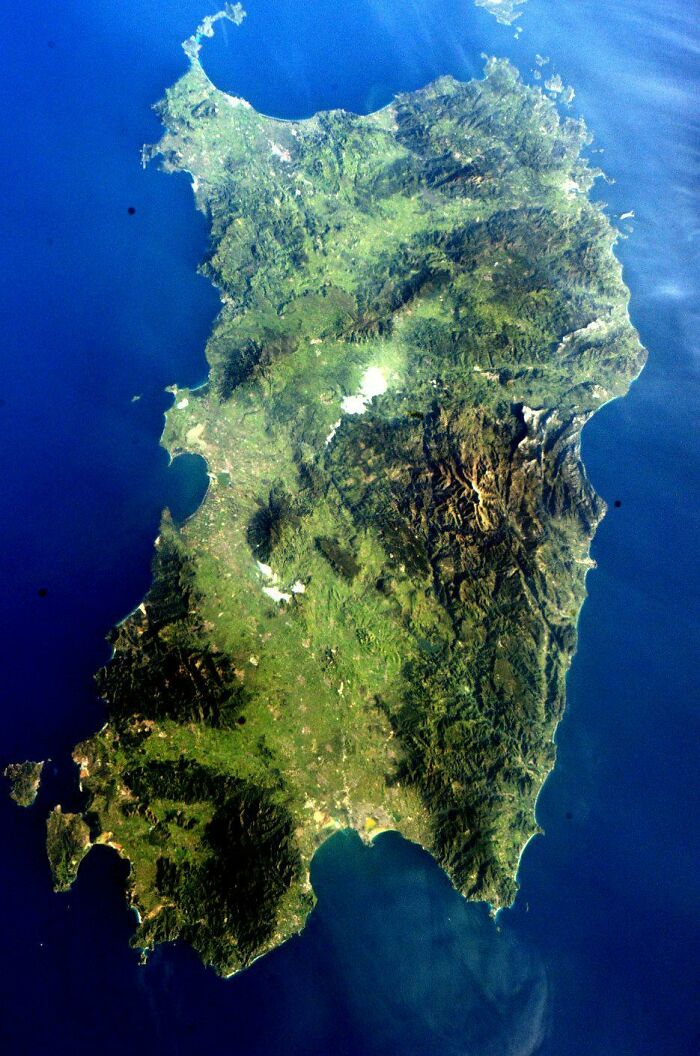
Image credits: MXN006
#19 Most Popular Lastnames In Europe
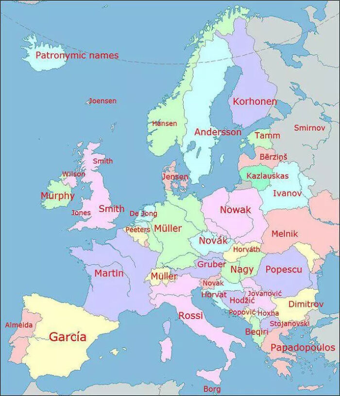
Image credits: vitor350z
#20 Place Names That Contain The Word 'Peak', 'Mountain', 'Ridge', 'Plain' And 'Field' In The United States
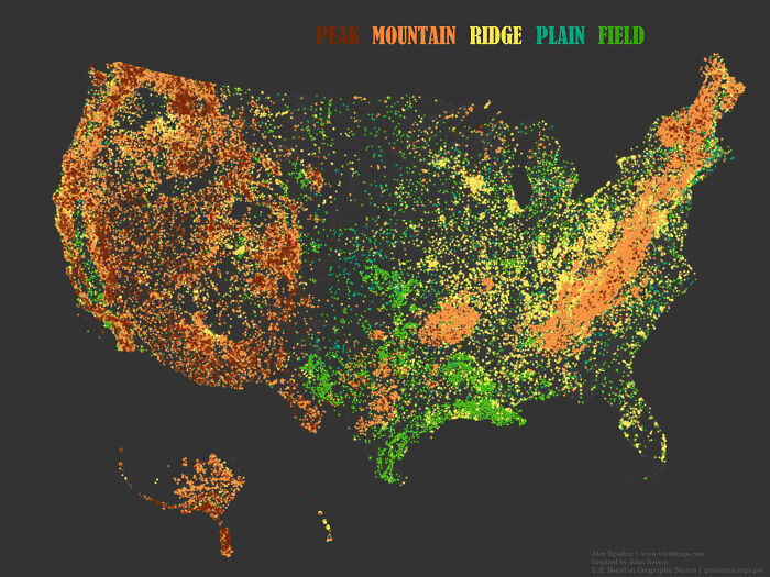
Image credits: AJgloe
#21 La Plata.. Buenas Aires.. Argentina
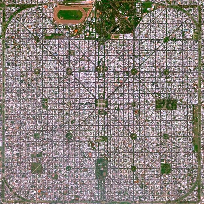
Image credits: mitozzzzzz
#22 Every Roman Settlement, And Nothing Else
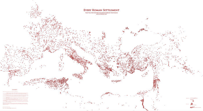
Image credits: ImUsingDaForce
#23 Ancient Lakes Of The Sahara
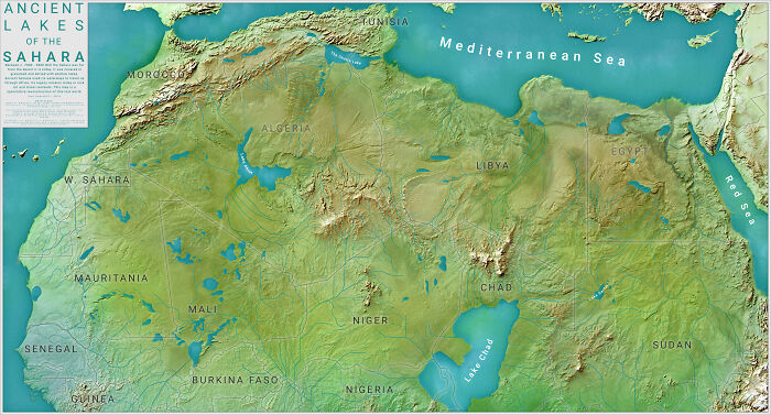
Image credits: ZOODUDE100
#24 In A Straight Line You Can Go From Belguim To France 11 Times

Image credits: Percentagon
#25 In Which State You Can Find The Highest Percentage Of People With Ancestry From Every European Country?
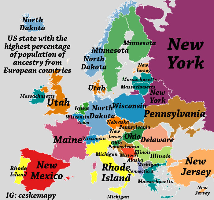
Image credits: ceskemapy
#26 The British Empire At It's Territorial Peak
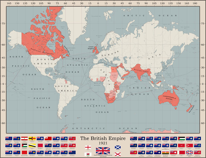
Image credits: freddyfredric
#27 Hand-Drawn Map Of The Polish-Lithuanian Commonwealth In 1618, By Me
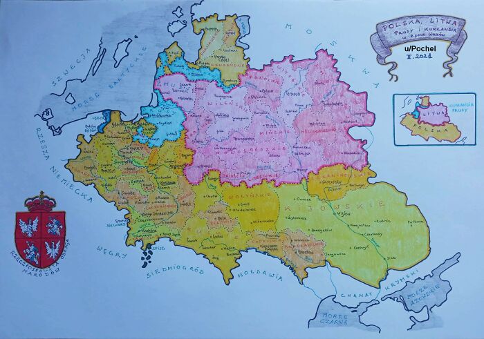
Image credits: Pochel
#28 Oldest Still Open Universities In Europe (The Word University Is Omitted On The Map)

Image credits: efisha
#29 People Employed In Science And Technology In Europe
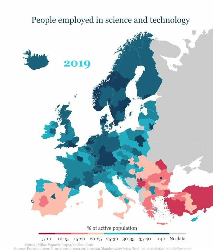
Image credits: betoelpro