Article created by: Greta Jaruševičiūtė
There’s a wonderful online community on Reddit that’s dedicated to beautiful, intriguing, and artistic maps that will wow you and make you see the world from a whole other perspective. As someone who loves doodling maps in my spare time, I’m in heaven. And even though our generous and benevolent social media overlords [cough cough] don’t allow us to mention the full name of the subreddit because of one particular word that it uses, make sure you visit the group, check out their latest maps, and maybe even become members yourselves, dear Pandas!
In the meantime, let’s enjoy some gorgeous and interesting maps, shall we? Remember to upvote your fave pics as you continue scrolling. In need of an extra mega map fix? You’ll find Bored Panda’s previous posts about the ‘Map [Whoops Can’t Mention That Word Here Anymore]’ community right here, as well as here.
We reached out to the founder and moderator of the subreddit, Patrick McGranaghan. He told Bored Panda all about how his passion for maps was first sparked, as well as how amateur cartographers can develop their sense of style and design to create better maps and do their imaginations justice.
More info: Reddit | Twitter | Tumblr
#1 This Is My Wedding Gift To My Wife. We Get Married Next Sunday. I Used A Woodburning Kit To Burn A Map Of All The States We Have Visited As A Couple. We Both Love To Travel And Backpack Do I Want To To Keep Adding To It As We Get Older
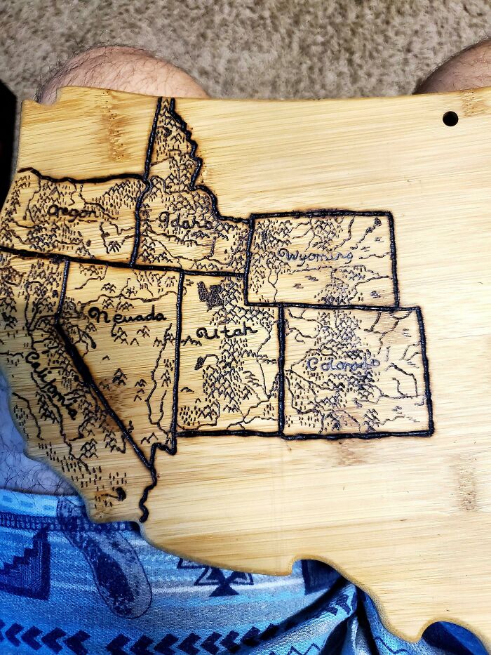
Image credits: Doofinx
#2 Occupied Bald Eagle Nests In Wisconsin. 1974 vs. 2019. Growth Credited To The Clean Water Act
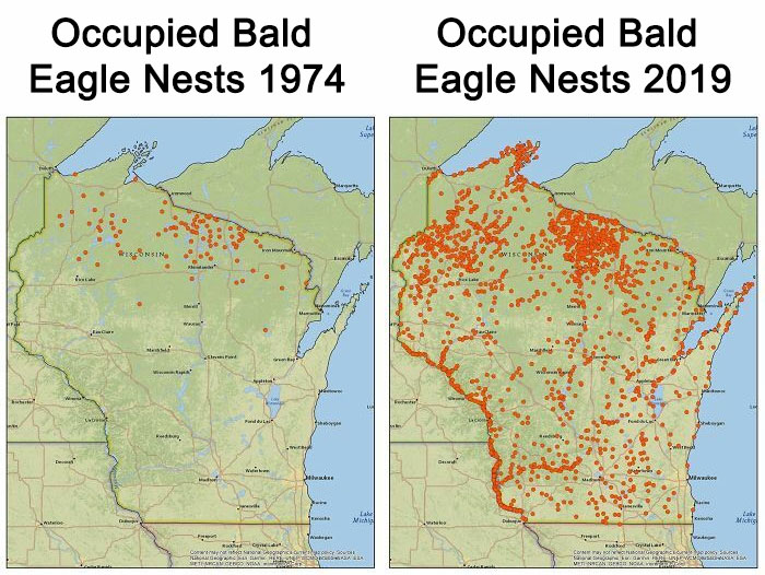
Image credits: Norcan987
#3 USA In Drawn In 3 Lines. Boundaries Marked With Gaps (The Best I Could)
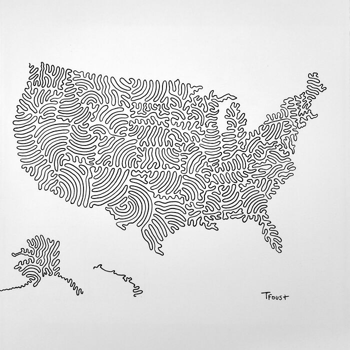
Image credits: tfoust10
#4 The World Of Infrastructure
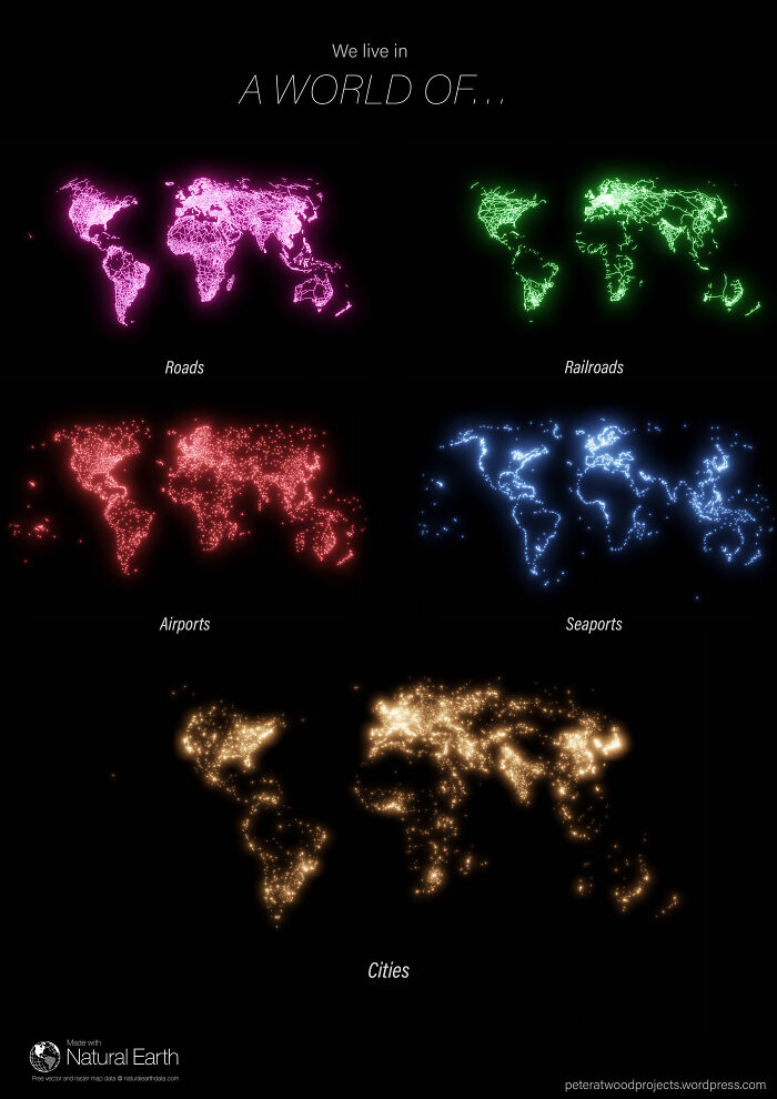
Image credits: reddit.com
#5 United Kingdom
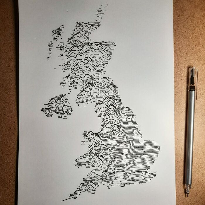
Image credits: orialairo
#6 Light Blue Is A Map As We Know It And Dark Blue Is The Actual Size Of Each Country
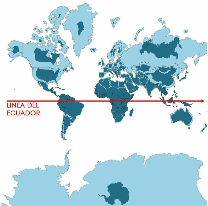
Image credits: aisbosseth
#7 A Map Of Finland's Bear Population, Made Up Of Bears
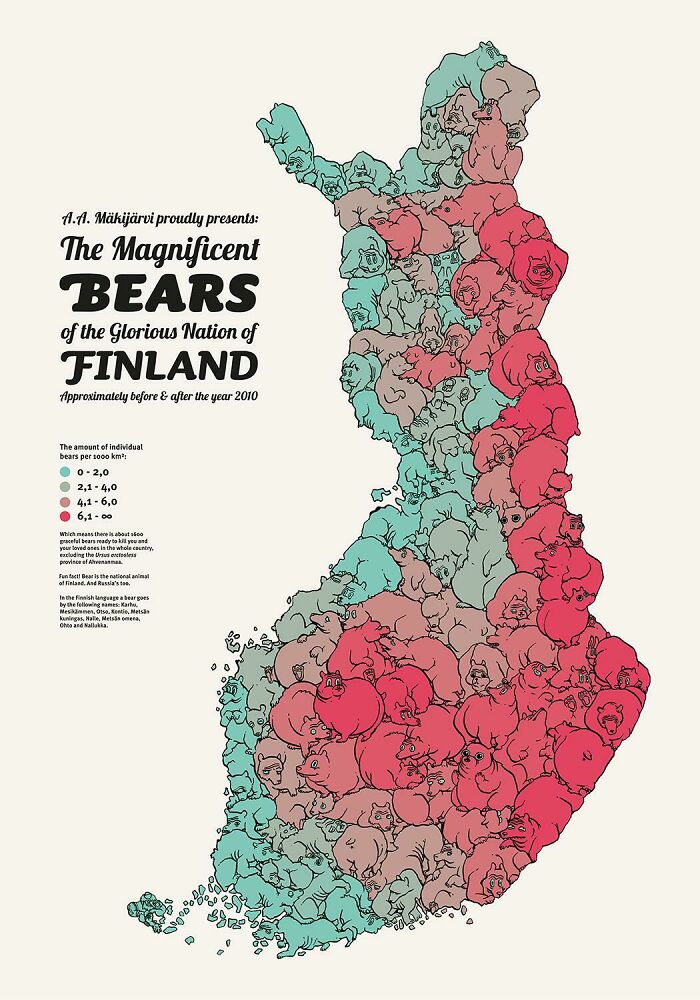
Image credits: Asmodeane
#8 To Combat The Threat Of Desertification Of The Sahel (The Region Immediately To The South Of The Sahara), The African Union Is Leading An Initiative To Plant The Great Green Wall, A 7,775 Km (4,830 Mi) Belt Of Trees Crossing The Entire Breadth Of North Africa
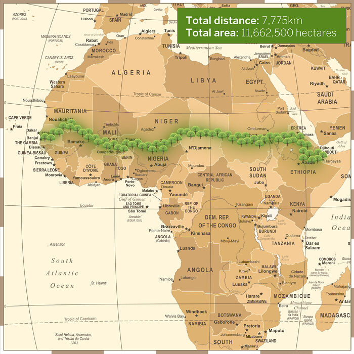
Image credits: reddit.com
#9 Just Walked In The Room And Found My 6 Year Old Drawing Countries By Hand
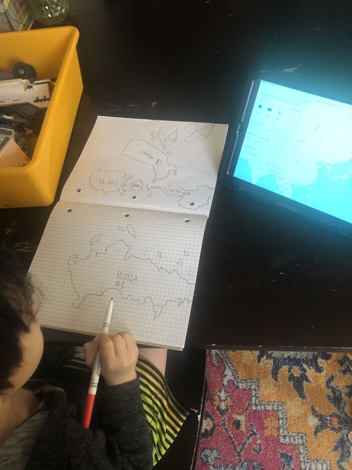
Image credits: 89LeBaron
#10 Map I Made Out Of Pressed Flowers!
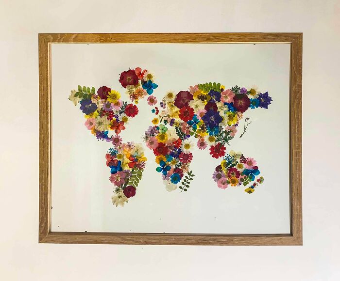
Image credits: _grumpycat1
#11 Wolf Distribution In Italy From 1900 To 2020
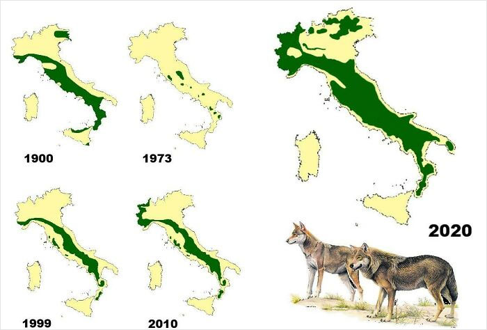
Image credits: Risingmagpie
#12 This Is Awesome
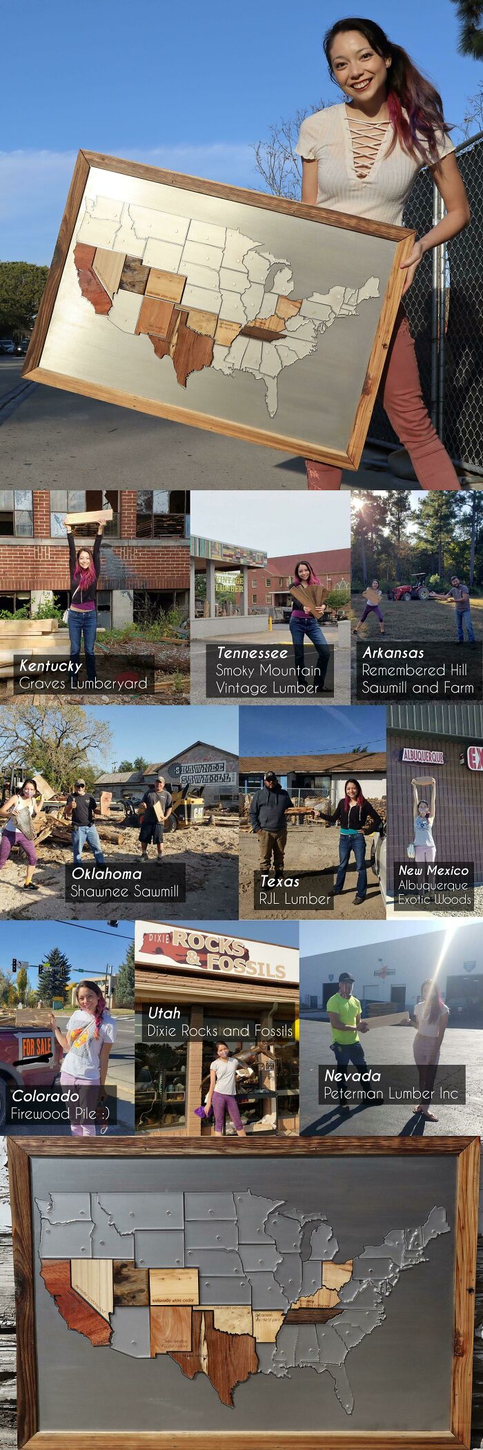
Image credits: Physical-Order
#13 Indo-European Language Family Tree
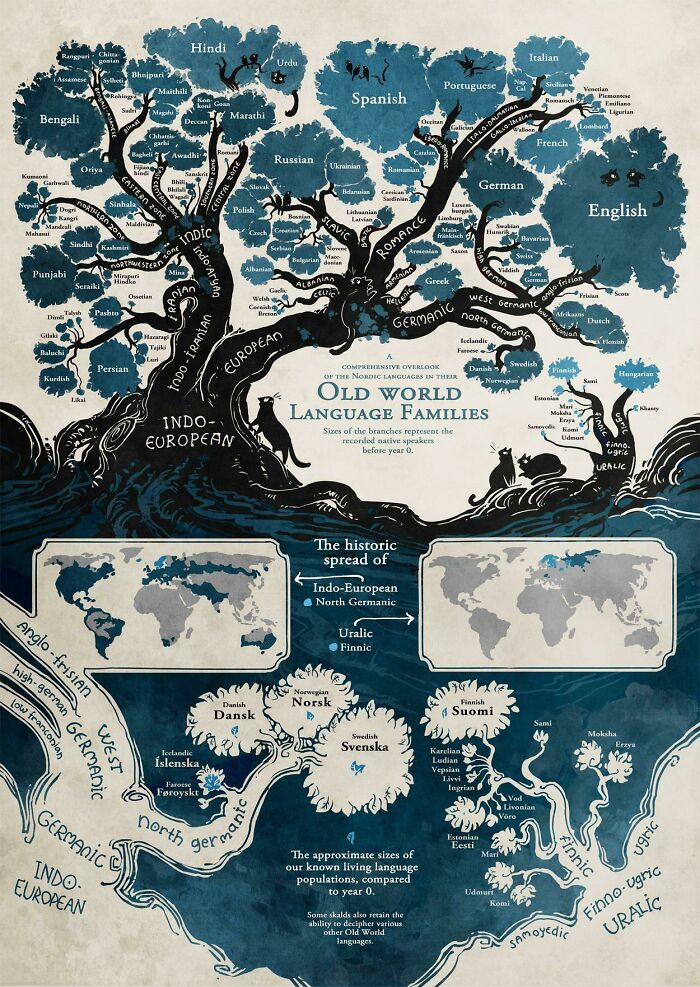
Image credits: Dovlatus
#14 The United States Of America: Alaskan Perspective
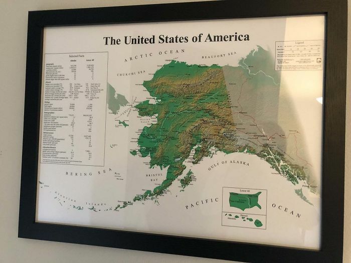
Image credits: loliplip
#15 I Made A Retro Pixel Map Of The USA! Tried To Include Some Of The Iconic Monuments/Locations That Resonated With Me
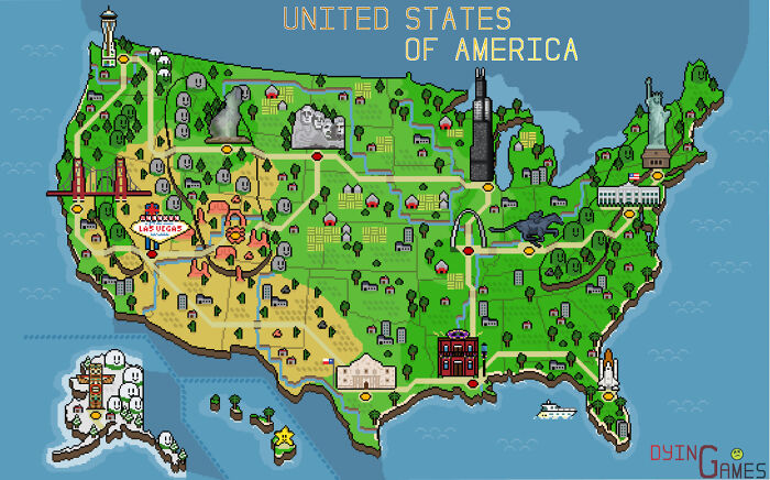
Image credits: reddit.com
#16 The Topography Of Italy
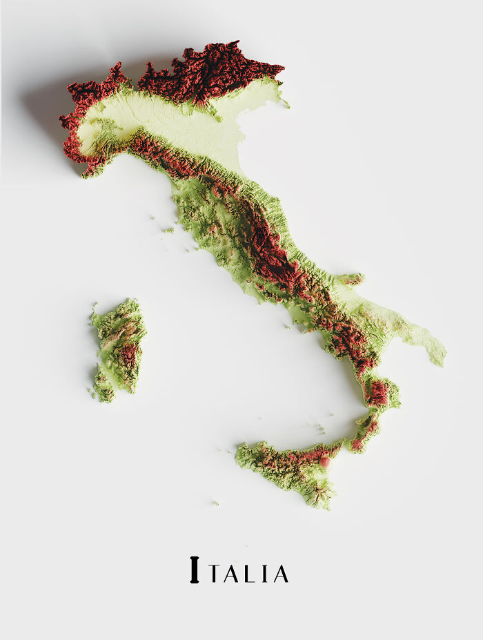
Image credits: boytutoy
#17 A Neat Little Map Guide
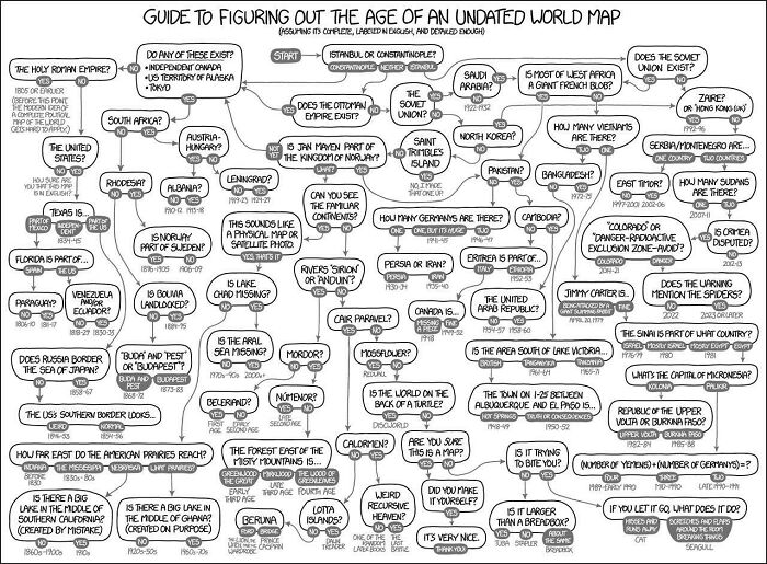
Image credits: PPedroSSancheZZ420
#18 Euler Diagram-Map Of The British Isles
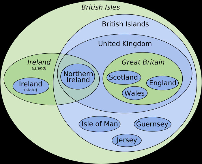
Image credits: InkyScrolls
#19 What The Netherlamds Would Naturally Look Like If They Hadn't Built Any Dikes To Prevent Flooding
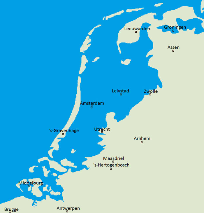
Image credits: DerpyRainbow506
#20 Map Of The 2191 Meter Deep Krubera Cave. The Deepest Known Cave System In The World
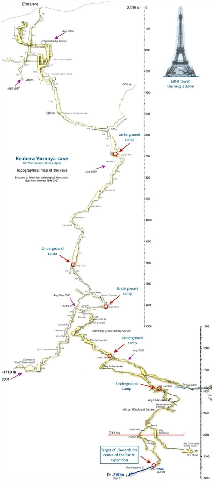
Image credits: VictoriaLisz
#21 The Oldest Universities In Continuous Operation
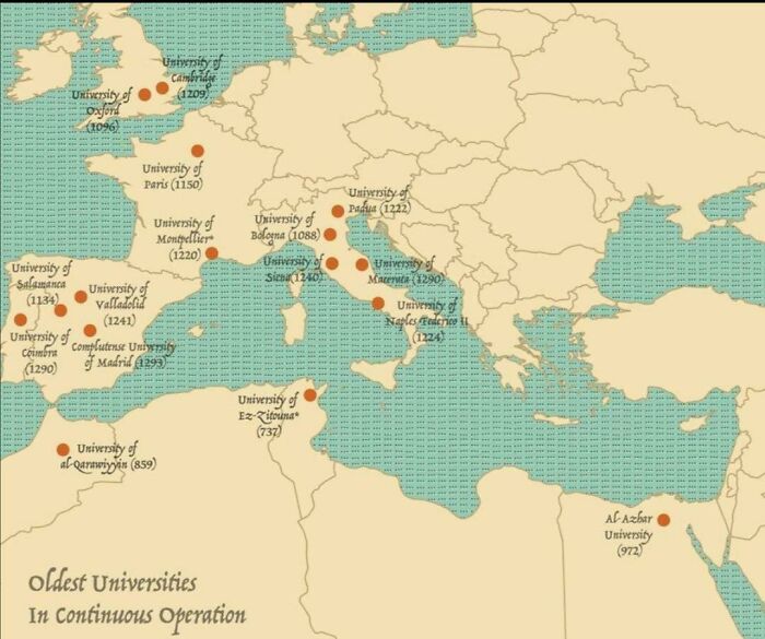
Image credits: bodafir
#22 Where Flamingos Are Found Naturally In The World
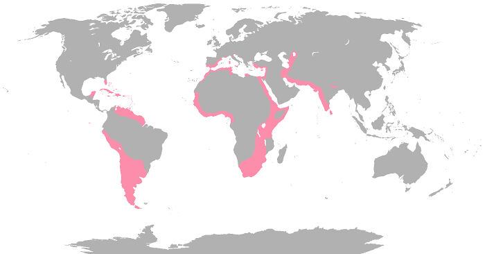
Image credits: cheeseface35
#23 Olympus Mons On Mars, The Largest Volcano In Our Solar System, Compared To Arizona
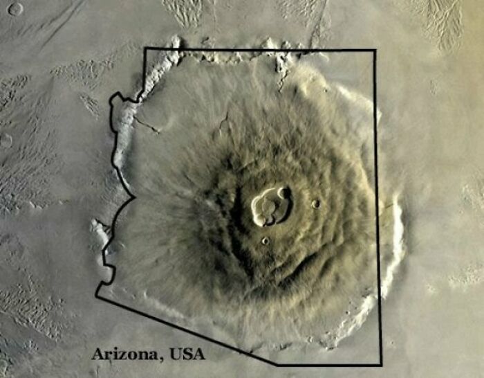
Image credits: ADarkcid
#24 Relief Map Of Baltic And Scandinavia
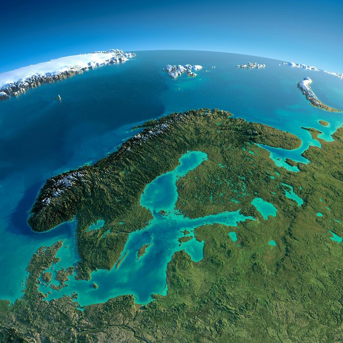
Image credits: Adaffor
#25 The True Size Of New Guinea
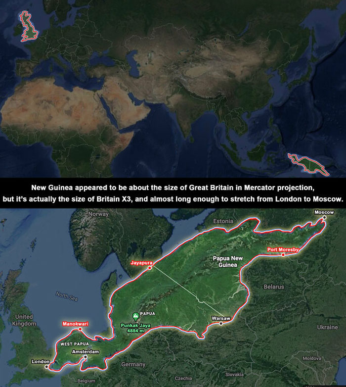
Image credits: BerryBlue_BlueBerry
#26 The Shire - English Counties Ending In 'Shire'
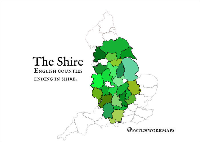
Image credits: trail_bagger
#27 Satellite Map Of Vatican City
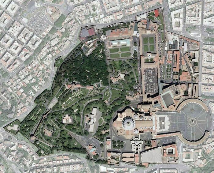
Image credits: AJgloe
#28 Europe Seen From Russia (Made In The 1950s)
- You Might Also Like: "30 Weird But True Facts About Royals"

Image credits: cpt_t37