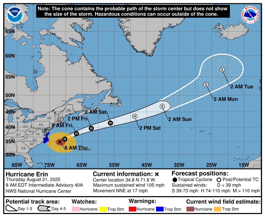
After battering North Carolina’s Outer Banks with strong winds and waves, Hurricane Erin began to move away from the coast Thursday morning, though it spawned dangerous conditions that have shuttered beaches up the East Coast.
Meteorologists cautioned that Erin has the potential to strengthen into a major Category 3 storm or greater when it peaks on Thursday, even though the storm is not expected to make U.S. landfall.
Storm surge, or rising sea level leading to flooding, and tropical storm strength winds will continue wreaking havoc on the Outer Banks until at least Friday, the National Hurricane Center warned.
Days after 130mph winds and torrential rainfall battered the Caribbean and left tens of thousands of Puerto Ricans without power, Erin’s outer bands brushed over the Outer Banks, closing beaches and several roads due to flooding. Authorities predicted that the biggest swells during high tide had the potential to cut off villages and homes in the Outer Banks, all while stirring up life-threatening rip currents and 20-foot-tall waves.
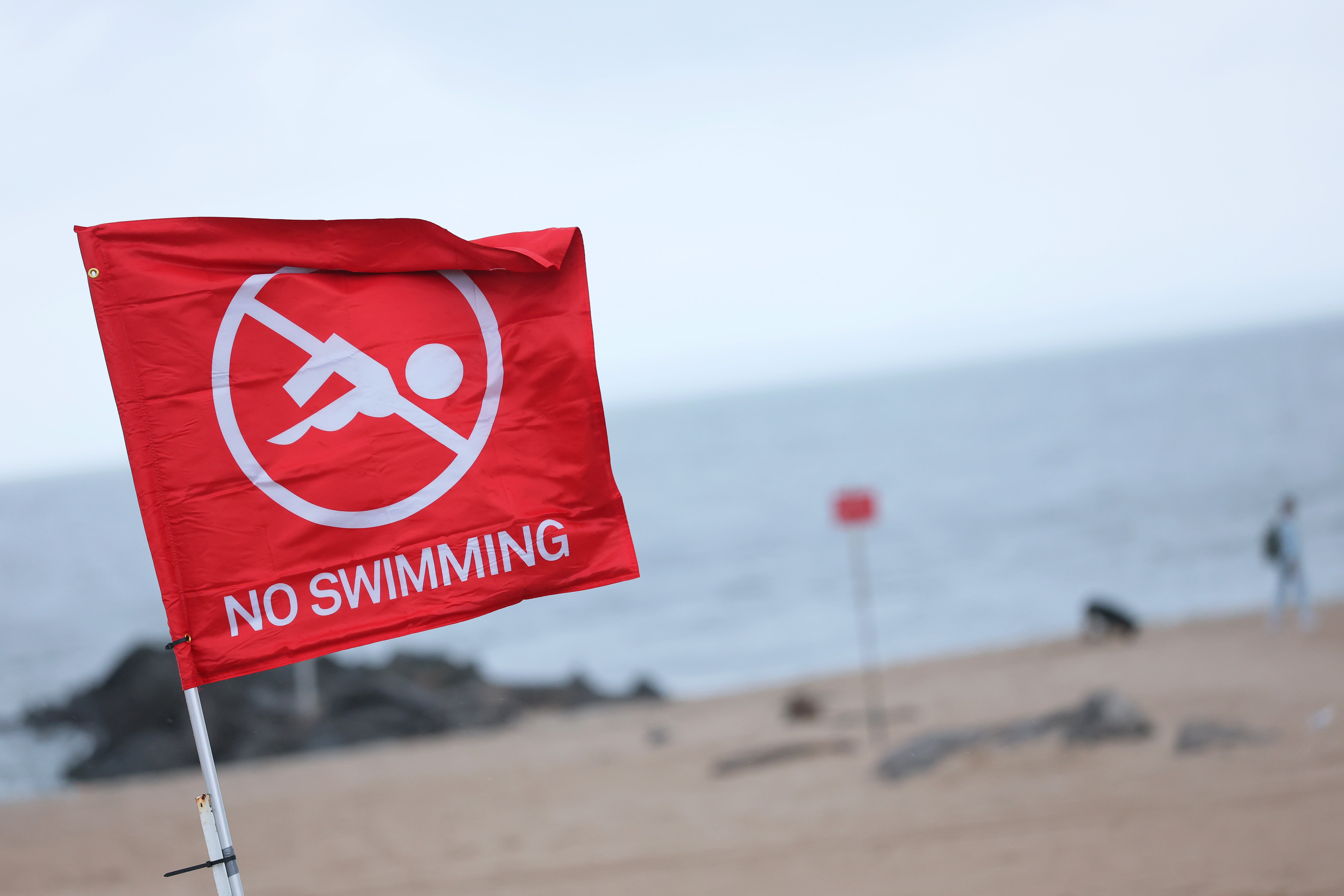
States along the East Coast braced for impact, with beaches from the Carolinas to Cape Cod closing to protect swimmers from what the National Weather Service described as “life-threatening surf and rip currents.”
Ahead of Erin’s peak, officials in Virginia moved resources to Virginia Beach and other coastal areas to prepare for any potential flooding or damage from the outer bands of the hurricane.
Storm surge flooding and tropical storm conditions were present Outer Banks area of North Carolina, forcing state Governor Josh Stein to declare a state of emergency.
Lifeguards in North Carolina made more than 75 rescues from rip currents along the Wrightsville area coastline Monday, prompting a no-swim order through Friday, according to the Wilmington Star-News.
“Turn around, don’t drown,” the governor said.
The storm surge will be accompanied by large waves, some up to 20ft high, and the possibility of flooding, according to the NOAA National Hurricane Center.
NOAA added that tropical storm conditions are expected Thursday along the Virginia coast, with tropical storm force gusts likely along portions of the remainder of the U.S. Mid-Atlantic and southern New England coasts Thursday through early Friday.
While the East Coast has so far been spared the cyclone’s full force, forecasters issued a slew of warnings, including “life-threatening surf and rip currents” for the U.S., Bahamas, Bermuda, and Atlantic Canada throughout this week.


New York City closed its beaches to swimming Wednesday and Thursday, and Governor Kathy Hochul ordered three state beaches on Long Island to prohibit swimming through Thursday.
In Massachusetts, Nantucket Island could see waves of more than 10 feet later this week.
The worst conditions were expected late Wednesday through Thursday as the eye of the storm is likely to be at the closest point to the coast, carving a path between the East Coast and Bermuda.
Satellite imagery and reports from a U.S. Air Force Hurricane Hunter aircraft indicated that Erin “is getting better organized, and slow strengthening is expected through Thursday night.”
Erin, the first Atlantic hurricane of 2025, exploded to a ferocious Category 5 Saturday before being downgraded to a Category 3 early Sunday morning, then regaining strength again later in the day.
Hurricane Erin live updates: North Carolina under state of emergency as beaches close in Northeast
Hurricane Erin gusts shut down East Coast beaches and swimmers from Carolinas to NYC to Cape Cod
Hurricane Erin live updates: Storm moves away from East Coast
Two more homes near collapse as Hurricane Erin waves pound North Carolina
Puerto Rico's schools are unequipped to cope with ever hotter heat waves


