The starts for Life Time Unbound Gravel events will all take place in downtown Emporia, Kansas on Commercial Street with the first races heading out as the sun rises to illuminate the iconic Granada Theatre. Riders in the signature Unbound Gravel 200 event will have staged starts, the elite men taking off at 6:00 a.m. CT, followed by the elite women five minutes later. The mass start for all other 200-mile riders will commence at 6:30 a.m.
Riders taking part in the 100-mile, 50-mile and 25-mile distances will depart at set times between 7:30 to 9:30 a.m. CT.
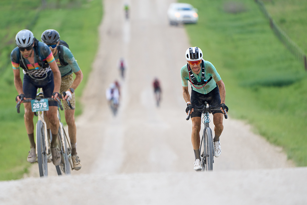
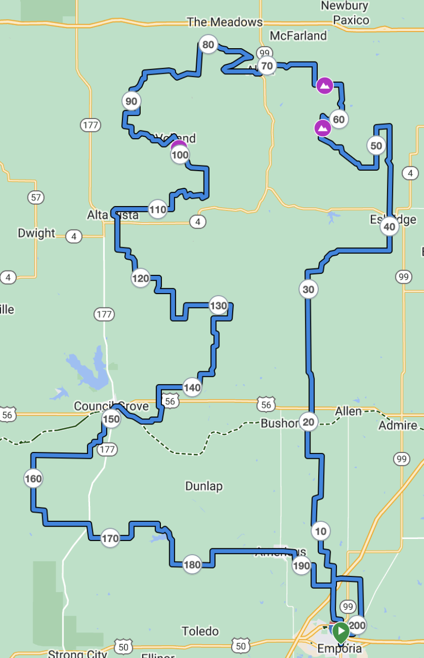
The 2024 course for Unbound Gravel 200 is slightly longer than billed, a total of 202.9 miles (327km) with 11,850 feet (3,600m) of elevation gain across 92% of gravel. The route returns to a northbound loop for the first time since 2021, and new rolling, rural roads provide for 2,750 more feet of elevation gain than the last two editions.
A new path out of town offers the first dirt roads just two miles in, using East 18th Avenue to make a loop to cross State Highway 99. At mile 25 the route takes Kaw Reserve Road, with technical and rugged double-track that leads to Eskridge and the first Neutral Water Oasis.
One of the hardest sections of the entire route comes after 45.5 miles, Divide Road. This relentless stretch of rough terrain has been used before, but the conditions are more rugged than in years past. This leads to a series of rollers on Boothill Road and a new section on the Prairie View Road climb, at mile 65 mile. It is in this section, west of Alma, that the extra elevation gain in 2024 can be found.
Once in Alma at mile 70, riders can take advantage of the first check point. The rocky terrain transitions to smoother gravel on the west side of town, but there are more climbs at Volland Road and the roads are exposed to the elements so riders can expect to battle the wind and endure increasing heat.
At mile 104, Little Egypt returns with a steep ascent over chunky rocks, where accelerations have taken place in past years to disrupt groups that have formed. The route moves to the east of Alta Vista, where there is a second Water Oasis at mile 112.
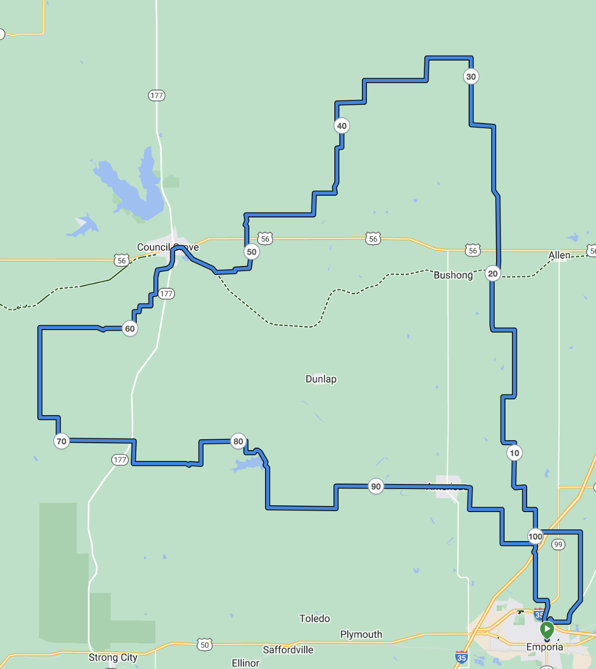
On the way south toward Council Grove, there is a water crossing at mile 138 with a steep ascent on the exit. The second and final Check Point is 10 miles beyond.
At mile 175 is the longest climb of the day up adjacent to Lake Kahola, an exposed and often windswept ramp followed by rollers. Eleven miles later is the final neutral water stop at Americus, but the elite riders will accelerate for the final stretch back into Emporia on Merchant Street, which skirts the Emporia State University campus with the punchy climb of Highland Hill.
Once across Highland Hill, riders turn left on 12th Avenue for two blocks, then right for the final straightaway on Commercial Street. The final 1.5 miles of the course will be barricaded to protect spectators and riders, with a dedicated finish chute for the Unbound Gravel 200 riders to finish alongside the three other categories in the heart of the city.