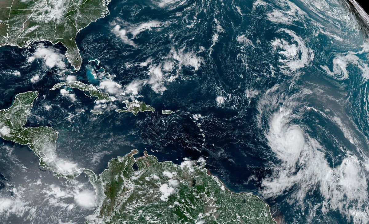
Tropical Storm Lee strengthened into a hurricane on Wednesday as it churned through the open waters of the Atlantic on a path that would take it near the northeast Caribbean.
The hurricane was located about 1,130 miles (1,815 kilometers) east of the northern Leeward Islands. It had maximum sustained winds of 75 mph (120 kph) and was moving west-northwest at 14 mph (22 kph), according to the National Hurricane Center.
Current projections show it not making landfall but passing just northeast of the British Virgin Islands, which is still recovering from hurricanes Maria and Irma in September 2017.
“It has the potential to become a powerhouse Category 5 hurricane, the strongest hurricane of the year,” said Jonathan Porter, chief meteorologist for AccuWeather.
Lee is the 12th named storm of the Atlantic hurricane season, which runs from June 1 to Nov. 30.
It is expected to develop into an “extremely dangerous" major hurricane by early Saturday, according to the National Hurricane Center, which noted the storm was moving over very warm water and in a moist environment.
The hurricane is expected to generate life-threatening swells forecast to hit the Lesser Antilles on Friday and Puerto Rico and the U.S. and British Virgin Islands this weekend, the center said. The seas around Puerto Rico could rise up to 12 feet, according to the National Weather Service in San Juan.
“There is still too much uncertainty regarding rainfall and possible wind impacts, as Lee is forecast to pass a couple hundred miles north of the islands,” it said.
The National Ocean and Atmospheric Administration warned in August that this year's season would produce an above-normal number of storms. Between 14 to 21 named storms are forecast. Of those, six to 11 could become hurricanes, with two to five of them possibly becoming major hurricanes, the agency said.
Meanwhile, AccuWeather updated its forecast, predicting there would be three to five hurricanes Category 3 or stronger this season, compared with one to three in its previous analysis.
In the Pacific, Jova strengthened into a Category 4 hurricane far off the southwest coast of Mexico and posed no threat to land.
It was located some 565 miles (910 kilometers) south-southwest of the southern tip of Baja California and moving west-northwest at 15 mph (24 kph) with winds up to 130 mph (215 kph). The storm was expected to keep growing stronger.