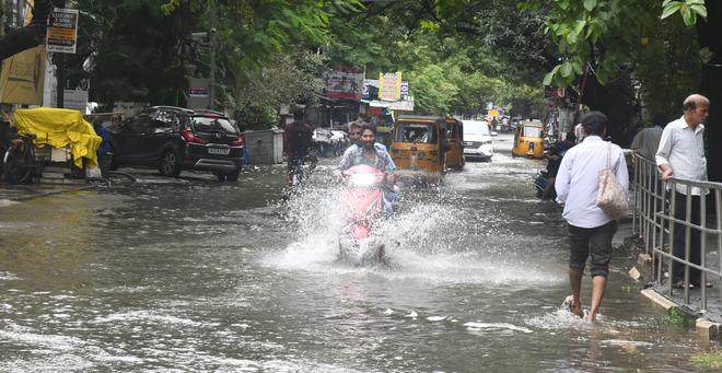
With the deep depression intensifying into Cyclone Michaung over the Southwest Bay of Bengal, the India Meteorological Department (IMD) on Sunday issued a heavy to very heavy rain warning for a few places in Chennai, Tiruvallur, Kancheepuram, and Chengalpattu districts till Monday evening.
Extremely heavy rainfall is also expected at one or two places over these districts as a result of the cyclone. The IMD has issued a red alert since there is a likelihood of over 20 cm of rainfall in these places.
S. Balachandran, Additional Director General of Meteorology, Regional Meteorological Centre (RMC), Chennai, told reporters that as of 8.30 a.m. on Sunday, the storm, moving at a speed of 8 kmph, lay centred at about 260 km east-northeast of Puducherry, 190 km east-southeast of Chennai, 310 km southeast of Nellore, 410 km south-southeast of Bapatla, and 430 km south-southeast of Machilipatnam.
It is likely to continue moving north-westward, intensify, and reach west-central Bay of Bengal off the south Andhra Pradesh and adjoining north Tamil Nadu coasts by forenoon on Monday. Thereafter, it will move nearly northwards, almost parallel and close to and cross the South Andhra Pradesh coast, between Nellore and Machilipatnam during forenoon of Tuesday as a severe cyclonic storm, with a maximum sustained wind speed of 90-100 kmph, gusting up to 110 kmph.
On Monday, RMC has predicted light to moderate rain is likely at many places with thunderstorm and lightning at one or two places over north Tamil Nadu, Puducherry, and Karaikal areas and at few places over south Tamil Nadu. Heavy to very heavy rain is likely to occur at a few places, with extremely heavy rain at one or two places over Chennai, Kancheepuram, Chengalpattu, and Tiruvallur districts.
Heavy to very heavy rain is likely to occur at one or two places over Ranipet, Vellore, Tiruvannamalai, Villupuram districts. Heavy rain is likely to occur at one or two places over Cuddalore, Kallakurichi, and Tirupattur districts.
On Tuesday, light to moderate rain has been forecast at a few places over south Tamil Nadu, at one or two places with thunderstorm and lightning over North Tamil Nadu, Puducherry, and Karaikal areas. Heavy rain is likely to occur at isolated places over Ranipet and Tiruvallur districts.
Windspeed warning
Strong winds, with speeds reaching 50-60 kmph gusting up to 70 kmph, are likely to occur over Cuddalore, Villupuram, Chengalpattu, Kancheepuram, Chennai, and Tiruvallur districts of Tamil Nadu and Puducherry till 8.30 a.m. on Monday.
Gale winds with speeds reaching 60-70 kmph, gusting up to 80 kmph, are likely to occur over Chengalpattu, Kancheepuram, Chennai, and Tiruvallur districts on Monday. Strong winds with speeds reaching 50-60 kmph, gusting up to 70 kmph, are likely to occur over Villupuram and Cuddalore districts of Tamil Nadu and Puducherry.
For Chennai and surroundings districts, the sky condition is likely to be generally cloudy. Heavy to very heavy rain has been predicted at a few places, with extremely heavy rain with thunderstorm and lightning is likely at one or two places.